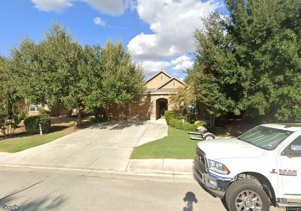
1513 Cap Ridge Peak New Braunfels, TX 78130
South New Braunfels NeighborhoodEstimated Value: $284,537 - $321,000
3
Beds
3
Baths
2,004
Sq Ft
$150/Sq Ft
Est. Value
About This Home
This home is located at 1513 Cap Ridge Peak, New Braunfels, TX 78130 and is currently estimated at $299,634, approximately $149 per square foot. 1513 Cap Ridge Peak is a home located in Guadalupe County with nearby schools including Canyon Middle School, Canyon High School, and Premier High School - New Braunfels.
Ownership History
Date
Name
Owned For
Owner Type
Purchase Details
Closed on
Aug 12, 2016
Sold by
Gonzalez Michael A and Gonzalez Veronica
Bought by
Stieb Lawrence Robert and Steib Karen Denise
Current Estimated Value
Home Financials for this Owner
Home Financials are based on the most recent Mortgage that was taken out on this home.
Original Mortgage
$164,250
Outstanding Balance
$148,279
Interest Rate
8.62%
Mortgage Type
Adjustable Rate Mortgage/ARM
Estimated Equity
$151,355
Purchase Details
Closed on
Dec 24, 2014
Sold by
Kb Home Lone Star Inc
Bought by
Gonzalez Michael A and Gonzalez Veronica
Home Financials for this Owner
Home Financials are based on the most recent Mortgage that was taken out on this home.
Original Mortgage
$198,000
Interest Rate
4.01%
Mortgage Type
VA
Create a Home Valuation Report for This Property
The Home Valuation Report is an in-depth analysis detailing your home's value as well as a comparison with similar homes in the area
Home Values in the Area
Average Home Value in this Area
Purchase History
| Date | Buyer | Sale Price | Title Company |
|---|---|---|---|
| Stieb Lawrence Robert | -- | Mission Title | |
| Gonzalez Michael A | -- | Atc |
Source: Public Records
Mortgage History
| Date | Status | Borrower | Loan Amount |
|---|---|---|---|
| Open | Stieb Lawrence Robert | $164,250 | |
| Previous Owner | Gonzalez Michael A | $198,000 |
Source: Public Records
Tax History Compared to Growth
Tax History
| Year | Tax Paid | Tax Assessment Tax Assessment Total Assessment is a certain percentage of the fair market value that is determined by local assessors to be the total taxable value of land and additions on the property. | Land | Improvement |
|---|---|---|---|---|
| 2025 | $1,756 | $294,182 | $39,583 | $254,599 |
| 2024 | $1,756 | $323,423 | $44,107 | $282,116 |
| 2023 | $5,355 | $294,021 | $52,373 | $297,468 |
| 2022 | $5,433 | $267,292 | $38,160 | $293,045 |
| 2021 | $5,210 | $242,993 | $25,736 | $217,257 |
| 2020 | $4,908 | $224,093 | $25,736 | $198,357 |
| 2019 | $4,692 | $207,614 | $25,736 | $181,878 |
| 2018 | $3,146 | $197,079 | $19,950 | $177,129 |
| 2017 | $744 | $197,435 | $21,346 | $176,089 |
| 2014 | $2,172 | $95,187 | $9,872 | $85,315 |
Source: Public Records
Map
Nearby Homes
- 1408 Prairie Rock
- 1425 Jordan Crossing
- 1460 Astor Creek
- 1452 Astor Creek
- 384 Copper Wood Dr
- 384 Copper Wood Dr Unit 1
- 223 Kinsley Way
- 1430 S State Highway 46
- 1283 State Highway 46 S
- 1678 Kolbe Trail
- The Easton Plan at Saengerhalle Meadows
- The Dalton Plan at Saengerhalle Meadows
- The Harris Plan at Saengerhalle Meadows
- The Kate Plan at Saengerhalle Meadows
- The Mitchell Plan at Saengerhalle Meadows
- The Nicole Plan at Saengerhalle Meadows
- The Baxtor Plan at Saengerhalle Meadows
- The Gaven Plan at Saengerhalle Meadows
- 1674 Kolbe Trail
- 1682 Kolbe Trail
- 1509 Cap Ridge Peak
- 1517 Cap Ridge Peak
- 1517 Cap Ridge
- 1509 Cap Ridge
- 1521 Cap Ridge Peak
- 1514 Prairie Rock
- 1505 Cap Ridge
- 1505 Cap Ridge Peak
- 1518 Prairie Rock
- 1522 Prairie Rock
- 1506 Prairie Rock
- 1510 Prairie Rock
- 1516 Cap Ridge Peak
- 1525 Cap Ridge Peak
- 1524 Cap Ridge
- 1520 Cap Ridge Peak
- 1526 Prairie Rock
- 1524 Cap Ridge Peak
- 1529 Cap Ridge Peak
- 1529 Cap Ridge