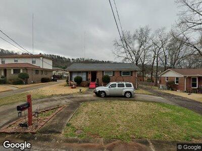
1513 Maple Ave SW Birmingham, AL 35211
Mason City NeighborhoodEstimated Value: $106,000 - $137,000
3
Beds
2
Baths
1,520
Sq Ft
$82/Sq Ft
Est. Value
About This Home
This home is located at 1513 Maple Ave SW, Birmingham, AL 35211 and is currently estimated at $124,480, approximately $81 per square foot. 1513 Maple Ave SW is a home located in Jefferson County with nearby schools including Richard Arrington Elementary School, Hemphill Elementary School, and Wenonah High School.
Ownership History
Date
Name
Owned For
Owner Type
Purchase Details
Closed on
Sep 12, 2008
Sold by
Russell Faith and Russell Ernest
Bought by
Russell Carolyn G
Current Estimated Value
Home Financials for this Owner
Home Financials are based on the most recent Mortgage that was taken out on this home.
Original Mortgage
$76,183
Interest Rate
6.49%
Mortgage Type
FHA
Create a Home Valuation Report for This Property
The Home Valuation Report is an in-depth analysis detailing your home's value as well as a comparison with similar homes in the area
Home Values in the Area
Average Home Value in this Area
Purchase History
| Date | Buyer | Sale Price | Title Company |
|---|---|---|---|
| Russell Carolyn G | $77,000 | None Available |
Source: Public Records
Mortgage History
| Date | Status | Borrower | Loan Amount |
|---|---|---|---|
| Closed | Russell Carolyn G | $83,830 | |
| Closed | Russell Carolyn G | $81,965 | |
| Closed | Russell Carolyn G | $76,183 | |
| Closed | Russell Faith | $23,425 | |
| Closed | Joshua Harding | $52,700 |
Source: Public Records
Tax History Compared to Growth
Tax History
| Year | Tax Paid | Tax Assessment Tax Assessment Total Assessment is a certain percentage of the fair market value that is determined by local assessors to be the total taxable value of land and additions on the property. | Land | Improvement |
|---|---|---|---|---|
| 2024 | -- | $12,880 | -- | -- |
| 2022 | $0 | $9,800 | $1,790 | $8,010 |
| 2021 | $0 | $9,800 | $1,790 | $8,010 |
| 2020 | $0 | $9,800 | $1,790 | $8,010 |
| 2019 | $0 | $9,800 | $0 | $0 |
| 2018 | $0 | $8,880 | $0 | $0 |
| 2017 | $0 | $8,880 | $0 | $0 |
| 2016 | $0 | $8,880 | $0 | $0 |
| 2015 | $572 | $8,880 | $0 | $0 |
| 2014 | $541 | $8,740 | $0 | $0 |
| 2013 | $541 | $8,740 | $0 | $0 |
Source: Public Records
Map
Nearby Homes
- 1448 Matt Leonard Dr SW
- 1445 Spaulding Ishkooda Rd
- 1625 Pine Ave SW
- 1812 14th Place SW
- 1745 Grant Ave SW
- 224 E Ann Dr SW
- 1625 17th St SW
- 141 SW Ann St
- 1641 18th St SW
- 1845 Henry Crumpton Dr
- 1541 18th St SW
- 1516 16th Way SW
- 1404 Mims St SW
- 1400 Mims St SW
- 2404 Ishkooda Rd SW
- 1404 18th St SW
- 1731 Mims Ave SW
- 1500 11th St SW
- 1547 Bay Ave SW
- 1341 16th Place SW
- 1513 Maple Ave SW
- 1509 Maple Ave SW
- 1517 Maple Ave SW
- 1505 Maple Ave SW
- 1516 Matt Leonard Dr SW
- 1521 Maple Ave SW
- 1520 Matt Leonard Dr SW
- 1512 Matt Leonard Dr SW
- 1524 Matt Leonard Dr SW
- 1508 Maple Ave SW
- 1512 Maple Ave SW
- 1508 Matt Leonard Dr SW
- 1525 Maple Ave SW
- 1504 Maple Ave SW
- 1501 Maple Ave SW
- 1516 Maple Ave SW
- 1504 Matt Leonard Dr SW
- 1528 Matt Leonard Dr SW
- 1520 Maple Ave SW
- 1500 Maple Ave SW