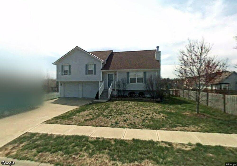
1513 NE Savoy Lees Summit, MO 64086
Estimated Value: $311,000 - $316,715
About This Home
This home is located at 1513 NE Savoy, Lees Summit, MO 64086 and is currently estimated at $314,429, approximately $245 per square foot. 1513 NE Savoy is a home located in Jackson County with nearby schools including Underwood Elementary School, Bernard C. Campbell Middle School, and Lee's Summit North High School.
Ownership History
We collect this data history from publicly available records. To have your information removed, we recommend requesting removal directly through your county’s website.
Purchase Details
Home Financials for this Owner
Home Financials are based on the most recent Mortgage that was taken out on this home.Purchase Details
Home Financials for this Owner
Home Financials are based on the most recent Mortgage that was taken out on this home.Home Values in the Area
Average Home Value in this Area
Purchase History
We collect this data history from publicly available records. To have your information removed, we recommend requesting removal directly through your county’s website.
| Date | Buyer | Sale Price | Title Company |
|---|---|---|---|
| -- | Kansas City Title | ||
| -- | Security Land Title Company |
Mortgage History
We collect this data history from publicly available records. To have your information removed, we recommend requesting removal directly through your county’s website.
| Date | Status | Borrower | Loan Amount |
|---|---|---|---|
| Open | $120,000 | ||
| Previous Owner | $97,400 | ||
| Closed | $30,000 |
Tax History
We collect this data history from publicly available records. To have your information removed, we recommend requesting removal directly through your county’s website.
| Year | Tax Paid | Tax Assessment Tax Assessment Total Assessment is a certain percentage of the fair market value that is determined by local assessors to be the total taxable value of land and additions on the property. | Land | Improvement |
|---|---|---|---|---|
| 2025 | $2,960 | $44,475 | $7,585 | $36,890 |
| 2024 | $2,938 | $40,993 | $7,277 | $33,716 |
| 2023 | $2,938 | $40,992 | $6,855 | $34,137 |
| 2022 | $2,715 | $33,630 | $4,352 | $29,278 |
| 2021 | $2,771 | $33,630 | $4,352 | $29,278 |
| 2020 | $2,611 | $31,384 | $4,352 | $27,032 |
| 2019 | $2,540 | $31,384 | $4,352 | $27,032 |
| 2018 | $2,382 | $27,315 | $3,788 | $23,527 |
| 2017 | $2,382 | $27,315 | $3,788 | $23,527 |
| 2016 | $2,384 | $27,056 | $4,047 | $23,009 |
| 2014 | $2,225 | $24,749 | $4,044 | $20,705 |
Map
- 1200 NE Colleen Dr
- 1108 NE Colleen Dr
- 1204 NE Hendrix Dr
- 1700 NE Bluff St
- 1708 NE Bluff St
- 908 NE Michael Dr
- 1029 NE Brookfield Dr
- 1416 NE Ernest Way
- 1412 NE Ernest Way
- 1713 NE Ravenwood Dr
- 1829 NE Riley Dr
- 1348 NE Timbercreek Dr
- 1740 NE Nine Oaks Dr
- 717 NE Ball Dr
- 1128 NE Westwind Dr
- 617 NE Birchwood Dr
- 1401 NE Bronze Dr
- 608 NE Birchwood Dr
- 1136 NE Birchwood Place
- 705 NE Banner Dr
- 1125 NE Bryant Dr
- 1136 NE Colleen Dr
- 1512 NE Savoy
- 1121 NE Bryant Dr
- 1508 NE Savoy
- 1132 NE Colleen Dr
- 1124 NE Colleen Dr
- 1116 NE Colleen Dr
- 1117 NE Bryant Dr
- 1124 NE Bryant Dr
- 1204 NE Colleen Dr
- 1137 NE Colleen Dr
- 1133 NE Colleen Dr
- 1120 NE Bryant Dr
- 1205 NE Bryant Cir
- 1141 NE Colleen Dr
- 1200 NE Bryant Cir
- 1129 NE Colleen Dr
- 1201 NE Colleen Dr
- 1116 NE Bryant Dr
Ask me questions while you tour the home.