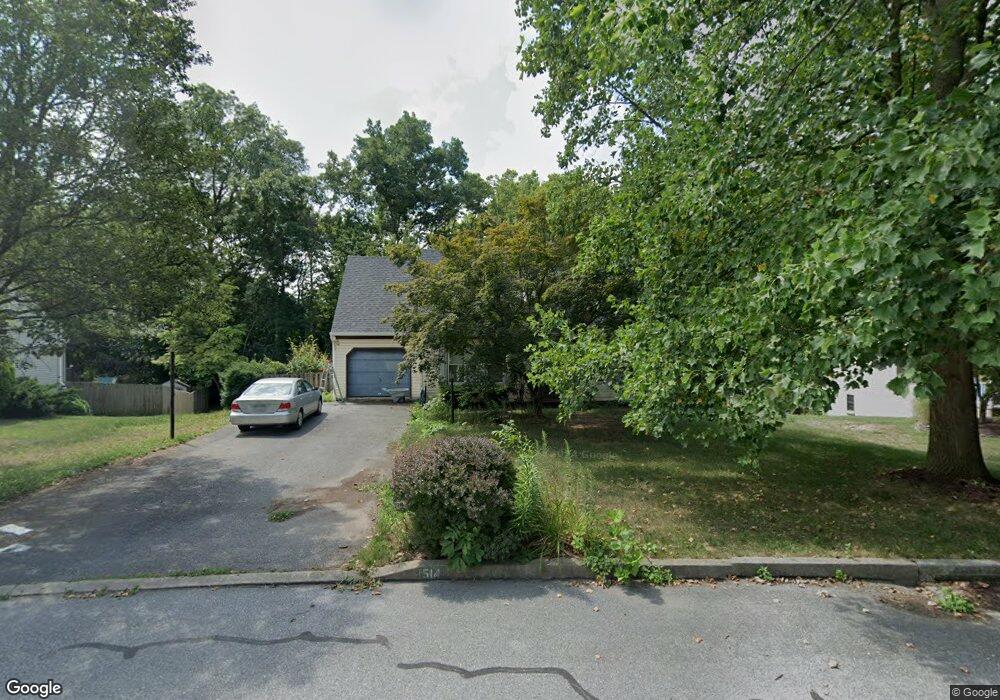
1514 Abbas Ave Lancaster, PA 17602
Bridgeport NeighborhoodEstimated Value: $375,710 - $486,000
4
Beds
2
Baths
1,591
Sq Ft
$275/Sq Ft
Est. Value
About This Home
This home is located at 1514 Abbas Ave, Lancaster, PA 17602 and is currently estimated at $436,928, approximately $274 per square foot. 1514 Abbas Ave is a home located in Lancaster County with nearby schools including Lampeter Elementary School, Hans Herr Elementary School, and Martin Meylin Middle School.
Ownership History
Date
Name
Owned For
Owner Type
Purchase Details
Closed on
Jul 3, 2002
Sold by
Cherry Douglas W and Cherry Carol A
Bought by
Clarke Edward J and Clarke Jennifer P
Current Estimated Value
Home Financials for this Owner
Home Financials are based on the most recent Mortgage that was taken out on this home.
Original Mortgage
$127,900
Outstanding Balance
$54,642
Interest Rate
6.82%
Estimated Equity
$382,286
Create a Home Valuation Report for This Property
The Home Valuation Report is an in-depth analysis detailing your home's value as well as a comparison with similar homes in the area
Home Values in the Area
Average Home Value in this Area
Purchase History
| Date | Buyer | Sale Price | Title Company |
|---|---|---|---|
| Clarke Edward J | $159,900 | Fidelity National Title |
Source: Public Records
Mortgage History
| Date | Status | Borrower | Loan Amount |
|---|---|---|---|
| Open | Clarke Edward J | $127,900 | |
| Closed | Clarke Edward J | $24,000 |
Source: Public Records
Tax History
| Year | Tax Paid | Tax Assessment Tax Assessment Total Assessment is a certain percentage of the fair market value that is determined by local assessors to be the total taxable value of land and additions on the property. | Land | Improvement |
|---|---|---|---|---|
| 2025 | $6,431 | $191,900 | $51,300 | $140,600 |
| 2024 | $6,431 | $191,900 | $51,300 | $140,600 |
| 2023 | $6,357 | $191,900 | $51,300 | $140,600 |
| 2022 | $6,114 | $191,900 | $51,300 | $140,600 |
| 2021 | $6,052 | $191,900 | $51,300 | $140,600 |
| 2020 | $6,052 | $191,900 | $51,300 | $140,600 |
| 2019 | $5,998 | $191,900 | $51,300 | $140,600 |
| 2018 | $3,087 | $191,900 | $51,300 | $140,600 |
| 2017 | $5,763 | $150,000 | $38,700 | $111,300 |
| 2016 | $5,700 | $150,000 | $38,700 | $111,300 |
| 2015 | $2,663 | $150,000 | $38,700 | $111,300 |
| 2014 | $4,789 | $150,000 | $38,700 | $111,300 |
Source: Public Records
Map
Nearby Homes
- 133 Conestoga Blvd
- 806 Lightfoot Dr
- 257 Longfellow Dr
- 38 Conestoga Dr
- 516 Conestoga Greenway Trail
- 1829 Krystle Dr
- 647 S Franklin St
- 1036 E King St
- 47 Riverside Ave
- 32 Greenfield Rd
- 464 S Ann St
- 911 E King St
- 980 E Orange St
- 70 Chesapeake St
- 8 White Tail Path
- 121 S Marshall St
- 227 S Ann St
- 53 S Marshall St
- 153 N Broad St
- 225 Dauphin St
- 1506 Abbas Ave
- 1522 Abbas Ave
- 1490 Abbas Ave
- 1528 Abbas Ave
- 355 Rozet Ave
- 1525 Abbas Ave
- 1480 Abbas Ave
- 1536 Abbas Ave
- 345 Rozet Ave
- 340 William Ln
- 109 River Bend Park
- 108 River Bend Park
- 107 River Bend Park
- 1475 Abbas Ave
- 335 Rozet Ave
- 1470 Abbas Ave
- 1544 Abbas Ave
- 98 River Bend Park Unit 98
- 99 River Bend Park
- 100 River Bend Park
Your Personal Tour Guide
Ask me questions while you tour the home.