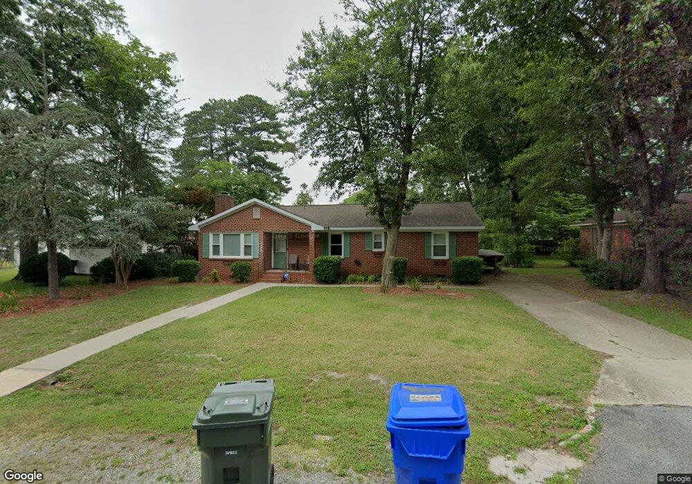
1514 Brittle Dr Suffolk, VA 23434
Holy Neck NeighborhoodEstimated Value: $308,000 - $325,000
3
Beds
2
Baths
1,400
Sq Ft
$224/Sq Ft
Est. Value
About This Home
This home is located at 1514 Brittle Dr, Suffolk, VA 23434 and is currently estimated at $313,184, approximately $223 per square foot. 1514 Brittle Dr is a home located in Suffolk City with nearby schools including Kilby Shores Elementary School, Forest Glen Middle School, and Lakeland High School.
Ownership History
Date
Name
Owned For
Owner Type
Purchase Details
Closed on
May 27, 2022
Sold by
Scott Adams Brian
Bought by
Hornyak Christina Nicole
Current Estimated Value
Home Financials for this Owner
Home Financials are based on the most recent Mortgage that was taken out on this home.
Original Mortgage
$243,340
Outstanding Balance
$231,193
Interest Rate
5.1%
Mortgage Type
New Conventional
Estimated Equity
$81,991
Create a Home Valuation Report for This Property
The Home Valuation Report is an in-depth analysis detailing your home's value as well as a comparison with similar homes in the area
Home Values in the Area
Average Home Value in this Area
Purchase History
| Date | Buyer | Sale Price | Title Company |
|---|---|---|---|
| Hornyak Christina Nicole | $285,000 | Fidelity National Title |
Source: Public Records
Mortgage History
| Date | Status | Borrower | Loan Amount |
|---|---|---|---|
| Open | Hornyak Christina Nicole | $243,340 |
Source: Public Records
Tax History Compared to Growth
Tax History
| Year | Tax Paid | Tax Assessment Tax Assessment Total Assessment is a certain percentage of the fair market value that is determined by local assessors to be the total taxable value of land and additions on the property. | Land | Improvement |
|---|---|---|---|---|
| 2024 | $3,946 | $276,900 | $65,000 | $211,900 |
| 2023 | $3,356 | $265,900 | $60,000 | $205,900 |
| 2022 | $2,506 | $229,900 | $60,000 | $169,900 |
| 2021 | $2,192 | $197,500 | $43,100 | $154,400 |
| 2020 | $2,086 | $187,900 | $43,100 | $144,800 |
| 2019 | $1,924 | $173,300 | $43,100 | $130,200 |
| 2018 | $1,979 | $167,300 | $43,100 | $124,200 |
| 2017 | $1,739 | $162,500 | $43,100 | $119,400 |
| 2016 | $1,687 | $157,700 | $43,100 | $114,600 |
| 2015 | $967 | $171,200 | $43,100 | $128,100 |
| 2014 | $967 | $171,200 | $43,100 | $128,100 |
Source: Public Records
Map
Nearby Homes
- 19 Grove Ave
- 68AC Manning Rd
- 116 Grove Ave
- 4035 Brians Ln
- SALEM Plan at Brewers Meadows South
- PENWELL Plan at Brewers Meadows South
- HAYDEN Plan at Brewers Meadows South
- GALEN Plan at Brewers Meadows South
- HANOVER Plan at Brewers Meadows South
- 202 Grove Ave
- 128 Deborah Dr
- 102 Tupelo Way
- 510 Boxwood Ct
- 4043 Brians Ln
- 4045 Brians Ln
- 4040 Brians Ln
- 4042 Brians Ln
- 4048 Brians Ln
- 109 Winterview Dr
- 1673 Faulk Rd
- 1512 Brittle Dr
- 1516 Brittle Dr
- 214 Staley Dr
- 212 Staley Dr
- 1511 Goodwin St
- 1509 Goodwin St
- 220 Staley Dr
- 210 Staley Dr
- 1507 Goodwin St
- 1513 Brittle Dr
- 1511 Brittle Dr
- 1509 Brittle Dr
- 217 Staley Dr
- 208 Staley Dr
- 211 Staley Dr
- 224 Staley Dr
- 307 Turlington Rd
- 1510 Goodwin St
- 309 Turlington Rd
- 221 Staley Dr