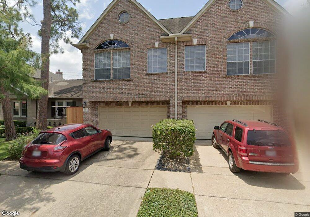
1514 Hazard St Unit A Houston, TX 77019
Montrose NeighborhoodEstimated Value: $595,725 - $796,000
3
Beds
3
Baths
2,603
Sq Ft
$268/Sq Ft
Est. Value
About This Home
This home is located at 1514 Hazard St Unit A, Houston, TX 77019 and is currently estimated at $697,431, approximately $267 per square foot. 1514 Hazard St Unit A is a home located in Harris County with nearby schools including Baker Montessori, Lanier Middle School, and Lamar High School.
Ownership History
Date
Name
Owned For
Owner Type
Purchase Details
Closed on
Jul 21, 2025
Sold by
Yu Vannevar and Yu Melissa Michelle
Bought by
Yu Living Trust and Yu
Current Estimated Value
Purchase Details
Closed on
May 8, 2003
Sold by
Dimlich Stephen H and Dimlich Kris Williams
Bought by
Weitz Ellen
Home Financials for this Owner
Home Financials are based on the most recent Mortgage that was taken out on this home.
Original Mortgage
$288,000
Interest Rate
5.77%
Mortgage Type
Purchase Money Mortgage
Create a Home Valuation Report for This Property
The Home Valuation Report is an in-depth analysis detailing your home's value as well as a comparison with similar homes in the area
Home Values in the Area
Average Home Value in this Area
Purchase History
| Date | Buyer | Sale Price | Title Company |
|---|---|---|---|
| Yu Living Trust | -- | None Listed On Document | |
| Weitz Ellen | -- | Chicago Title |
Source: Public Records
Mortgage History
| Date | Status | Borrower | Loan Amount |
|---|---|---|---|
| Previous Owner | Weitz Ellen | $288,000 | |
| Closed | Weitz Ellen | $36,000 |
Source: Public Records
Tax History Compared to Growth
Tax History
| Year | Tax Paid | Tax Assessment Tax Assessment Total Assessment is a certain percentage of the fair market value that is determined by local assessors to be the total taxable value of land and additions on the property. | Land | Improvement |
|---|---|---|---|---|
| 2025 | $8,846 | $612,742 | $275,000 | $337,742 |
| 2024 | $8,846 | $579,325 | $275,000 | $304,325 |
| 2023 | $8,846 | $583,494 | $275,000 | $308,494 |
| 2022 | $11,819 | $536,777 | $275,000 | $261,777 |
| 2021 | $11,799 | $506,261 | $262,500 | $243,761 |
| 2020 | $12,320 | $508,899 | $262,500 | $246,399 |
| 2019 | $11,703 | $462,503 | $150,000 | $312,503 |
| 2018 | $9,616 | $487,511 | $150,000 | $337,511 |
| 2017 | $12,936 | $487,511 | $150,000 | $337,511 |
| 2016 | $12,936 | $487,511 | $150,000 | $337,511 |
| 2015 | $8,232 | $487,511 | $150,000 | $337,511 |
| 2014 | $8,232 | $441,995 | $131,250 | $310,745 |
Source: Public Records
Map
Nearby Homes
- 1509 Mcduffie St
- 1606 Hazard St
- 1510 Morse St
- 1606 Woodhead St
- 1201 Mcduffie St Unit 198
- 1712 Mcduffie St
- 1601 S Shepherd Dr Unit 20
- 1601 S Shepherd Dr Unit 29
- 1601 S Shepherd Dr Unit 138
- 1810 Hazard St Unit A
- 1711 Huldy St Unit A
- 1956 Vermont St
- 1822 Morse St Unit A
- 3711 Newhouse St
- 2105 Del Monte Dr
- 1914 W Gray St Unit 301
- 1025 S Shepherd Dr Unit 209
- 1906 Woodhead St
- 1909 Brun St Unit 17
- 1909 Brun St Unit 16
- 1514 Hazard St Unit B
- 1514A Hazard St
- 1510 Hazard St
- 1600 Hazard St
- 1508 Hazard St
- 1513 Mcduffie St
- 1515 Mcduffie St
- 1511 Mcduffie St
- 1506 Hazard St
- 1604 Hazard St
- 1517 Mcduffie St
- 1504 Hazard St
- 1507 Mcduffie St
- 1505 Mcduffie St
- 1513 Hazard St
- 1601 Mcduffie St
- 1967 Peden St
- 1511 Hazard St
- 1517 Hazard St
- 1502 Hazard St