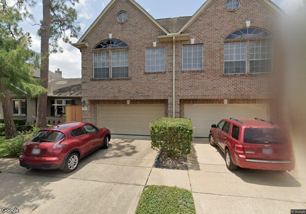
1514 Hazard St Unit B Houston, TX 77019
Montrose NeighborhoodEstimated Value: $593,809 - $787,000
4
Beds
3
Baths
2,510
Sq Ft
$281/Sq Ft
Est. Value
About This Home
This home is located at 1514 Hazard St Unit B, Houston, TX 77019 and is currently estimated at $706,202, approximately $281 per square foot. 1514 Hazard St Unit B is a home located in Harris County with nearby schools including Baker Montessori, Lanier Middle School, and Lamar High School.
Ownership History
Date
Name
Owned For
Owner Type
Purchase Details
Closed on
Sep 17, 2013
Sold by
Reed Christine and Kneisel Kenneth L
Bought by
Yu Vannevar and Yu Melissa
Current Estimated Value
Home Financials for this Owner
Home Financials are based on the most recent Mortgage that was taken out on this home.
Original Mortgage
$366,000
Outstanding Balance
$273,660
Interest Rate
4.45%
Mortgage Type
New Conventional
Estimated Equity
$432,542
Purchase Details
Closed on
Sep 25, 2006
Sold by
Melhem Ziad Abraham
Bought by
Kneisel Kenneth L and Reed Christine
Home Financials for this Owner
Home Financials are based on the most recent Mortgage that was taken out on this home.
Original Mortgage
$145,000
Interest Rate
6.37%
Mortgage Type
Purchase Money Mortgage
Purchase Details
Closed on
Aug 5, 2004
Sold by
Melhem Danielle Khouri
Bought by
Melhem Ziad Abraham
Purchase Details
Closed on
Jun 20, 2003
Sold by
Clifford Philip F and Clifford Suzanne S
Bought by
Melhem Daniel and Melhem Ziad
Home Financials for this Owner
Home Financials are based on the most recent Mortgage that was taken out on this home.
Original Mortgage
$369,000
Interest Rate
5.37%
Mortgage Type
Purchase Money Mortgage
Purchase Details
Closed on
Dec 10, 1999
Sold by
Cleaver Custom Homes Inc
Bought by
Dimlich Stephen H and Dimlich Kris Williams
Home Financials for this Owner
Home Financials are based on the most recent Mortgage that was taken out on this home.
Original Mortgage
$257,600
Interest Rate
7.37%
Create a Home Valuation Report for This Property
The Home Valuation Report is an in-depth analysis detailing your home's value as well as a comparison with similar homes in the area
Home Values in the Area
Average Home Value in this Area
Purchase History
| Date | Buyer | Sale Price | Title Company |
|---|---|---|---|
| Yu Vannevar | -- | Old Republic National Title | |
| Kneisel Kenneth L | -- | Startex Title Company | |
| Melhem Ziad Abraham | -- | -- | |
| Melhem Daniel | -- | -- | |
| Dimlich Stephen H | -- | Stewart Title Company |
Source: Public Records
Mortgage History
| Date | Status | Borrower | Loan Amount |
|---|---|---|---|
| Open | Yu Vannevar | $366,000 | |
| Previous Owner | Kneisel Kenneth L | $145,000 | |
| Previous Owner | Melhem Daniel | $369,000 | |
| Previous Owner | Dimlich Stephen H | $257,600 |
Source: Public Records
Tax History Compared to Growth
Tax History
| Year | Tax Paid | Tax Assessment Tax Assessment Total Assessment is a certain percentage of the fair market value that is determined by local assessors to be the total taxable value of land and additions on the property. | Land | Improvement |
|---|---|---|---|---|
| 2025 | $8,846 | $612,742 | $275,000 | $337,742 |
| 2024 | $8,846 | $579,325 | $275,000 | $304,325 |
| 2023 | $8,846 | $583,494 | $275,000 | $308,494 |
| 2022 | $11,819 | $536,777 | $275,000 | $261,777 |
| 2021 | $11,799 | $506,261 | $262,500 | $243,761 |
| 2020 | $12,320 | $508,899 | $262,500 | $246,399 |
| 2019 | $11,703 | $462,503 | $150,000 | $312,503 |
| 2018 | $9,616 | $487,511 | $150,000 | $337,511 |
| 2017 | $12,936 | $487,511 | $150,000 | $337,511 |
| 2016 | $12,936 | $487,511 | $150,000 | $337,511 |
| 2015 | $8,957 | $487,511 | $150,000 | $337,511 |
| 2014 | $8,957 | $441,995 | $131,250 | $310,745 |
Source: Public Records
Map
Nearby Homes
- 1509 Mcduffie St
- 1606 Hazard St
- 1510 Morse St
- 1606 Woodhead St
- 1201 Mcduffie St Unit 198
- 1712 Mcduffie St
- 1601 S Shepherd Dr Unit 20
- 1601 S Shepherd Dr Unit 29
- 1601 S Shepherd Dr Unit 138
- 1810 Hazard St Unit A
- 1711 Huldy St Unit A
- 1956 Vermont St
- 1822 Morse St Unit A
- 3711 Newhouse St
- 2105 Del Monte Dr
- 1914 W Gray St Unit 301
- 1025 S Shepherd Dr Unit 209
- 1906 Woodhead St
- 1909 Brun St Unit 17
- 1909 Brun St Unit 16
- 1514 Hazard St Unit A
- 1514A Hazard St
- 1510 Hazard St
- 1600 Hazard St
- 1508 Hazard St
- 1513 Mcduffie St
- 1515 Mcduffie St
- 1511 Mcduffie St
- 1506 Hazard St
- 1604 Hazard St
- 1517 Mcduffie St
- 1504 Hazard St
- 1507 Mcduffie St
- 1505 Mcduffie St
- 1513 Hazard St
- 1601 Mcduffie St
- 1967 Peden St
- 1511 Hazard St
- 1517 Hazard St
- 1502 Hazard St