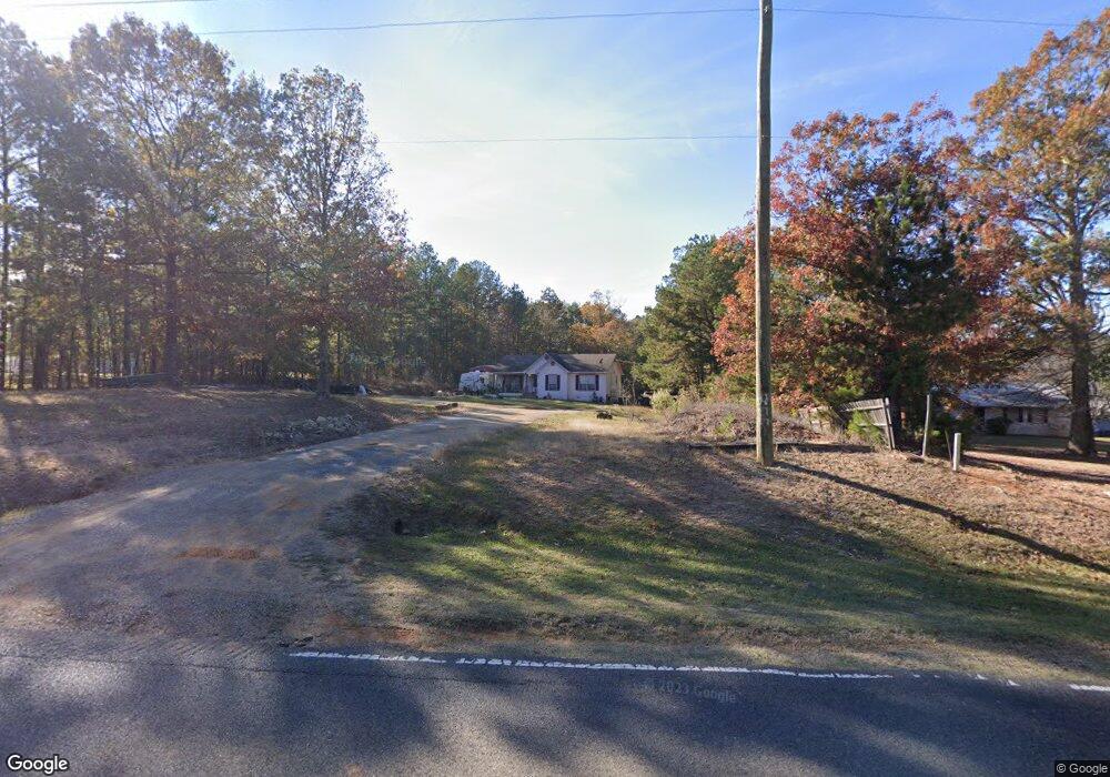
1514 Highway 151 S Calhoun, LA 71225
Estimated Value: $149,314 - $287,000
3
Beds
2
Baths
1,335
Sq Ft
$150/Sq Ft
Est. Value
About This Home
This home is located at 1514 Highway 151 S, Calhoun, LA 71225 and is currently estimated at $200,329, approximately $150 per square foot. 1514 Highway 151 S is a home located in Ouachita Parish with nearby schools including Calhoun Elementary School, Central Elementary School, and Calhoun Middle School.
Ownership History
Date
Name
Owned For
Owner Type
Purchase Details
Closed on
Jun 9, 2006
Sold by
Mcadams Everett Wade and Graham Bonnie Lee
Bought by
Delgado Edward Camilo and Twilbeck Lynne Marie
Current Estimated Value
Home Financials for this Owner
Home Financials are based on the most recent Mortgage that was taken out on this home.
Original Mortgage
$84,550
Outstanding Balance
$49,681
Interest Rate
6.56%
Mortgage Type
Unknown
Estimated Equity
$150,648
Create a Home Valuation Report for This Property
The Home Valuation Report is an in-depth analysis detailing your home's value as well as a comparison with similar homes in the area
Home Values in the Area
Average Home Value in this Area
Purchase History
| Date | Buyer | Sale Price | Title Company |
|---|---|---|---|
| Delgado Edward Camilo | $89,000 | None Available |
Source: Public Records
Mortgage History
| Date | Status | Borrower | Loan Amount |
|---|---|---|---|
| Open | Delgado Edward Camilo | $84,550 |
Source: Public Records
Tax History Compared to Growth
Tax History
| Year | Tax Paid | Tax Assessment Tax Assessment Total Assessment is a certain percentage of the fair market value that is determined by local assessors to be the total taxable value of land and additions on the property. | Land | Improvement |
|---|---|---|---|---|
| 2024 | $138 | $8,900 | $1,400 | $7,500 |
| 2023 | $138 | $8,900 | $1,400 | $7,500 |
| 2022 | $790 | $8,900 | $1,400 | $7,500 |
| 2021 | $799 | $8,900 | $1,400 | $7,500 |
| 2020 | $799 | $8,900 | $1,400 | $7,500 |
| 2019 | $797 | $8,900 | $1,400 | $7,500 |
| 2018 | $125 | $8,900 | $1,400 | $7,500 |
| 2017 | $797 | $8,900 | $1,400 | $7,500 |
| 2016 | $797 | $8,900 | $1,400 | $7,500 |
| 2015 | $125 | $8,900 | $1,400 | $7,500 |
| 2014 | $125 | $8,900 | $1,400 | $7,500 |
| 2013 | $125 | $8,900 | $1,400 | $7,500 |
Source: Public Records
Map
Nearby Homes
- 176 Lubenia Rd
- 419 Leckie Rd
- 385 Chief Ln
- 383 Chief Ln
- 191 Simba Ln
- 364 Chief Ln
- 338 Chief Ln
- 122 Simba Ln
- 316 Chief Ln
- 168 Chief Ln
- 0 Luebenia Rd Unit 205254
- Lot 14 Hartland Loop
- Lot 28 Hartland Loop
- LOT 8 Hartland Loop
- Lot 13 Hartland Loop
- Lot 23 Hartland Loop
- Lot 27 Hartland Loop
- Lot 22 Hartland Loop
- 0 Leckie Rd Unit Lot B 11551630
- 0 Leckie Rd Unit 11347493
- 1494 Highway 151 S
- 142 Luebenia Rd
- 142 Luebenia Rd Unit 40.38 acres
- 2 Luebenia Rd
- 157 Luebenia Rd
- 00 Luebenia Rd
- 00 Luebenia Rd Unit 40.38 acres
- 207 Luebenia Rd
- 155 Leckie Rd
- 1944 Golson Rd
- 1633 Highway 151 S
- 1965 Golson Rd
- 1975 Golson Rd
- 2015 Golson Rd
- 1949 Golson Rd
- 157 Leckie Rd
- 192 Leckie Rd
- 1957 Golson Rd
- 2017 Golson Rd
- 1896 Golson Rd