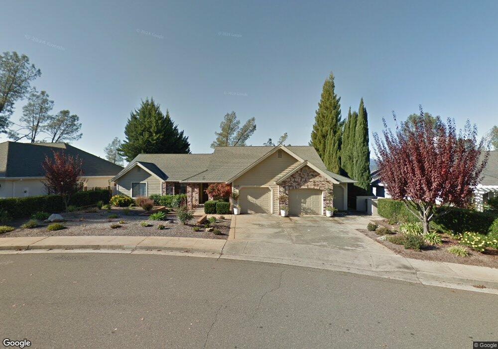
1514 Saint Andrews Dr Redding, CA 96003
Gold Hills NeighborhoodEstimated Value: $422,000 - $533,000
3
Beds
3
Baths
2,375
Sq Ft
$209/Sq Ft
Est. Value
About This Home
This home is located at 1514 Saint Andrews Dr, Redding, CA 96003 and is currently estimated at $495,863, approximately $208 per square foot. 1514 Saint Andrews Dr is a home located in Shasta County with nearby schools including Columbia Elementary School, Mountain View Middle School, and Foothill High School.
Ownership History
Date
Name
Owned For
Owner Type
Purchase Details
Closed on
Jul 6, 2023
Sold by
Vanness Donna
Bought by
Peters Family 2023 Trust and Peters
Current Estimated Value
Purchase Details
Closed on
May 4, 2023
Sold by
Peters Sean E and Peters Karen K
Bought by
Peters Family 2023 Trust
Purchase Details
Closed on
Nov 13, 2018
Sold by
Theodore Claire Nicole and John And Frances Crossley Trus
Bought by
Peters Sean E and Mitts Karen K
Purchase Details
Closed on
Jun 5, 2001
Sold by
Crossley John and Crossley Frances
Bought by
Crossley John and Crossley Frances C
Purchase Details
Closed on
Aug 31, 2000
Sold by
Denuccio Charles A
Bought by
Crossley John and Crossley Frances
Create a Home Valuation Report for This Property
The Home Valuation Report is an in-depth analysis detailing your home's value as well as a comparison with similar homes in the area
Home Values in the Area
Average Home Value in this Area
Purchase History
| Date | Buyer | Sale Price | Title Company |
|---|---|---|---|
| Peters Family 2023 Trust | -- | None Listed On Document | |
| Peters Family 2023 Trust | -- | None Listed On Document | |
| Peters Sean E | $150,000 | Placer Title Co | |
| Crossley John | -- | -- | |
| Crossley John | $250,000 | Fidelity National Title Co |
Source: Public Records
Tax History
| Year | Tax Paid | Tax Assessment Tax Assessment Total Assessment is a certain percentage of the fair market value that is determined by local assessors to be the total taxable value of land and additions on the property. | Land | Improvement |
|---|---|---|---|---|
| 2025 | $1,954 | $167,324 | $55,774 | $111,550 |
| 2024 | $1,958 | $164,044 | $54,681 | $109,363 |
| 2023 | $1,958 | $160,828 | $53,609 | $107,219 |
| 2022 | $1,885 | $157,675 | $52,558 | $105,117 |
| 2021 | $1,878 | $154,584 | $51,528 | $103,056 |
| 2020 | $1,865 | $153,000 | $51,000 | $102,000 |
| 2019 | $1,823 | $150,000 | $50,000 | $100,000 |
| 2018 | $4,296 | $355,528 | $96,961 | $258,567 |
| 2017 | $4,343 | $348,558 | $95,060 | $253,498 |
| 2016 | $4,075 | $341,725 | $93,197 | $248,528 |
| 2015 | $4,012 | $336,593 | $91,798 | $244,795 |
| 2014 | $3,903 | $331,497 | $90,408 | $241,089 |
Source: Public Records
Map
Nearby Homes
- 6173 Brassie Way
- 6040 Constitution Way
- 1672 Saint Andrews Dr
- 5890 Shadow Glen Dr
- 5808 Constitution Way
- 1779 Player Ct
- 11632 Ridgewood Rd
- 1546 Gold Hills Dr
- 5513 Diamond Ridge Dr
- 948 & 950 Hawley
- 19340 Carnegie Ct
- 19324 Hollow Ln
- 19011 Freda Ln
- 2132 Hope Ln
- 1102 Hope Ln
- 6014 Mid Drive Trail
- 662 Ansley Ct
- 19219 Nike Ct
- 5663 Terra Linda Way
- 12009 Theresa Ln
- 1514 St Andrews Dr
- 1502 Saint Andrews Dr
- 1538 St Andrews Dr
- 1515 Saint Andrews Dr
- 19053 Hollow Ln
- 1484 Saint Andrews Dr
- 1484 St Andrews Dr
- 1544 Saint Andrews Dr
- 1539 Saint Andrews Dr
- 1472 Saint Andrews Dr
- 1472 St Andrews Dr
- 1556 St Andrews Dr
- 1556 Saint Andrews Dr
- 1547 St Andrews Dr
- 1547 Saint Andrews Dr
- 6129 Turnberry 1weup7mr20t3
- 6129 Turnberry Ct
- 1460 Saint Andrews Dr
- Lot 10 Turnberry Ct
- 0 Turnberry Ct
Your Personal Tour Guide
Ask me questions while you tour the home.