Estimated Value: $976,374 - $1,062,000
5
Beds
2
Baths
1,344
Sq Ft
$763/Sq Ft
Est. Value
About This Home
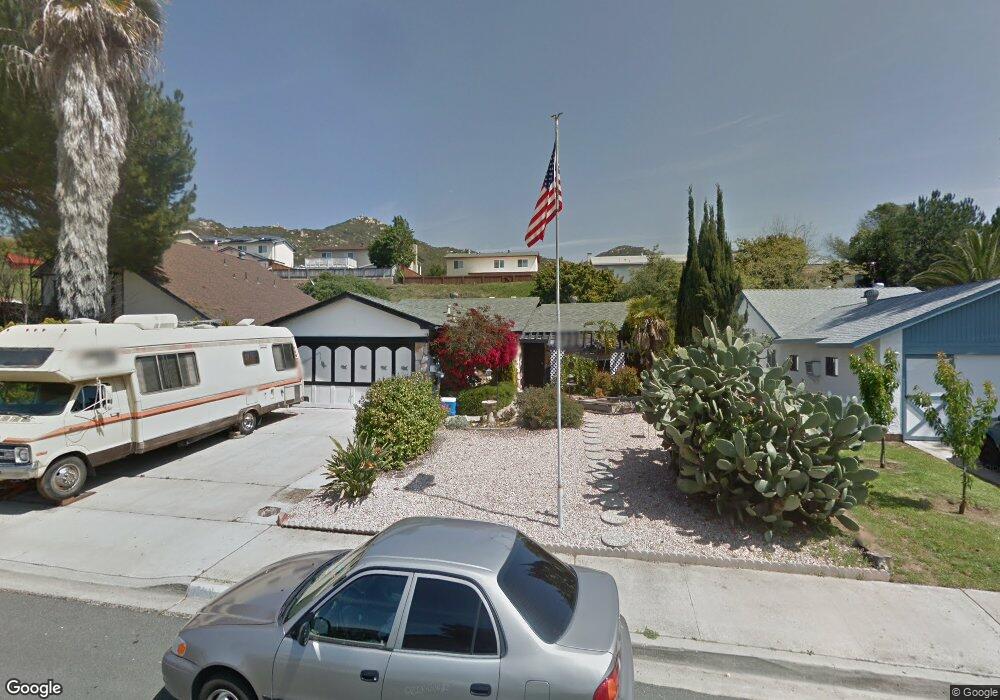
This home is located at 15141 Luis St, Poway, CA 92064 and is currently estimated at $1,024,844, approximately $762 per square foot. 15141 Luis St is a home located in San Diego County with nearby schools including Painted Rock Elementary, Bernardo Heights Middle, and Rancho Bernardo High.
Ownership History
Date
Name
Owned For
Owner Type
Purchase Details
Closed on
Nov 11, 2015
Sold by
Larson Allen M
Bought by
Dooney Donovan
Current Estimated Value
Home Financials for this Owner
Home Financials are based on the most recent Mortgage that was taken out on this home.
Original Mortgage
$308,750
Outstanding Balance
$242,351
Interest Rate
3.73%
Mortgage Type
New Conventional
Estimated Equity
$782,493
Purchase Details
Closed on
Sep 28, 2007
Sold by
Larson Allen M and Larson Helen K
Bought by
Larson Allen M and Larson Helen D
Purchase Details
Closed on
Nov 14, 2005
Sold by
Larson Allen M and Larson Helen K
Bought by
Larson Allen M and Larson Helen K
Home Financials for this Owner
Home Financials are based on the most recent Mortgage that was taken out on this home.
Original Mortgage
$155,800
Interest Rate
6.27%
Mortgage Type
Purchase Money Mortgage
Create a Home Valuation Report for This Property
The Home Valuation Report is an in-depth analysis detailing your home's value as well as a comparison with similar homes in the area
Home Values in the Area
Average Home Value in this Area
Purchase History
| Date | Buyer | Sale Price | Title Company |
|---|---|---|---|
| Dooney Donovan | $325,000 | Fidelity Natl Title Co Sd | |
| Larson Allen M | -- | None Available | |
| Larson Allen M | -- | -- | |
| Larson Allen M | -- | United Title |
Source: Public Records
Mortgage History
| Date | Status | Borrower | Loan Amount |
|---|---|---|---|
| Open | Dooney Donovan | $308,750 | |
| Previous Owner | Larson Allen M | $155,800 |
Source: Public Records
Tax History
| Year | Tax Paid | Tax Assessment Tax Assessment Total Assessment is a certain percentage of the fair market value that is determined by local assessors to be the total taxable value of land and additions on the property. | Land | Improvement |
|---|---|---|---|---|
| 2025 | $4,250 | $384,728 | $260,433 | $124,295 |
| 2024 | $4,250 | $377,185 | $255,327 | $121,858 |
| 2023 | $4,159 | $369,790 | $250,321 | $119,469 |
| 2022 | $4,089 | $362,540 | $245,413 | $117,127 |
| 2021 | $4,036 | $355,432 | $240,601 | $114,831 |
| 2020 | $3,982 | $351,788 | $238,134 | $113,654 |
| 2019 | $3,878 | $344,891 | $233,465 | $111,426 |
| 2018 | $3,770 | $338,130 | $228,888 | $109,242 |
| 2017 | $170 | $331,500 | $224,400 | $107,100 |
| 2016 | $3,593 | $325,000 | $220,000 | $105,000 |
| 2015 | $1,265 | $113,275 | $27,271 | $86,004 |
| 2014 | $1,237 | $111,057 | $26,737 | $84,320 |
Source: Public Records
Map
Nearby Homes
- 0 La Manda Dr Unit 260002248
- 14613 Plumwood St
- 14725 Fieldview Way
- 14811 Summerbreeze Way
- 12526 Boulder Mountain Rd Unit 1,2,3
- 15601 Via Marchena
- 15606 Via Marchena
- 12333 Bachimba Ct
- Hawkeye Waverly Downs Way Unit A70
- 15748 Via Calanova Unit LU98
- 12135 Caminito Corriente
- 12047 Alta Carmel Ct Unit 189
- 12059 Alta Carmel Ct Unit 167
- 12023 Alta Carmel Ct Unit 253
- 12059 Alta Carmel Ct Unit 168
- 14230 Jonah Way
- 15913 Avenida Villaha Unit 42
- 12027 Caminito Corriente
- 16118 Selva Dr
- 15130 Saddlebrook Ln
Your Personal Tour Guide
Ask me questions while you tour the home.