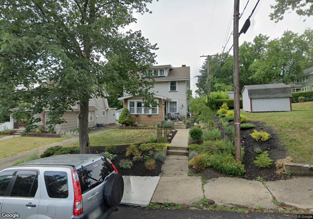
1515 10th St NW Canton, OH 44703
Southwest Canton NeighborhoodEstimated Value: $103,692 - $129,000
3
Beds
1
Bath
1,154
Sq Ft
$105/Sq Ft
Est. Value
About This Home
This home is located at 1515 10th St NW, Canton, OH 44703 and is currently estimated at $121,423, approximately $105 per square foot. 1515 10th St NW is a home located in Stark County with nearby schools including Early Learning Center @ Schreiber, Cedar Elementary School, and McGregor Elementary School.
Ownership History
Date
Name
Owned For
Owner Type
Purchase Details
Closed on
Apr 28, 2006
Sold by
Mayle Ella K and Mayle Carl R
Bought by
Mayle Carl R and Mayle Ella K
Current Estimated Value
Purchase Details
Closed on
Oct 21, 1999
Sold by
Lehberger James R and Lehberger Betty M
Bought by
Mayle Ella K and Mayle Carl R
Home Financials for this Owner
Home Financials are based on the most recent Mortgage that was taken out on this home.
Original Mortgage
$51,300
Interest Rate
7.91%
Mortgage Type
Purchase Money Mortgage
Create a Home Valuation Report for This Property
The Home Valuation Report is an in-depth analysis detailing your home's value as well as a comparison with similar homes in the area
Home Values in the Area
Average Home Value in this Area
Purchase History
| Date | Buyer | Sale Price | Title Company |
|---|---|---|---|
| Mayle Carl R | -- | None Available | |
| Mayle Ella K | $54,000 | Mk Title Agency Of Stark Cou |
Source: Public Records
Mortgage History
| Date | Status | Borrower | Loan Amount |
|---|---|---|---|
| Previous Owner | Mayle Ella K | $51,300 |
Source: Public Records
Tax History Compared to Growth
Tax History
| Year | Tax Paid | Tax Assessment Tax Assessment Total Assessment is a certain percentage of the fair market value that is determined by local assessors to be the total taxable value of land and additions on the property. | Land | Improvement |
|---|---|---|---|---|
| 2025 | $1,282 | $25,970 | $6,650 | $19,320 |
| 2024 | $4,592 | $25,970 | $6,650 | $19,320 |
| 2023 | $4,592 | $21,180 | $7,110 | $14,070 |
| 2022 | $1,231 | $21,180 | $7,110 | $14,070 |
| 2021 | $1,244 | $21,180 | $7,110 | $14,070 |
| 2020 | $1,053 | $16,030 | $5,670 | $10,360 |
| 2019 | $919 | $16,040 | $5,670 | $10,370 |
| 2018 | $925 | $16,040 | $5,670 | $10,370 |
| 2017 | $890 | $14,040 | $4,940 | $9,100 |
| 2016 | $892 | $14,040 | $4,940 | $9,100 |
| 2015 | $898 | $14,040 | $4,940 | $9,100 |
| 2014 | $809 | $11,880 | $4,170 | $7,710 |
| 2013 | $391 | $11,880 | $4,170 | $7,710 |
Source: Public Records
Map
Nearby Homes
- 1016 Clinton Ave SW
- 924 Prospect Ave SW
- 719 Prospect Ave SW
- 1215 Dueber Ave SW
- 1021 Greenfield Ave SW
- 633 Park Ave SW
- 1227 Greenfield Ave SW
- 1356 Margaret Ave SW
- 1001 Harrison Ave SW
- 631 Greenfield Ave SW
- 1370 Lee Ct SW
- 1384 Stark Ave SW
- 1000 6th St SW
- 1009 Arlington Ave SW
- 2411 Strasser Place SW
- 2420 Clyde Place SW
- 241 Raymont Ct SW
- 202 Lincoln Ave NW
- 921 Clarendon Ave SW
- 306 Park Ave NW
- 1515 10th St SW
- 938 Clinton Ave SW
- 928 Clinton Ave SW
- 937 Camden Ave SW
- 935 Camden Ave SW
- 1514 10th St SW
- 1518 10th St SW
- 929 Camden Ave SW
- 1000 Clinton Ave SW
- 1001 Camden Ave SW
- 1004 Clinton Ave SW
- 1007 Camden Ave SW
- 920 Clinton Ave SW
- 921 Camden Ave SW
- 1008 Clinton Ave SW
- 917 Camden Ave SW
- 1009 Camden Ave SW
- 1012 Clinton Ave SW
- 939 Clinton Ave SW
- 1013 Camden Ave SW