Estimated Value: $211,136 - $645,000
--
Bed
--
Bath
--
Sq Ft
5,750
Sq Ft Lot
About This Home
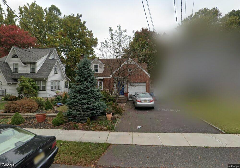
This home is located at 1515 Brookside Dr, Union, NJ 07083 and is currently estimated at $512,034. 1515 Brookside Dr is a home located in Union County with nearby schools including Livingston Elementary School, Union High School, and St Michael Parish School.
Ownership History
Date
Name
Owned For
Owner Type
Purchase Details
Closed on
Sep 26, 2012
Sold by
Montalbine Diane-Montalbine Lucy
Bought by
Montalbine Diane
Current Estimated Value
Purchase Details
Closed on
Jul 29, 2003
Sold by
Okunonke Ije
Bought by
Montalbine Diane and Montalbine Lucy
Purchase Details
Closed on
May 15, 2003
Sold by
Obiorah Edwin
Bought by
Okunonke Ije
Purchase Details
Closed on
Apr 26, 1999
Sold by
Obiorah Edwin N and Okunonke Ije
Bought by
Okunonke Ije
Home Financials for this Owner
Home Financials are based on the most recent Mortgage that was taken out on this home.
Original Mortgage
$141,600
Interest Rate
7.09%
Purchase Details
Closed on
Dec 20, 1996
Sold by
Rodrigues Margaret
Bought by
Obiorah Edwin N and Okunonke Ije
Home Financials for this Owner
Home Financials are based on the most recent Mortgage that was taken out on this home.
Original Mortgage
$148,500
Interest Rate
7.48%
Create a Home Valuation Report for This Property
The Home Valuation Report is an in-depth analysis detailing your home's value as well as a comparison with similar homes in the area
Home Values in the Area
Average Home Value in this Area
Purchase History
| Date | Buyer | Sale Price | Title Company |
|---|---|---|---|
| Montalbine Diane | -- | -- | |
| Montalbine Diane | $275,000 | -- | |
| Okunonke Ije | -- | -- | |
| Okunonke Ije | -- | -- | |
| Obiorah Edwin N | $165,000 | -- |
Source: Public Records
Mortgage History
| Date | Status | Borrower | Loan Amount |
|---|---|---|---|
| Previous Owner | Okunonke Ije | $141,600 | |
| Previous Owner | Obiorah Edwin N | $148,500 |
Source: Public Records
Tax History Compared to Growth
Tax History
| Year | Tax Paid | Tax Assessment Tax Assessment Total Assessment is a certain percentage of the fair market value that is determined by local assessors to be the total taxable value of land and additions on the property. | Land | Improvement |
|---|---|---|---|---|
| 2025 | $8,829 | $39,500 | $20,500 | $19,000 |
| 2024 | $8,559 | $39,500 | $20,500 | $19,000 |
| 2023 | $8,559 | $39,500 | $20,500 | $19,000 |
| 2022 | $8,262 | $39,500 | $20,500 | $19,000 |
| 2021 | $8,062 | $39,500 | $20,500 | $19,000 |
| 2020 | $7,901 | $39,500 | $20,500 | $19,000 |
| 2019 | $7,795 | $39,500 | $20,500 | $19,000 |
| 2018 | $7,662 | $39,500 | $20,500 | $19,000 |
| 2017 | $7,548 | $39,500 | $20,500 | $19,000 |
| 2016 | $7,364 | $39,500 | $20,500 | $19,000 |
| 2015 | $7,242 | $39,500 | $20,500 | $19,000 |
| 2014 | $7,080 | $39,500 | $20,500 | $19,000 |
Source: Public Records
Map
Nearby Homes
- 1040 Cranbrook Rd
- 1370 Beverly Rd
- 1267 Erhardt St
- 1393 Cornell Place
- 1322 Marcella Dr
- 365 Broadwell Ave
- 969 Arnet Ave
- 875 Salem Rd
- 142 Eastern Pkwy
- 286 Mclean Place
- 328 Minute Arms Rd
- 631 Golf Terrace
- 553 Harvard Ave
- 557 Yale Ave
- 795 Colonial Arms Rd
- 507 Locust Ave
- 617 Tillman St
- 314 Fitzpatrick St
- 169 Valley View Rd
- 112 Apple Tree Ln
- 1509 Brookside Dr
- 1519 Brookside Dr
- 1505 Brookside Dr
- 1523 Brookside Dr
- 1510 Union County Pkwy
- 1506 Union County Pkwy
- 1514 Union County Pkwy
- 1527 Brookside Dr
- 1500 Union County Pkwy
- 1508 Brookside Dr
- 1512 Brookside Dr
- 1501 Brookside Dr
- 1504 Brookside Dr
- 1516 Brookside Dr
- 1497 Brookside Dr
- 1520 Brookside Dr
- 1500 Brookside Dr
- 1531 Brookside Dr
- 1029 Sayre Rd
- 1496 Union County Pkwy