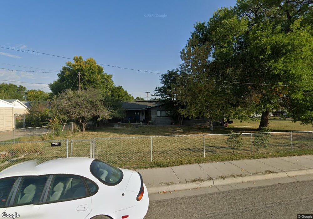
1515 E Main St Laurel, MT 59044
Estimated Value: $211,000 - $289,258
3
Beds
1
Bath
1,532
Sq Ft
$163/Sq Ft
Est. Value
About This Home
This home is located at 1515 E Main St, Laurel, MT 59044 and is currently estimated at $249,565, approximately $162 per square foot. 1515 E Main St is a home located in Yellowstone County with nearby schools including Fred W. Graff School, West School, and Laurel Middle School.
Ownership History
Date
Name
Owned For
Owner Type
Purchase Details
Closed on
Apr 11, 2025
Sold by
Vogele Arthur P
Bought by
Banded Properties Llc
Current Estimated Value
Purchase Details
Closed on
Jul 27, 2021
Sold by
Tones Joel A
Bought by
Vogele Arthur P
Home Financials for this Owner
Home Financials are based on the most recent Mortgage that was taken out on this home.
Original Mortgage
$60,000
Interest Rate
2.96%
Mortgage Type
New Conventional
Create a Home Valuation Report for This Property
The Home Valuation Report is an in-depth analysis detailing your home's value as well as a comparison with similar homes in the area
Home Values in the Area
Average Home Value in this Area
Purchase History
| Date | Buyer | Sale Price | Title Company |
|---|---|---|---|
| Banded Properties Llc | -- | None Listed On Document | |
| Vogele Arthur P | -- | None Listed On Document |
Source: Public Records
Mortgage History
| Date | Status | Borrower | Loan Amount |
|---|---|---|---|
| Previous Owner | Vogele Arthur P | $60,000 |
Source: Public Records
Tax History
| Year | Tax Paid | Tax Assessment Tax Assessment Total Assessment is a certain percentage of the fair market value that is determined by local assessors to be the total taxable value of land and additions on the property. | Land | Improvement |
|---|---|---|---|---|
| 2025 | $2,363 | $198,457 | $53,367 | $145,090 |
| 2024 | $2,363 | $218,500 | $44,708 | $173,792 |
| 2023 | $2,195 | $218,500 | $44,708 | $173,792 |
| 2022 | $1,750 | $156,700 | $0 | $0 |
| 2021 | $2,083 | $195,000 | $0 | $0 |
| 2020 | $1,952 | $181,500 | $0 | $0 |
| 2019 | $2,014 | $181,500 | $0 | $0 |
| 2018 | $1,776 | $156,200 | $0 | $0 |
| 2017 | $1,649 | $156,200 | $0 | $0 |
| 2016 | $1,552 | $147,200 | $0 | $0 |
| 2015 | $1,535 | $147,200 | $0 | $0 |
| 2014 | $1,429 | $70,967 | $0 | $0 |
Source: Public Records
Map
Nearby Homes
- 1108 E 8th St
- 605 Date Ave
- 1104 E 8th St
- 1031 Fir Ave
- 1321 E Railroad St
- 801 E 4th St
- 717 E 5th, 506 Alder Ave
- 717 E 5th St
- 414 Wyoming Ave
- 809 Pennsylvania Ave
- 516 Pennsylvania Ave
- 110 E 5th St
- 1665 Wild Lupine Ln
- 603 5th Ave
- 116 4th Ave
- 409 Maple Ave
- 1319 Valley Dr
- 211 Woodland Ave
- 319 6th Ave
- 1627 Brookway Cir
- 616 Locust Ave
- TBD E Main St
- 601 Juniper Ave
- 618 Locust Ave
- 523 Juniper Ave
- 605 Juniper Ave
- 519 Juniper Ave
- 622 Locust Ave
- 605 Locust Ave
- 615 Juniper Ave
- 628 Locust Ave
- 619 Juniper Ave
- 619 Locust Ave
- 617 Locust Ave
- 602 Juniper Ave
- 608 Juniper Ave
- 610 Juniper Ave
- 702 Locust Ave
- 524 Juniper Ave
- 614 Juniper Ave
Your Personal Tour Guide
Ask me questions while you tour the home.