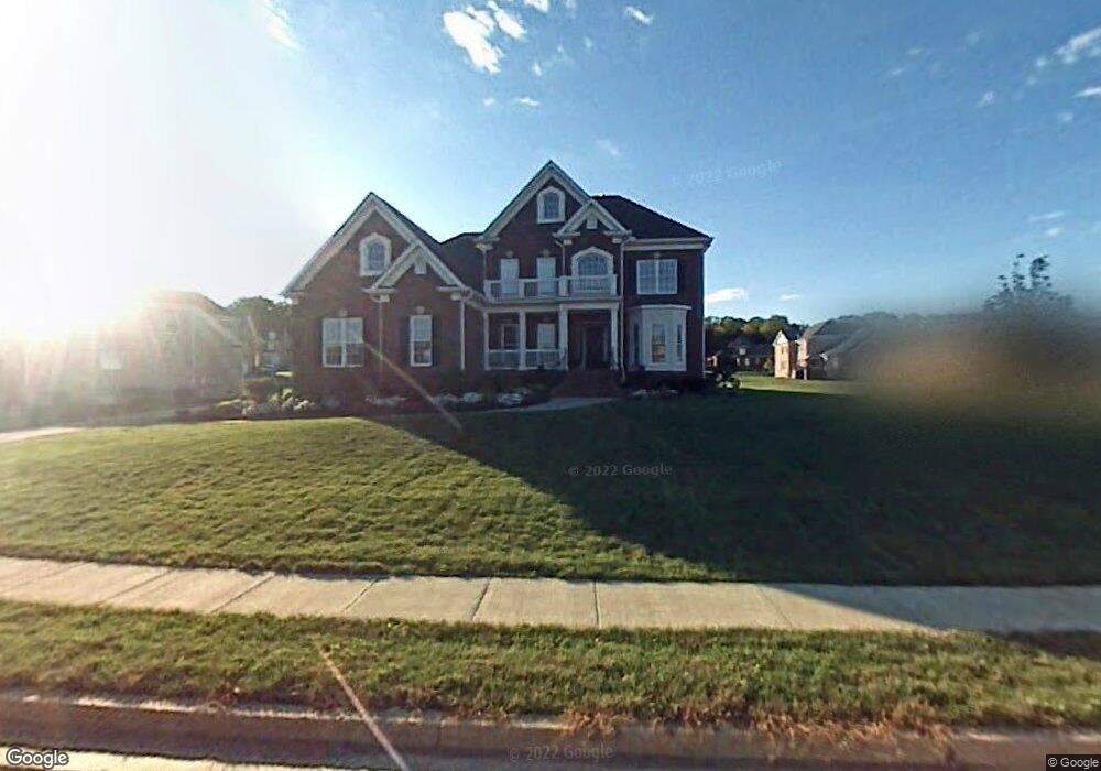
1515 Pumpkin Ridge Ct Nolensville, TN 37135
Estimated Value: $1,093,000 - $1,185,000
--
Bed
4
Baths
3,397
Sq Ft
$336/Sq Ft
Est. Value
About This Home
This home is located at 1515 Pumpkin Ridge Ct, Nolensville, TN 37135 and is currently estimated at $1,140,732, approximately $335 per square foot. 1515 Pumpkin Ridge Ct is a home located in Williamson County with nearby schools including Sunset Elementary School, Sunset Middle School, and Nolensville High School.
Ownership History
Date
Name
Owned For
Owner Type
Purchase Details
Closed on
Dec 2, 2022
Sold by
Myers Michael W and Myers Stephanie L
Bought by
Michael And Stephanie Myers Living Trust
Current Estimated Value
Purchase Details
Closed on
Oct 24, 2006
Sold by
Newmark Homes Lp
Bought by
Myers Michael W and Myers Stephanie L
Home Financials for this Owner
Home Financials are based on the most recent Mortgage that was taken out on this home.
Original Mortgage
$350,000
Interest Rate
6.39%
Mortgage Type
Purchase Money Mortgage
Create a Home Valuation Report for This Property
The Home Valuation Report is an in-depth analysis detailing your home's value as well as a comparison with similar homes in the area
Home Values in the Area
Average Home Value in this Area
Purchase History
| Date | Buyer | Sale Price | Title Company |
|---|---|---|---|
| Michael And Stephanie Myers Living Trust | -- | -- | |
| Myers Michael W | $493,699 | Overland Title Company Llc |
Source: Public Records
Mortgage History
| Date | Status | Borrower | Loan Amount |
|---|---|---|---|
| Previous Owner | Myers Michael W | $350,000 |
Source: Public Records
Tax History Compared to Growth
Tax History
| Year | Tax Paid | Tax Assessment Tax Assessment Total Assessment is a certain percentage of the fair market value that is determined by local assessors to be the total taxable value of land and additions on the property. | Land | Improvement |
|---|---|---|---|---|
| 2024 | $3,773 | $173,875 | $45,000 | $128,875 |
| 2023 | $3,773 | $173,875 | $45,000 | $128,875 |
| 2022 | $3,773 | $173,875 | $45,000 | $128,875 |
| 2021 | $3,773 | $173,875 | $45,000 | $128,875 |
| 2020 | $3,504 | $139,575 | $28,750 | $110,825 |
| 2019 | $3,308 | $139,575 | $28,750 | $110,825 |
| 2018 | $3,210 | $139,575 | $28,750 | $110,825 |
| 2017 | $3,182 | $139,575 | $28,750 | $110,825 |
| 2016 | $0 | $139,575 | $28,750 | $110,825 |
| 2015 | -- | $115,425 | $23,750 | $91,675 |
| 2014 | -- | $115,425 | $23,750 | $91,675 |
Source: Public Records
Map
Nearby Homes
- 2510 Benington Place
- 1760 Benington Place
- 2533 Benington Place
- 1969 Ashburn Ct
- 2032 Universe Ct
- 1818 Eaves Ct
- 2713 Bering Ct
- 2020 Vail Trace
- 2004 Vail Trace
- 2025 Vail Trace
- 2029 Delaware Dr
- 2025 Delaware Dr
- 2009 Vail Trace
- 9917 Elland Rd
- 2203 Carouth Ct
- 300 Conoga Dr
- 9910 Elland Rd
- 1529 Hyde Ln
- 152 Brooksbank Dr
- 9908 Elland Rd
- 1505 Pumpkin Ridge Ct
- 1512 Pumpkin Ridge
- 1401 Wolf Creek Dr
- 1405 Wolf Creek Dr
- 2504 Benington Place
- 1516 Pumpkin Ridge Ct
- 1520 Pumpkin Ridge Ct
- 1512 Pumpkin Ridge Ct
- 1508 Pumpkin Ridge Ct
- 1409 Wolf Creek Dr
- 2516 Benington Place
- 1504 Pumpkin Ridge Ct
- 1500 Pumpkin Ridge Ct
- 1524 Pumpkin Ridge Ct
- 1496 Pumpkin Ridge Ct
- 1400 Wolf Creek Dr
- 1404 Wolf Creek Dr
- 1027 Benington Place
- 1528 Pumpkin Ridge Ct
- 1492 Pumpkin Ridge Ct