15163 State Route Ff Edgar Springs, MO 65462
Estimated Value: $262,000 - $409,332
3
Beds
3
Baths
2,000
Sq Ft
$160/Sq Ft
Est. Value
About This Home
This home is located at 15163 State Route Ff, Edgar Springs, MO 65462 and is currently estimated at $319,111, approximately $159 per square foot. 15163 State Route Ff is a home located in Phelps County with nearby schools including Phelps Co. Elementary School.
Ownership History
Date
Name
Owned For
Owner Type
Purchase Details
Closed on
Mar 20, 2007
Current Estimated Value
Purchase Details
Closed on
Dec 4, 2006
Purchase Details
Closed on
Feb 4, 2005
Purchase Details
Closed on
Feb 27, 2004
Purchase Details
Closed on
Mar 20, 2003
Purchase Details
Closed on
Jul 10, 1995
Purchase Details
Closed on
Sep 12, 1994
Purchase Details
Closed on
Jul 28, 1987
Purchase Details
Closed on
May 7, 1959
Create a Home Valuation Report for This Property
The Home Valuation Report is an in-depth analysis detailing your home's value as well as a comparison with similar homes in the area
Home Values in the Area
Average Home Value in this Area
Purchase History
| Date | Buyer | Sale Price | Title Company |
|---|---|---|---|
| -- | -- | -- | |
| -- | -- | -- | |
| -- | -- | -- | |
| -- | -- | -- | |
| -- | -- | -- | |
| -- | -- | -- | |
| -- | -- | -- | |
| -- | -- | -- | |
| -- | -- | -- |
Source: Public Records
Tax History Compared to Growth
Tax History
| Year | Tax Paid | Tax Assessment Tax Assessment Total Assessment is a certain percentage of the fair market value that is determined by local assessors to be the total taxable value of land and additions on the property. | Land | Improvement |
|---|---|---|---|---|
| 2024 | $795 | $22,670 | $2,710 | $19,960 |
| 2023 | $793 | $22,670 | $2,710 | $19,960 |
| 2022 | $798 | $22,670 | $2,710 | $19,960 |
| 2021 | $799 | $22,670 | $2,710 | $19,960 |
| 2020 | $809 | $22,670 | $2,710 | $19,960 |
| 2019 | $806 | $22,670 | $2,710 | $19,960 |
| 2018 | $810 | $22,670 | $2,710 | $19,960 |
| 2017 | $742 | $20,760 | $2,710 | $18,050 |
| 2016 | $735 | $20,760 | $2,710 | $18,050 |
| 2015 | -- | $20,760 | $2,710 | $18,050 |
| 2014 | -- | $20,930 | $2,880 | $18,050 |
| 2013 | -- | $20,930 | $0 | $0 |
Source: Public Records
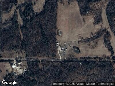
Map
Nearby Homes
- 20290 State Route H
- 708 Locust St
- 255 Walnut St
- 751 High St
- 0 Tbd S Us Highway 63
- 29515 S Us Highway 63
- 29405 U S 63
- 30190 S Us Highway 63
- 0 County Road 6130
- 663 County Road 2590
- 4243 Highway Oo
- 0 24 6 Acres Highway Oo Unit MAR25007966
- 0 Highway C Unit MAR24074253
- 19585 State Route M
- 31950 County Road 6250
- 15100 Private Drive 6021
- 0 1 15 + - Ac County Road 6390
- 22892 Highway C
- 000 County Road 6388
- 13090 County Road 5340
- 15163 State Route Ff
- 15163 State Route Ff
- 15330 State Route Ff
- 14901 State Route Ff
- 14611 State Route Ff
- 15671 State Route Ff
- 0 40 Acres State Route Ff
- 15785 State Route H
- 0 58 27 Acres State Route Ff
- 0 + -58 99 Acres State Route Ff Unit 22069121
- 0 58 99 Acres State Route Ff Unit 22078669
- 0 58 99 Acres State Route Ff Unit 22078463
- 0 58 99 Acres State Route Ff Unit 22069492
- 14680 State Route Ff
- 472 State Route Ff
- 443 State Route Ff
- 450 State Route Ff Unit 472
- 417 State Route Ff
- 420 State Route Ff Unit 422
- 371 State Route Ff