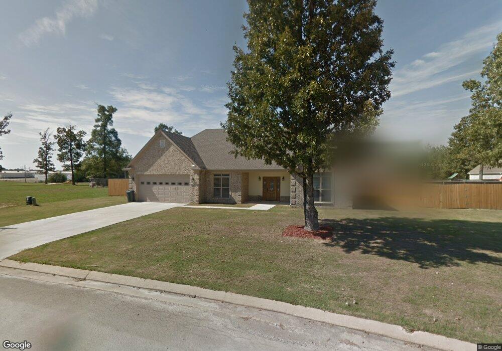
1517 Allison Cir New Albany, MI 38652
Estimated Value: $238,000 - $337,000
3
Beds
2
Baths
1,798
Sq Ft
$162/Sq Ft
Est. Value
About This Home
This home is located at 1517 Allison Cir, New Albany, MI 38652 and is currently estimated at $291,250, approximately $161 per square foot. 1517 Allison Cir is a home located in Union County with nearby schools including New Albany Elementary School, New Albany/S.Tippah/Union County Alternative School, and New Albany Middle School.
Ownership History
Date
Name
Owned For
Owner Type
Purchase Details
Closed on
Nov 19, 2020
Sold by
Karg Brian Scott and Karg Chelsea
Bought by
Rojas Armando and Rojas Ma Salome
Current Estimated Value
Purchase Details
Closed on
Sep 27, 2019
Sold by
Lemus Moises and Lemus Andrea
Bought by
Karg Brian and Karg Chelsea
Home Financials for this Owner
Home Financials are based on the most recent Mortgage that was taken out on this home.
Original Mortgage
$212,087
Interest Rate
3.5%
Mortgage Type
Unknown
Purchase Details
Closed on
Dec 14, 2012
Sold by
Hale William A
Bought by
Lemus Moises and Lemus Andrea
Create a Home Valuation Report for This Property
The Home Valuation Report is an in-depth analysis detailing your home's value as well as a comparison with similar homes in the area
Home Values in the Area
Average Home Value in this Area
Purchase History
| Date | Buyer | Sale Price | Title Company |
|---|---|---|---|
| Rojas Armando | -- | None Available | |
| Karg Brian | -- | None Available | |
| Lemus Moises | -- | -- |
Source: Public Records
Mortgage History
| Date | Status | Borrower | Loan Amount |
|---|---|---|---|
| Previous Owner | Karg Brian | $212,087 |
Source: Public Records
Tax History Compared to Growth
Tax History
| Year | Tax Paid | Tax Assessment Tax Assessment Total Assessment is a certain percentage of the fair market value that is determined by local assessors to be the total taxable value of land and additions on the property. | Land | Improvement |
|---|---|---|---|---|
| 2024 | $2,554 | $19,938 | $0 | $0 |
| 2023 | $2,563 | $19,938 | $0 | $0 |
| 2022 | $2,042 | $16,255 | $0 | $0 |
| 2021 | $1,984 | $16,303 | $0 | $0 |
| 2020 | $1,984 | $16,303 | $0 | $0 |
| 2019 | $1,975 | $16,238 | $0 | $0 |
| 2018 | $1,851 | $15,349 | $0 | $0 |
| 2017 | $1,570 | $13,733 | $0 | $0 |
| 2016 | $1,508 | $13,733 | $0 | $0 |
| 2015 | -- | $13,733 | $0 | $0 |
| 2014 | -- | $12,897 | $0 | $0 |
Source: Public Records
Map
Nearby Homes
- 1509 Allison Cir
- 1329 Moss Hill Dr
- 1315 Moss Hill Dr
- 559 County Road 75
- 0 Lot 8 Sam T Barkley Dr
- 0 Lot 6 Sam T Barkley Dr
- 0 Lot 5 Sam T Barkley Dr
- 0 Lot 4 Sam T Barkley Dr
- 0 Lot 3 Sam T Barkley Dr
- 0 Lot 2 Sam Tbarkley Dr Unit 23-1317
- Lot 48 Rolling Hills Dr
- Lot 49 Rolling Hills Dr
- 931 Reed St
- 0 Sam T Barkley Dr
- 665 County Road 75
- 816 W Bankhead St
- 0 Coulter Dr Denton Rd Unit 24-3689
- 0 W Hwy 178
- 1515 Allison Cir
- 1505 Allison Cir
- 1505 Allison Cir
- 1517 Allison Cir
- 1517 Allison Cir
- 810 Melanie Ln
- 808 Melanie Ln
- 806 Melanie Ln
- 805 Melanie Ln
- 804 Melanie Ln
- 809 Melanie Ln
- 1502 Allison Cir
- 1508 Allison Cir
- 1503 Allison Cir
- 811 Melanie Ln
- 1504 Allison Cir
- 1506 Allison Cir
- 1519 Allison Cir
- 1503 Moss Hill Dr
- 1505 Moss Hill Dr