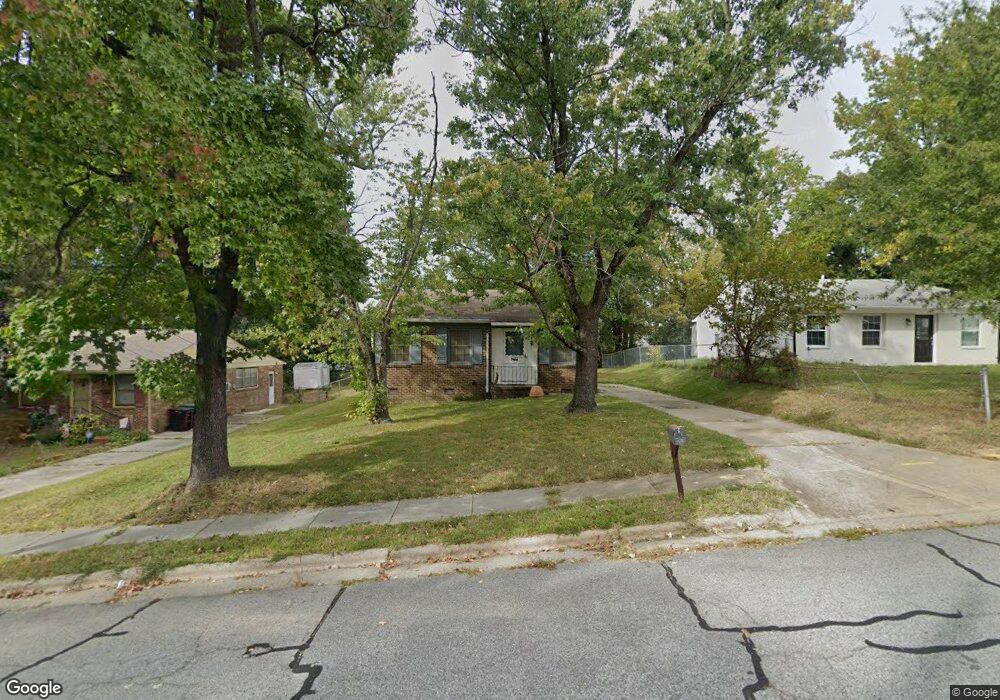
1517 Graves Ave High Point, NC 27260
Downtown High Point NeighborhoodEstimated Value: $130,000 - $153,000
3
Beds
1
Bath
928
Sq Ft
$152/Sq Ft
Est. Value
About This Home
This home is located at 1517 Graves Ave, High Point, NC 27260 and is currently estimated at $141,411, approximately $152 per square foot. 1517 Graves Ave is a home located in Guilford County with nearby schools including Kirkman Park Elementary School, Penn-Griffin School for the Arts, and T.W. Andrews High School.
Ownership History
Date
Name
Owned For
Owner Type
Purchase Details
Closed on
Aug 22, 2000
Sold by
William Best Jack and William Bessie W
Bought by
Legrande Gordon W and Legrande Louise
Current Estimated Value
Home Financials for this Owner
Home Financials are based on the most recent Mortgage that was taken out on this home.
Original Mortgage
$36,000
Outstanding Balance
$12,915
Interest Rate
8.07%
Estimated Equity
$128,496
Create a Home Valuation Report for This Property
The Home Valuation Report is an in-depth analysis detailing your home's value as well as a comparison with similar homes in the area
Home Values in the Area
Average Home Value in this Area
Purchase History
| Date | Buyer | Sale Price | Title Company |
|---|---|---|---|
| Legrande Gordon W | $40,000 | -- |
Source: Public Records
Mortgage History
| Date | Status | Borrower | Loan Amount |
|---|---|---|---|
| Open | Legrande Gordon W | $36,000 |
Source: Public Records
Tax History Compared to Growth
Tax History
| Year | Tax Paid | Tax Assessment Tax Assessment Total Assessment is a certain percentage of the fair market value that is determined by local assessors to be the total taxable value of land and additions on the property. | Land | Improvement |
|---|---|---|---|---|
| 2025 | $779 | $56,500 | $10,000 | $46,500 |
| 2024 | $779 | $56,500 | $10,000 | $46,500 |
| 2023 | $779 | $56,500 | $10,000 | $46,500 |
| 2022 | $762 | $56,500 | $10,000 | $46,500 |
| 2021 | $635 | $46,100 | $10,000 | $36,100 |
| 2020 | $635 | $46,100 | $10,000 | $36,100 |
| 2019 | $635 | $46,100 | $0 | $0 |
| 2018 | $632 | $46,100 | $0 | $0 |
| 2017 | $635 | $46,100 | $0 | $0 |
| 2016 | $722 | $51,500 | $0 | $0 |
| 2015 | $726 | $51,500 | $0 | $0 |
| 2014 | $739 | $51,500 | $0 | $0 |
Source: Public Records
Map
Nearby Homes
- 1515 Graves Ave
- 1528 Graves Ave
- 1711 Edmondson Place
- 1508 Boundary Ave
- 1602 Boundary Ave
- 1604 Boundary Ave
- 1606 Boundary Ave
- 901 Circle Dr
- 828 Willow Place
- 208 Hay St
- 1702 E Martin Luther King Junior Dr
- 1224 S Downing St
- 408 Meredith St
- 905 Mint Ave
- 408 Hobson St
- 1201 Pearson Place
- 1202 Dartmouth Ave
- 1725 Lamb Ave
- 1418 Wendell Ave
- 320 4th St
- 1513 Graves Ave
- 1521 Graves Ave
- 1318 Boundary Ave
- 1320 Boundary Ave
- 1316 Boundary Ave
- 1523 Graves Ave
- 1314 Boundary Ave
- 1322 Boundary Ave
- 1511 Graves Ave
- 1518 Graves Ave
- 1516 Graves Ave
- 1520 Graves Ave
- 1312 Boundary Ave
- 1324 Boundary Ave
- 1522 Graves Ave
- 1525 Graves Ave
- 1509 Graves Ave
- 1512 Graves Ave
- 1310 Boundary Ave
- 1524 Graves Ave