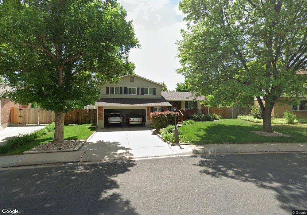
1517 Mayfield Ln Longmont, CO 80501
Southmoor NeighborhoodEstimated Value: $517,000 - $629,000
3
Beds
3
Baths
1,700
Sq Ft
$337/Sq Ft
Est. Value
About This Home
This home is located at 1517 Mayfield Ln, Longmont, CO 80501 and is currently estimated at $573,260, approximately $337 per square foot. 1517 Mayfield Ln is a home located in Boulder County with nearby schools including Indian Peaks Elementary School, Sunset Middle School, and Niwot High School.
Ownership History
Date
Name
Owned For
Owner Type
Purchase Details
Closed on
Feb 27, 1986
Bought by
Lester Jeffrey K and Lester Nadeen T
Current Estimated Value
Purchase Details
Closed on
Mar 20, 1981
Bought by
Lester Jeffrey K and Lester Nadeen T
Purchase Details
Closed on
Mar 12, 1981
Bought by
Lester Jeffrey K and Lester Nadeen T
Purchase Details
Closed on
Jul 7, 1976
Bought by
Lester Jeffrey K and Lester Nadeen T
Create a Home Valuation Report for This Property
The Home Valuation Report is an in-depth analysis detailing your home's value as well as a comparison with similar homes in the area
Home Values in the Area
Average Home Value in this Area
Purchase History
| Date | Buyer | Sale Price | Title Company |
|---|---|---|---|
| Lester Jeffrey K | $89,900 | -- | |
| Lester Jeffrey K | $75,400 | -- | |
| Lester Jeffrey K | $73,400 | -- | |
| Lester Jeffrey K | $40,600 | -- |
Source: Public Records
Tax History Compared to Growth
Tax History
| Year | Tax Paid | Tax Assessment Tax Assessment Total Assessment is a certain percentage of the fair market value that is determined by local assessors to be the total taxable value of land and additions on the property. | Land | Improvement |
|---|---|---|---|---|
| 2025 | $2,602 | $34,319 | $14,650 | $19,669 |
| 2024 | $2,602 | $34,319 | $14,650 | $19,669 |
| 2023 | $2,567 | $33,902 | $18,258 | $19,330 |
| 2022 | $2,748 | $27,772 | $12,934 | $14,838 |
| 2021 | $2,784 | $28,571 | $13,306 | $15,265 |
| 2020 | $2,467 | $25,397 | $10,511 | $14,886 |
| 2019 | $2,428 | $25,397 | $10,511 | $14,886 |
| 2018 | $2,150 | $22,630 | $7,632 | $14,998 |
| 2017 | $2,120 | $25,019 | $8,438 | $16,581 |
| 2016 | $1,923 | $20,123 | $8,119 | $12,004 |
| 2015 | $1,833 | $17,807 | $5,970 | $11,837 |
| 2014 | $1,663 | $17,807 | $5,970 | $11,837 |
Source: Public Records
Map
Nearby Homes
- 1435 Missouri Ave
- 1327 Brookfield Dr
- 1527 S Vivian St
- 1801 S Pratt Pkwy
- 1350 S Lincoln St
- 1435 Ashcroft Dr
- 2030 Emerald Dr
- 1321 Onyx Cir
- 2050 Emerald Dr
- 1028 Katy Ln
- 2119 Onyx Way
- 2240 Summitview Dr
- 919 S Sherman St
- 2215 Parkview Dr
- 1456 Sepia Ave
- 1518 Sepia Ave
- 912 Confidence Dr
- 2284 Indian Peaks Cir
- 802 Neon Forest Cir
- 2237 Eagleview Way
- 1511 Mayfield Ln
- 1523 Mayfield Ln
- 1516 Mayfield Ln
- 1503 Mayfield Ln
- 1620 Hartley Ct
- 1445 Lefthand Dr
- 1502 Mayfield Ln
- 1530 Mayfield Ln
- 1438 Brookfield Dr
- 1628 Hartley Ct
- 1507 Lefthand Dr
- 1536 Mayfield Ln
- 1443 Brookfield Dr
- 1429 Missouri Ave
- 1513 Lefthand Dr
- 1432 Brookfield Dr
- 1493 Mayfield Cir
- 1621 Hartley Ct
- 1490 Mayfield Cir
- 1542 Mayfield Ln