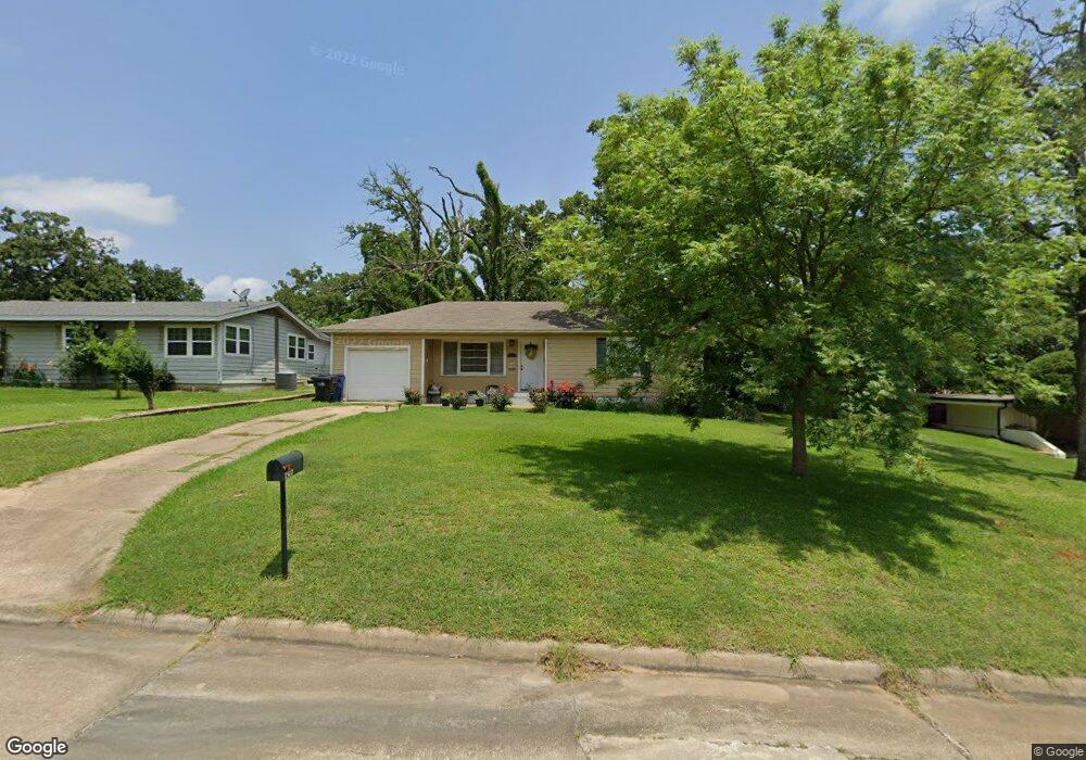
1517 W Munson St Denison, TX 75020
Estimated Value: $174,901 - $193,000
3
Beds
2
Baths
1,144
Sq Ft
$161/Sq Ft
Est. Value
About This Home
This home is located at 1517 W Munson St, Denison, TX 75020 and is currently estimated at $183,951, approximately $160 per square foot. 1517 W Munson St is a home located in Grayson County with nearby schools including Houston Elementary School, Scott Middle School, and Denison High School.
Ownership History
Date
Name
Owned For
Owner Type
Purchase Details
Closed on
Apr 29, 2016
Sold by
Ranger Prospects Llc
Bought by
Wroten Roger Dale
Current Estimated Value
Home Financials for this Owner
Home Financials are based on the most recent Mortgage that was taken out on this home.
Original Mortgage
$85,975
Outstanding Balance
$68,598
Interest Rate
3.73%
Mortgage Type
New Conventional
Estimated Equity
$115,353
Purchase Details
Closed on
May 23, 2013
Sold by
Number Three Cw Stewart Family Lp
Bought by
Ranger Prospects Llc
Purchase Details
Closed on
Mar 18, 2013
Sold by
Number Two Cw Stewart Family Lp
Bought by
Number Three Cw Stewart Family Lp
Purchase Details
Closed on
Oct 26, 2007
Sold by
Holt Stephanie Denise
Bought by
Number Two Cw Stewart Family Lp
Home Financials for this Owner
Home Financials are based on the most recent Mortgage that was taken out on this home.
Original Mortgage
$42,463
Interest Rate
6.32%
Mortgage Type
Purchase Money Mortgage
Create a Home Valuation Report for This Property
The Home Valuation Report is an in-depth analysis detailing your home's value as well as a comparison with similar homes in the area
Home Values in the Area
Average Home Value in this Area
Purchase History
| Date | Buyer | Sale Price | Title Company |
|---|---|---|---|
| Wroten Roger Dale | -- | Red River Title Co | |
| Ranger Prospects Llc | -- | Red River Title Co | |
| Number Three Cw Stewart Family Lp | -- | Red River Title Company | |
| Number Two Cw Stewart Family Lp | -- | Red River Title Co |
Source: Public Records
Mortgage History
| Date | Status | Borrower | Loan Amount |
|---|---|---|---|
| Open | Wroten Roger Dale | $85,975 | |
| Previous Owner | Number Two Cw Stewart Family Lp | $42,463 |
Source: Public Records
Tax History Compared to Growth
Tax History
| Year | Tax Paid | Tax Assessment Tax Assessment Total Assessment is a certain percentage of the fair market value that is determined by local assessors to be the total taxable value of land and additions on the property. | Land | Improvement |
|---|---|---|---|---|
| 2025 | $1,811 | $139,496 | $42,036 | $97,460 |
| 2024 | $3,057 | $131,573 | $0 | $0 |
| 2023 | $1,458 | $119,612 | $0 | $0 |
| 2022 | $2,584 | $108,738 | $0 | $0 |
| 2021 | $2,493 | $98,853 | $18,600 | $80,253 |
| 2020 | $2,719 | $103,093 | $18,600 | $84,493 |
| 2019 | $2,627 | $103,780 | $18,600 | $85,180 |
| 2018 | $2,407 | $86,781 | $15,066 | $71,715 |
| 2017 | $2,286 | $81,711 | $11,904 | $69,807 |
| 2016 | $1,854 | $66,260 | $11,810 | $54,450 |
| 2015 | $1,349 | $63,221 | $11,810 | $51,411 |
| 2014 | $1,779 | $62,977 | $11,810 | $51,167 |
Source: Public Records
Map
Nearby Homes
- 1508 W Shepherd St
- 1315 W Hull St
- 1730 W Hull St
- 1105 Woodlawn Blvd
- 901 Old State Ln
- 1224 W Nelson St
- 501 S Eddy Ave
- 1217 W Nelson St
- 1319 W Morgan St
- 1510 W Heron St
- 1131 W Shepherd St
- 612 Ambassador St
- 1326 W Crawford St
- 1223 W Owing St
- 1127 W Morgan St
- 12 Ambassador Ct
- 600 Ambassador St
- 1120 W Owing St
- 1109 S Chandler Ave
- 1221 W Crawford St
- 1519 W Munson St
- 1501 W Munson St
- 1523 W Munson St
- 1512 W Day St
- 1504 W Day St
- 1526 W Day St
- 1500 W Day St
- 1528 W Day St
- 820 S Fairbanks Ave
- 1510 W Munson St
- 1506 W Munson St
- 1514 W Munson St
- 901 S Maurice Ave
- 800 S Fairbanks Ave
- 828 S Maurice Ave
- 900 S Fairbanks Ave
- 1430 W Day St
- 900 S Maurice Ave
- 1513 W Day St
- 1424 W Day St