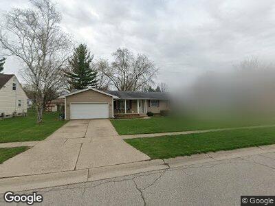
1518 Diane Dr Flushing, MI 48433
Estimated Value: $176,318 - $240,000
--
Bed
--
Bath
1,232
Sq Ft
$170/Sq Ft
Est. Value
About This Home
This home is located at 1518 Diane Dr, Flushing, MI 48433 and is currently estimated at $209,080, approximately $169 per square foot. 1518 Diane Dr is a home located in Genesee County with nearby schools including Springview Elementary School, Flushing Middle School, and Flushing High School.
Ownership History
Date
Name
Owned For
Owner Type
Purchase Details
Closed on
Apr 7, 2014
Sold by
Boldt Jason
Bought by
Boldt Sandra
Current Estimated Value
Purchase Details
Closed on
Jan 30, 2007
Sold by
Boldt Sandra V and Boldt Michael E
Bought by
Boldt Sandra V
Home Financials for this Owner
Home Financials are based on the most recent Mortgage that was taken out on this home.
Original Mortgage
$116,000
Interest Rate
6.19%
Mortgage Type
New Conventional
Purchase Details
Closed on
Dec 11, 2006
Sold by
Boldt Sandra V
Bought by
Boldt Sandra V and Boldt Michael E
Home Financials for this Owner
Home Financials are based on the most recent Mortgage that was taken out on this home.
Original Mortgage
$116,000
Interest Rate
6.19%
Mortgage Type
New Conventional
Create a Home Valuation Report for This Property
The Home Valuation Report is an in-depth analysis detailing your home's value as well as a comparison with similar homes in the area
Home Values in the Area
Average Home Value in this Area
Purchase History
| Date | Buyer | Sale Price | Title Company |
|---|---|---|---|
| Boldt Sandra | -- | None Available | |
| Boldt Sandra V | -- | Guaranty Title Company | |
| Boldt Sandra V | -- | None Available | |
| Boldt Sandra V | -- | None Available |
Source: Public Records
Mortgage History
| Date | Status | Borrower | Loan Amount |
|---|---|---|---|
| Closed | Boldt Sandra | $112,138 | |
| Closed | Boldt Sandra V | $116,000 | |
| Closed | Boldt Sandra | $29,000 |
Source: Public Records
Tax History Compared to Growth
Tax History
| Year | Tax Paid | Tax Assessment Tax Assessment Total Assessment is a certain percentage of the fair market value that is determined by local assessors to be the total taxable value of land and additions on the property. | Land | Improvement |
|---|---|---|---|---|
| 2024 | $2,053 | $84,900 | $0 | $0 |
| 2023 | $1,977 | $76,600 | $0 | $0 |
| 2022 | $2,175 | $69,600 | $0 | $0 |
| 2021 | $2,175 | $63,300 | $0 | $0 |
| 2020 | $1,740 | $60,300 | $0 | $0 |
| 2019 | $1,712 | $56,600 | $0 | $0 |
| 2018 | $2,012 | $51,600 | $0 | $0 |
| 2017 | $1,887 | $49,100 | $0 | $0 |
| 2016 | $1,872 | $40,893 | $0 | $0 |
| 2015 | $1,863 | $0 | $0 | $0 |
| 2012 | -- | $46,600 | $46,600 | $0 |
Source: Public Records
Map
Nearby Homes
- 1508 Flushing Rd
- 1451 Flushing Rd
- 1506 Golfside Ct
- 1436 E Pierson Rd
- 3378 N Elms Rd
- 3371 Ann Dr
- 3844 Ann Dr
- 162 Beacon Point Pkwy
- 3241 Woodvalley Dr
- 7130 Kings Way
- 7132 Kings Way
- 7134 Kings Way
- 7136 Kings Way
- 7069 Kings Way
- 7067 Kings Way
- 7061 Kings Way
- 7059 Kings Way
- 7057 Kings Way
- 7053 Kings Way
- 7051 Kings Way