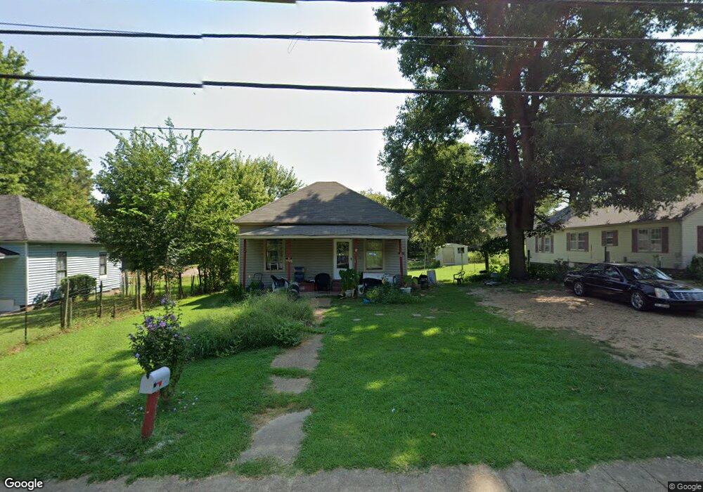
1518 S College St Covington, TN 38019
Estimated Value: $56,000 - $98,000
--
Bed
1
Bath
784
Sq Ft
$92/Sq Ft
Est. Value
About This Home
This home is located at 1518 S College St, Covington, TN 38019 and is currently estimated at $72,198, approximately $92 per square foot. 1518 S College St is a home located in Tipton County with nearby schools including Crestview Elementary School, Crestview Middle School, and Covington High School.
Ownership History
Date
Name
Owned For
Owner Type
Purchase Details
Closed on
Apr 9, 2021
Sold by
Cromwwell & Scott Llc
Bought by
Edmondson Rentals Llc
Current Estimated Value
Home Financials for this Owner
Home Financials are based on the most recent Mortgage that was taken out on this home.
Original Mortgage
$269,250
Interest Rate
2.9%
Mortgage Type
Commercial
Purchase Details
Closed on
Apr 14, 2005
Sold by
Tidwell John J
Bought by
Cromwell & Scott Llc
Create a Home Valuation Report for This Property
The Home Valuation Report is an in-depth analysis detailing your home's value as well as a comparison with similar homes in the area
Home Values in the Area
Average Home Value in this Area
Purchase History
| Date | Buyer | Sale Price | Title Company |
|---|---|---|---|
| Edmondson Rentals Llc | $369,000 | None Available | |
| Cromwell & Scott Llc | $14,000 | -- |
Source: Public Records
Mortgage History
| Date | Status | Borrower | Loan Amount |
|---|---|---|---|
| Closed | Edmondson Rentals Llc | $269,250 |
Source: Public Records
Tax History Compared to Growth
Tax History
| Year | Tax Paid | Tax Assessment Tax Assessment Total Assessment is a certain percentage of the fair market value that is determined by local assessors to be the total taxable value of land and additions on the property. | Land | Improvement |
|---|---|---|---|---|
| 2024 | $215 | $8,450 | $3,325 | $5,125 |
| 2023 | $215 | $8,450 | $3,325 | $5,125 |
| 2022 | $198 | $6,050 | $2,450 | $3,600 |
| 2021 | $199 | $6,050 | $2,450 | $3,600 |
| 2020 | $198 | $6,050 | $2,450 | $3,600 |
| 2019 | $163 | $4,350 | $1,875 | $2,475 |
| 2018 | $163 | $4,350 | $1,875 | $2,475 |
| 2017 | $163 | $4,350 | $1,875 | $2,475 |
| 2016 | $155 | $4,350 | $1,875 | $2,475 |
| 2015 | $155 | $4,125 | $1,875 | $2,250 |
| 2014 | $154 | $4,114 | $0 | $0 |
Source: Public Records
Map
Nearby Homes
- 502 James Ave
- 1519 Walters St
- 417 Lennanwood Ave
- 1329 Herring Dr
- 1469 S Main St
- 714 W Sherrod Ave
- 210 Kinney Ave
- 600 W Sherrod Ave
- 722 S Main St
- 715 S Maple St
- 513 Garland Ave
- 624 Fyfe St
- 316 Sanford Ave
- 0 Burnett Ln Unit RTC2939045
- 0 Oil Mill Rd Unit 10206359
- 0 Antioch Hwy 51 Rd Unit RTC2980495
- 133 W Washington Ave
- 111 W Washington Ave
- 104 Russwood Dr
- 296 E Washington Ave Unit 3
- 1512 S College St
- 1524 S College St
- 1510 S College St
- 201 Gillespie Dr
- 1602 S College St
- 200 Gillespie Dr
- 202 Rogers Ave
- 1508 S College St
- 205 Gillespie Dr
- 1519 S College St
- 1511 S College St
- 1605 S College St
- 1608 S College St
- 203 Rogers Ave Unit 205
- 1504 S College St
- 204 Gillespie Dr
- 1509 S College St
- 213 Gillespie Dr
- 1607 S College St
- 204 Rogers Ave