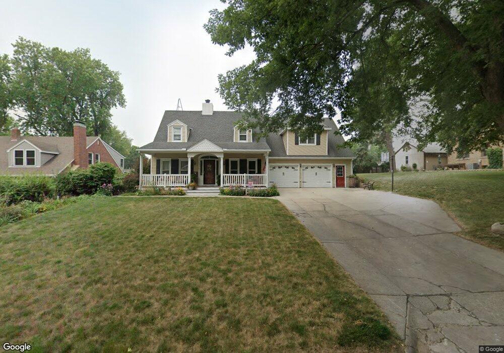
1519 N Adams St Carroll, IA 51401
Estimated Value: $303,000 - $356,150
4
Beds
4
Baths
3,134
Sq Ft
$105/Sq Ft
Est. Value
About This Home
This home is located at 1519 N Adams St, Carroll, IA 51401 and is currently estimated at $330,288, approximately $105 per square foot. 1519 N Adams St is a home with nearby schools including Fairview Elementary School, Adams Elementary School, and Carroll Middle School.
Ownership History
Date
Name
Owned For
Owner Type
Purchase Details
Closed on
Jan 7, 2008
Sold by
Wittrock David N and Wittrock Lynn E
Bought by
Berg Roger W and Berg Kathleen A
Current Estimated Value
Create a Home Valuation Report for This Property
The Home Valuation Report is an in-depth analysis detailing your home's value as well as a comparison with similar homes in the area
Home Values in the Area
Average Home Value in this Area
Purchase History
| Date | Buyer | Sale Price | Title Company |
|---|---|---|---|
| Berg Roger W | $10,500 | None Available |
Source: Public Records
Tax History Compared to Growth
Tax History
| Year | Tax Paid | Tax Assessment Tax Assessment Total Assessment is a certain percentage of the fair market value that is determined by local assessors to be the total taxable value of land and additions on the property. | Land | Improvement |
|---|---|---|---|---|
| 2025 | $4,340 | $391,130 | $25,440 | $365,690 |
| 2024 | $4,250 | $341,130 | $25,440 | $315,690 |
| 2023 | $4,261 | $341,130 | $25,440 | $315,690 |
| 2022 | $4,044 | $287,890 | $21,670 | $266,220 |
| 2021 | $4,044 | $287,890 | $21,670 | $266,220 |
| 2020 | $4,136 | $287,890 | $21,670 | $266,220 |
| 2019 | $4,114 | $287,890 | $21,670 | $266,220 |
| 2018 | $3,872 | $287,890 | $21,670 | $266,220 |
| 2017 | $3,864 | $279,056 | $19,324 | $259,732 |
| 2016 | $3,608 | $260,800 | $0 | $0 |
| 2015 | $3,608 | $242,930 | $0 | $0 |
| 2014 | $3,314 | $242,930 | $0 | $0 |
Source: Public Records
Map
Nearby Homes
- 1509 Birch St
- 1601 N Main St
- 1515 N Main St
- 1320 N Adams St
- 318 W 13th St
- 260 Bass St
- 1108 N Main St
- 1102 N Main St
- 265 Perch St
- 1015 N Adams St
- 219 Windwood Dr
- 631 W 17th St
- 1546 Olive St
- 1608 Salinger Ave
- 1852 Quint Ave
- 1026 N Clark St
- 926 N Court St
- 621 Alta Vista Dr
- 638 Capistrano Ave
- 611 W 21st St
- 1515 N Adams St
- 1605 N Adams St
- 1520 Birch St
- 1528 Birch St
- 1513 N Adams St
- 1534 Birch St
- 1507 N Adams St
- 1518 N Adams St
- 1512 Birch St
- 1609 N Adams St
- 1522 N Adams St
- 1525 Birch St
- 1540 Birch St
- 1508 Birch St
- 1516 N Adams St
- 1505 N Adams St
- 1615 N Adams St
- 1606 N Adams St
- 1513 Birch St
- 1508 N Adams St