Estimated Value: $190,000 - $195,000
4
Beds
1
Bath
1,299
Sq Ft
$148/Sq Ft
Est. Value
About This Home
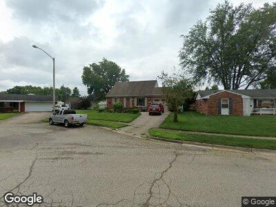
This home is located at 1519 Oshaughnesy Dr, Xenia, OH 45385 and is currently estimated at $192,848, approximately $148 per square foot. 1519 Oshaughnesy Dr is a home located in Greene County with nearby schools including Xenia High School, Summit Academy Community School for Alternative Learners - Xenia, and Legacy Christian Academy.
Ownership History
Date
Name
Owned For
Owner Type
Purchase Details
Closed on
Jan 17, 2025
Sold by
Hanson Patricia Y
Bought by
Hanson Tammy D and Hanson Tonya D
Current Estimated Value
Purchase Details
Closed on
Jul 6, 2020
Sold by
Hanson Patricia Y
Bought by
Hanson Ronnie D and Hanson Tammy D
Purchase Details
Closed on
Oct 15, 2019
Sold by
Hanson Thomas D and Hanson Patricia Y
Bought by
Hanson Thomas D and Hanson Patricia Y
Create a Home Valuation Report for This Property
The Home Valuation Report is an in-depth analysis detailing your home's value as well as a comparison with similar homes in the area
Home Values in the Area
Average Home Value in this Area
Purchase History
| Date | Buyer | Sale Price | Title Company |
|---|---|---|---|
| Hanson Thomas D | -- | None Available |
Source: Public Records
Mortgage History
| Date | Status | Borrower | Loan Amount |
|---|---|---|---|
| Previous Owner | Hanson Thomas D | $90,142 | |
| Previous Owner | Hanson Thomas | $73,917 | |
| Previous Owner | Hanson Thomas D | $15,000 | |
| Previous Owner | Hanson Thomas D | $76,500 |
Source: Public Records
Tax History Compared to Growth
Tax History
| Year | Tax Paid | Tax Assessment Tax Assessment Total Assessment is a certain percentage of the fair market value that is determined by local assessors to be the total taxable value of land and additions on the property. | Land | Improvement |
|---|---|---|---|---|
| 2024 | $2,000 | $57,780 | $12,080 | $45,700 |
| 2023 | $2,000 | $57,780 | $12,080 | $45,700 |
| 2022 | $1,586 | $41,180 | $7,110 | $34,070 |
| 2021 | $1,607 | $41,180 | $7,110 | $34,070 |
| 2020 | $1,538 | $41,180 | $7,110 | $34,070 |
| 2019 | $1,272 | $33,990 | $6,920 | $27,070 |
| 2018 | $1,277 | $33,990 | $6,920 | $27,070 |
| 2017 | $1,130 | $33,990 | $6,920 | $27,070 |
| 2016 | $1,130 | $30,680 | $6,920 | $23,760 |
| 2015 | $1,133 | $30,680 | $6,920 | $23,760 |
| 2014 | $1,084 | $30,680 | $6,920 | $23,760 |
Source: Public Records
Map
Nearby Homes
- 2975 Wyoming Dr
- 1853 Pueblo Dr
- 1974 Connecticut Dr
- 1579 Commonwealth Dr
- 1669 Wigwam Trail
- 1967 Drake Dr
- 2014 Vermont Dr
- 1583 Roxbury Dr
- 356 Kansas Dr
- 1513 Maumee Dr
- 1371 Arrowhead Trail
- 121 S Progress Dr
- 2201 Nebraska Dr
- 1015 Colorado Dr
- 1361 Kylemore Dr
- 2222 Carolina Dr
- 2106 Tennessee Dr
- 399 Concord Way
- 615 Concord Way
- 518 Jodee Dr
- 1519 Oshaughnesy Dr
- 1533 Oshaughnesy Dr
- 1507 Oshaughnesy Dr
- 2052 Wyandot Dr
- 2066 Wyandot Dr
- 2038 Wyandot Dr
- 1545 Oshaughnesy Dr
- 1493 Oshaughnesy Dr
- 2080 Wyandot Dr
- 2024 Wyandot Dr
- 1520 Oshaughnesy Dr
- 1481 Oshaughnesy Dr
- 1528 Ottawa Dr
- 1521 Seneca Dr
- 2094 Wyandot Dr
- 2010 Wyandot Dr
- 1480 Oshaughnesy Dr
- 1471 Oshaughnesy Dr
- 1571 Otoole Dr
- 1570 Otoole Dr