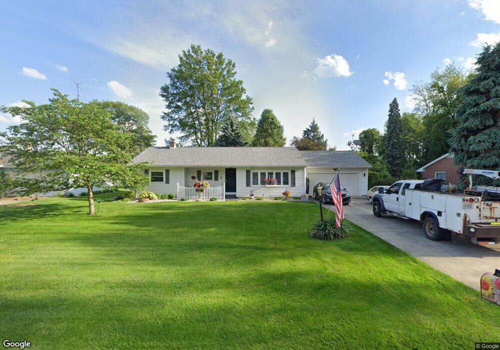
1519 River Dr Fremont, OH 43420
Estimated Value: $192,000 - $244,000
2
Beds
2
Baths
1,302
Sq Ft
$166/Sq Ft
Est. Value
About This Home
This home is located at 1519 River Dr, Fremont, OH 43420 and is currently estimated at $215,645, approximately $165 per square foot. 1519 River Dr is a home located in Sandusky County with nearby schools including Fremont Ross High School, Bishop Hoffman Catholic School - This is St Joe's School now, and St. Joseph School.
Ownership History
Date
Name
Owned For
Owner Type
Purchase Details
Closed on
Jun 8, 2007
Sold by
Walter John W and Walter Thomas E
Bought by
Smith Michael L and Smith Carole A
Current Estimated Value
Home Financials for this Owner
Home Financials are based on the most recent Mortgage that was taken out on this home.
Original Mortgage
$80,000
Interest Rate
6.21%
Mortgage Type
Purchase Money Mortgage
Purchase Details
Closed on
Feb 29, 2000
Sold by
Summey Carol J
Bought by
Walter John W and Walter Thomas E
Home Financials for this Owner
Home Financials are based on the most recent Mortgage that was taken out on this home.
Original Mortgage
$67,500
Interest Rate
8.25%
Mortgage Type
New Conventional
Purchase Details
Closed on
Sep 1, 1991
Sold by
Walter John W and Walter Thomas
Bought by
Smith Michael L and Smith Carole A
Purchase Details
Closed on
Jul 1, 1990
Bought by
Smith Michael L and Smith Carole A
Create a Home Valuation Report for This Property
The Home Valuation Report is an in-depth analysis detailing your home's value as well as a comparison with similar homes in the area
Home Values in the Area
Average Home Value in this Area
Purchase History
| Date | Buyer | Sale Price | Title Company |
|---|---|---|---|
| Smith Michael L | $143,000 | First American | |
| Walter John W | $66,000 | -- | |
| Smith Michael L | -- | -- | |
| Smith Michael L | -- | -- |
Source: Public Records
Mortgage History
| Date | Status | Borrower | Loan Amount |
|---|---|---|---|
| Closed | Smith Michael L | $80,000 | |
| Previous Owner | Walter John W | $67,500 |
Source: Public Records
Tax History Compared to Growth
Tax History
| Year | Tax Paid | Tax Assessment Tax Assessment Total Assessment is a certain percentage of the fair market value that is determined by local assessors to be the total taxable value of land and additions on the property. | Land | Improvement |
|---|---|---|---|---|
| 2024 | $1,754 | $59,990 | $12,530 | $47,460 |
| 2023 | $1,717 | $41,380 | $8,650 | $32,730 |
| 2022 | $1,717 | $41,380 | $8,650 | $32,730 |
| 2021 | $1,770 | $41,380 | $8,650 | $32,730 |
| 2020 | $1,558 | $35,710 | $8,650 | $27,060 |
| 2019 | $1,561 | $35,710 | $8,650 | $27,060 |
| 2018 | $1,519 | $35,710 | $8,650 | $27,060 |
| 2017 | $1,423 | $33,260 | $8,650 | $24,610 |
| 2016 | $1,248 | $33,260 | $8,650 | $24,610 |
| 2015 | $1,227 | $33,260 | $8,650 | $24,610 |
| 2014 | $1,320 | $34,270 | $8,470 | $25,800 |
| 2013 | $1,292 | $34,270 | $8,470 | $25,800 |
Source: Public Records
Map
Nearby Homes
- 1420 Center St
- 10 Meadowbrook Dr
- 10 Meadowbrook Ln
- 64 River Run Dr Unit J
- 135 Briarwood Cir
- 1719 Buckland Ave
- 1485 Autumn Woods Dr
- 350 Conner Dr
- 1818 Finley Dr
- 1970 Morrison Rd
- 2484 Buckland Ave
- 1832 Myrtle St
- 1013 Whittlesey St
- 905 Twinn St
- 1028 June St
- 815 South St
- 625 Bush Place
- 1611 Mcpherson Blvd
- 616 S Wood St
- 933 E Cole Rd
- 1515 River Dr
- 1523 River Dr
- 1518 W Arrowhead Rd
- 1511 River Dr
- 1518 Arrowhead Dr
- 1518 W Arrowhead Dr
- 1512 W Arrowhead Rd
- 1522 W Arrowhead Rd
- 1520 River Dr
- 1516 River Dr
- 1524 River Dr
- 1512 River Dr
- 1508 W Arrowhead Rd
- 1507 River Dr
- 1508 Arrowhead Dr
- 1504 W Arrowhead Rd
- 1504 Arrowhead Dr
- 1503 River Dr
- 1521 W Arrowhead Rd
- 1513 W Arrowhead Rd