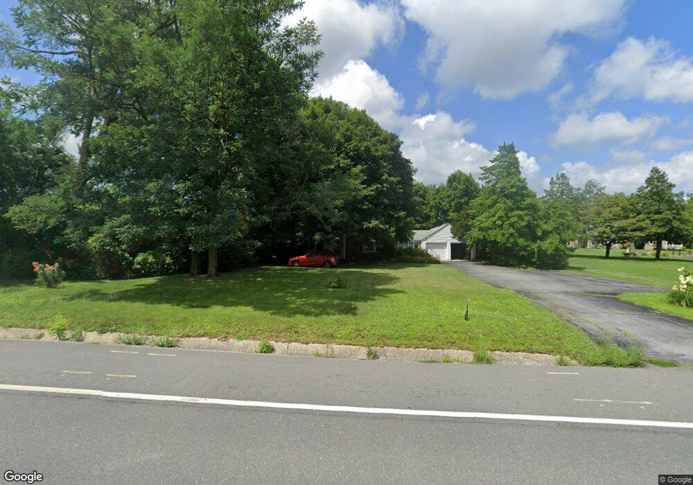
1519 S Dupont Hwy New Castle, DE 19720
Saint Georges NeighborhoodEstimated Value: $403,020 - $587,000
4
Beds
2
Baths
2,628
Sq Ft
$182/Sq Ft
Est. Value
About This Home
This home is located at 1519 S Dupont Hwy, New Castle, DE 19720 and is currently estimated at $479,255, approximately $182 per square foot. 1519 S Dupont Hwy is a home located in New Castle County with nearby schools including Southern Elementary School, Gunning Bedford Middle School, and Aquinas Academy.
Ownership History
Date
Name
Owned For
Owner Type
Purchase Details
Closed on
Dec 7, 2012
Sold by
Linden Hill Farm Lp
Bought by
Toll De Lp
Current Estimated Value
Purchase Details
Closed on
Jun 7, 2001
Sold by
Lupinek Patricia L
Bought by
Denker Doris B and Denker Ernestine Harrison
Create a Home Valuation Report for This Property
The Home Valuation Report is an in-depth analysis detailing your home's value as well as a comparison with similar homes in the area
Home Values in the Area
Average Home Value in this Area
Purchase History
| Date | Buyer | Sale Price | Title Company |
|---|---|---|---|
| Toll De Lp | $722,500 | None Available | |
| Denker Doris B | -- | -- | |
| Lupinek Patricia L | -- | -- |
Source: Public Records
Tax History Compared to Growth
Tax History
| Year | Tax Paid | Tax Assessment Tax Assessment Total Assessment is a certain percentage of the fair market value that is determined by local assessors to be the total taxable value of land and additions on the property. | Land | Improvement |
|---|---|---|---|---|
| 2024 | $2,631 | $78,900 | $11,600 | $67,300 |
| 2023 | $2,385 | $78,900 | $11,600 | $67,300 |
| 2022 | $2,501 | $78,900 | $11,600 | $67,300 |
| 2021 | $2,518 | $78,900 | $11,600 | $67,300 |
| 2020 | $2,518 | $78,900 | $11,600 | $67,300 |
| 2019 | $2,059 | $78,900 | $11,600 | $67,300 |
| 2018 | $2,467 | $78,900 | $11,600 | $67,300 |
| 2017 | $2,304 | $78,900 | $11,600 | $67,300 |
| 2016 | $2,059 | $78,900 | $11,600 | $67,300 |
| 2015 | $2,059 | $78,900 | $11,600 | $67,300 |
| 2014 | $2,060 | $78,900 | $11,600 | $67,300 |
Source: Public Records
Map
Nearby Homes
- 1119 Casey Dr
- 1049 Matthew Way
- 1225 Caitlin Way
- 31 Crestpoint Dr
- 2159 Mccoy Rd
- 1902 Mccoy Rd
- 6 Delaware St
- 402 Derrytown Dr
- 4010 Kirkwood Saint Georges Rd
- 35 N Dragon Dr
- 102 Parker Dr
- 8 Tamar Ct
- 300 Fenn Ct
- 348 Starboard Dr
- 121 Willow Oak Blvd
- 210 Olivia Way
- 325 Howell School Rd
- 616 Clifton Dr
- 319 Pheasant Dr
- 235 Hope Ct W
- 1517 S Dupont Hwy
- 123 W Harvest Dr
- 121 W Harvest Dr
- 119 W Harvest Dr
- 604 Highpointe Dr
- 117 W Harvest Dr
- 400 Kathryn Ct
- 402 Kathryn Ct
- 404 Kathryn Ct
- 122 W Harvest Dr
- 120 W Harvest Dr
- 104 Love Ct
- 406 Kathryn Ct
- 105 Love Ct
- 115 W Harvest Dr
- 513 Isadore Dr
- 118 W Harvest Dr
- 403 Kathryn Ct
- 401 Kathryn Ct
- 1502 S Dupont Hwy