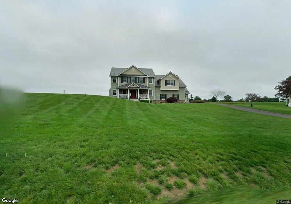
1519 Swamp Rd Furlong, PA 18925
Estimated Value: $829,000 - $1,040,000
4
Beds
4
Baths
3,535
Sq Ft
$269/Sq Ft
Est. Value
About This Home
This home is located at 1519 Swamp Rd, Furlong, PA 18925 and is currently estimated at $951,667, approximately $269 per square foot. 1519 Swamp Rd is a home with nearby schools including Bridge Valley Elementary School, Holicong Middle School, and Central Bucks High School - East.
Ownership History
Date
Name
Owned For
Owner Type
Purchase Details
Closed on
Apr 30, 2013
Sold by
Wicen Joseph M and Rodman Eastburn D
Bought by
Ferris Patrick and Ferris Julie
Current Estimated Value
Purchase Details
Closed on
Mar 24, 2009
Sold by
Wicen Joseph M
Bought by
Wicen Joseph M and Rodman Eastburn D
Purchase Details
Closed on
Jun 22, 2005
Sold by
Wicen Frank and Wicen Stephen F
Bought by
Wicen Frank J and Wicen Stephen F
Create a Home Valuation Report for This Property
The Home Valuation Report is an in-depth analysis detailing your home's value as well as a comparison with similar homes in the area
Home Values in the Area
Average Home Value in this Area
Purchase History
| Date | Buyer | Sale Price | Title Company |
|---|---|---|---|
| Ferris Patrick | $90,000 | None Available | |
| Wicen Joseph M | -- | None Available | |
| Wicen Frank J | -- | -- |
Source: Public Records
Tax History Compared to Growth
Tax History
| Year | Tax Paid | Tax Assessment Tax Assessment Total Assessment is a certain percentage of the fair market value that is determined by local assessors to be the total taxable value of land and additions on the property. | Land | Improvement |
|---|---|---|---|---|
| 2025 | $10,202 | $62,660 | $7,250 | $55,410 |
| 2024 | $10,202 | $62,660 | $7,250 | $55,410 |
| 2023 | $9,856 | $62,660 | $7,250 | $55,410 |
| 2022 | $9,738 | $62,660 | $7,250 | $55,410 |
| 2021 | $9,621 | $62,660 | $7,250 | $55,410 |
| 2020 | $8,927 | $58,140 | $7,250 | $50,890 |
| 2019 | $8,869 | $58,140 | $7,250 | $50,890 |
| 2018 | $8,869 | $58,140 | $7,250 | $50,890 |
| 2017 | $8,797 | $58,140 | $7,250 | $50,890 |
| 2016 | $8,884 | $58,140 | $7,250 | $50,890 |
| 2015 | -- | $58,140 | $7,250 | $50,890 |
| 2014 | -- | $1,000 | $1,000 | $0 |
Source: Public Records
Map
Nearby Homes
- 1515 Sugar Bottom Rd
- 0 Old York Rd Unit PABU2103356
- 2080 Bedfordshire Rd
- 1948 Forest Grove Rd
- 2209 Swamp Rd
- 108 Eagle Ct Unit 105
- 4549 Lower Mountain Rd
- 2113 Redbud Ln
- 3657 Powder Horn Dr
- 3017 Dorchester St E Unit 125
- 1221 Creek Rd
- 2310 S Whittmore St
- 1501 Deborah Ct Unit 2102
- 3772 Powder Horn Dr
- 2807 Mountain Laurel Dr
- 1530 Spruce Ct
- 377 Spring Meadow Cir
- 1416 Angela Ct Unit 1004
- 2443 Sugar Bottom Rd
- 2417 April Dr
- 1495 Swamp Rd
- 1547 Swamp Rd
- 1506 Swamp Rd
- 0 Swamp Rd Unit 1005793640
- 0 Swamp Rd Unit 5356333
- 0 Swamp Rd Unit 5390949
- 0 Swamp Rd Unit 5398131
- 0 Swamp Rd Unit 6975253
- 0 Swamp Rd Unit 1008556318
- 1483 Swamp Rd
- 1469 Swamp Rd
- 1580 Swamp Rd
- 1447 Swamp Rd
- 1607 Swamp Rd
- 1610 Swamp Rd
- 1429 Swamp Rd
- 1608 Swamp Rd
- 1735 Swamp Rd
- 1606 Swamp Rd
- 1680 Swamp Rd
