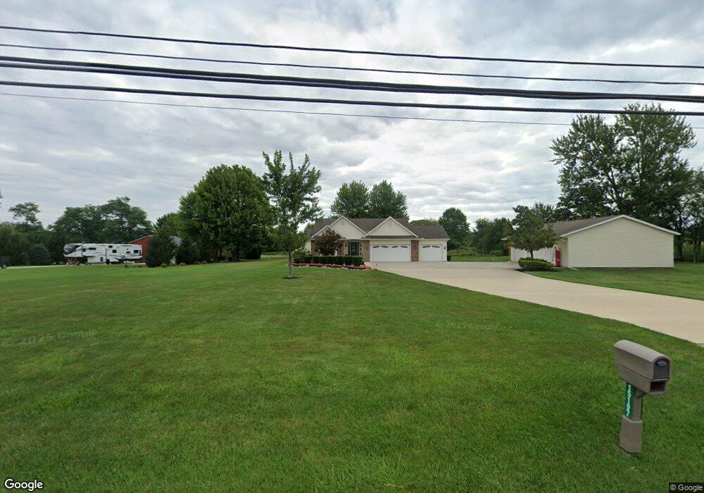
15197 State Route 301 Lagrange, OH 44050
Estimated Value: $383,000 - $479,000
2
Beds
3
Baths
1,901
Sq Ft
$225/Sq Ft
Est. Value
About This Home
This home is located at 15197 State Route 301, Lagrange, OH 44050 and is currently estimated at $427,491, approximately $224 per square foot. 15197 State Route 301 is a home located in Lorain County with nearby schools including Keystone Elementary School, Keystone Middle School, and Keystone High School.
Ownership History
Date
Name
Owned For
Owner Type
Purchase Details
Closed on
Jul 6, 2012
Sold by
Fannie Mae
Bought by
Kuchenrither John M and Kuchenrither Sharon L
Current Estimated Value
Purchase Details
Closed on
Jan 12, 2012
Sold by
Rbs Citizens N A
Bought by
Federal National Mortgage Association
Purchase Details
Closed on
Oct 27, 2008
Sold by
Yensho Elizabeth and Abahazi Madge V
Bought by
Abahazi Matthew Ludwig and Abahazi Heather Ashley
Home Financials for this Owner
Home Financials are based on the most recent Mortgage that was taken out on this home.
Original Mortgage
$155,000
Interest Rate
5.12%
Mortgage Type
Purchase Money Mortgage
Purchase Details
Closed on
Jun 17, 2002
Sold by
Yensho Elizabeth and Abahazi Madge
Bought by
Kramer John R and Kramer Mary T
Create a Home Valuation Report for This Property
The Home Valuation Report is an in-depth analysis detailing your home's value as well as a comparison with similar homes in the area
Home Values in the Area
Average Home Value in this Area
Purchase History
| Date | Buyer | Sale Price | Title Company |
|---|---|---|---|
| Kuchenrither John M | -- | Ohio Title Corporation | |
| Federal National Mortgage Association | $180,000 | None Available | |
| Abahazi Matthew Ludwig | $150,000 | Old Republic Title | |
| Kramer John R | $42,000 | -- |
Source: Public Records
Mortgage History
| Date | Status | Borrower | Loan Amount |
|---|---|---|---|
| Previous Owner | Abahazi Matthew Ludwig | $155,000 |
Source: Public Records
Tax History Compared to Growth
Tax History
| Year | Tax Paid | Tax Assessment Tax Assessment Total Assessment is a certain percentage of the fair market value that is determined by local assessors to be the total taxable value of land and additions on the property. | Land | Improvement |
|---|---|---|---|---|
| 2024 | $4,577 | $121,674 | $20,104 | $101,570 |
| 2023 | $4,276 | $96,607 | $19,506 | $77,102 |
| 2022 | $4,265 | $96,607 | $19,506 | $77,102 |
| 2021 | $4,265 | $96,607 | $19,506 | $77,102 |
| 2020 | $3,672 | $76,130 | $15,370 | $60,760 |
| 2019 | $3,649 | $76,130 | $15,370 | $60,760 |
| 2018 | $3,645 | $76,130 | $15,370 | $60,760 |
| 2017 | $3,731 | $74,960 | $16,260 | $58,700 |
| 2016 | $3,704 | $74,960 | $16,260 | $58,700 |
| 2015 | $3,698 | $74,960 | $16,260 | $58,700 |
| 2014 | $3,022 | $70,720 | $15,340 | $55,380 |
| 2013 | $2,658 | $64,980 | $15,340 | $49,640 |
Source: Public Records
Map
Nearby Homes
- 756 N Center St
- 40725 Biggs Rd
- 829 Robinson Dr
- 831 Robinson Dr
- 41635 Parsons Rd
- 822 Robinson Dr
- 808 Buckingham Dr
- 800 Buckingham Dr
- 128 Harvest Ct
- 630 Rundle St
- 548 William St
- 607 Rundle St
- 516 Appomattox Ct
- 171 Keywood Blvd
- 40175 Banks Rd
- 433 N Center St
- 40185 Banks Rd
- 40163 Banks Rd
- 0 Dill Ct Unit 5072837
- 194 Railroad St
- 15197 Lagrange Rd
- 15157 Lagrange Rd
- 15186 State Route 301
- 15055 State Route 301
- 15011 State Route 301
- 15443 State Route 301
- 14996 State Route 301
- 14945 State Route 301
- 15456 State Route 301
- 131 Buckingham
- 118 Garfield Dr
- 15518 State Route 301
- 14907 State Route 301
- 15536 State Route 301
- 15552 State Route 301
- 15576 State Route 301
- 14809 Lagrange Rd
- 14871 State Route 301
- 14838 State Route 301
- 14809 State Route 301