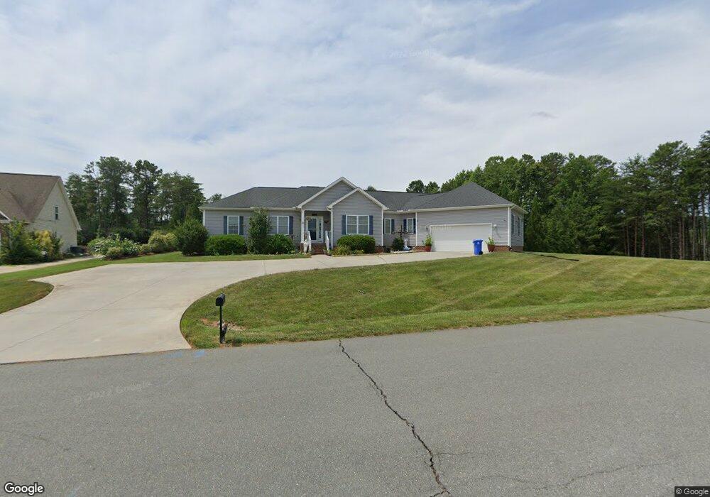
152 Berkeley Dr Lexington, NC 27295
Estimated Value: $379,000 - $539,000
3
Beds
2
Baths
3,772
Sq Ft
$121/Sq Ft
Est. Value
About This Home
This home is located at 152 Berkeley Dr, Lexington, NC 27295 and is currently estimated at $455,091, approximately $120 per square foot. 152 Berkeley Dr is a home located in Davidson County with nearby schools including Friedberg Elementary School, Oak Grove Middle School, and Oak Grove High School.
Ownership History
Date
Name
Owned For
Owner Type
Purchase Details
Closed on
Jun 17, 2011
Sold by
Miller Jack H and Miller Betty M
Bought by
Ennamorato Carl Louis and Ennamorato Lily
Current Estimated Value
Home Financials for this Owner
Home Financials are based on the most recent Mortgage that was taken out on this home.
Original Mortgage
$225,000
Interest Rate
4.53%
Mortgage Type
Construction
Purchase Details
Closed on
Sep 15, 2004
Sold by
Turn Key Properties Inc
Bought by
Miller Jack H
Create a Home Valuation Report for This Property
The Home Valuation Report is an in-depth analysis detailing your home's value as well as a comparison with similar homes in the area
Purchase History
| Date | Buyer | Sale Price | Title Company |
|---|---|---|---|
| Ennamorato Carl Louis | $23,000 | None Available | |
| Miller Jack H | $35,000 | -- |
Source: Public Records
Mortgage History
| Date | Status | Borrower | Loan Amount |
|---|---|---|---|
| Previous Owner | Ennamorato Carl Louis | $225,000 |
Source: Public Records
Tax History
| Year | Tax Paid | Tax Assessment Tax Assessment Total Assessment is a certain percentage of the fair market value that is determined by local assessors to be the total taxable value of land and additions on the property. | Land | Improvement |
|---|---|---|---|---|
| 2025 | $2,192 | $337,200 | $0 | $0 |
| 2024 | $2,126 | $337,200 | $0 | $0 |
| 2023 | $2,158 | $337,200 | $0 | $0 |
| 2022 | $2,059 | $337,200 | $0 | $0 |
| 2021 | $2,059 | $337,200 | $0 | $0 |
| 2020 | $1,545 | $252,910 | $0 | $0 |
| 2019 | $1,568 | $252,910 | $0 | $0 |
| 2018 | $1,568 | $252,910 | $0 | $0 |
| 2017 | $1,568 | $252,910 | $0 | $0 |
| 2016 | $1,568 | $252,910 | $0 | $0 |
| 2015 | $1,568 | $252,910 | $0 | $0 |
| 2014 | $1,578 | $254,540 | $0 | $0 |
Source: Public Records
Map
Nearby Homes
- 280 Dyna Dr
- 6002 Deer Hunter Ln
- 2393 Union Grove Rd
- 618 Widaustin Dr
- 429 Mendenhall Dr
- 151 Kyle Smith Ct Unit 1059
- 000 Hickory Tree Rd
- 156 Sentry Ct
- 1710 S Union Grove Rd
- 449 Falcon Ln
- 445 Falcon Ln
- 437 Falcon Ln
- 448 Falcon Ln
- 444 Falcon Ln
- 400 Falcon Ln
- 350 Falcon Ln
- 351 Falcon Ln
- 108 Hartman Branch Ln
- 690 Bryson Blvd
- 680 Bryson Blvd
Your Personal Tour Guide
Ask me questions while you tour the home.