Estimated Value: $104,000 - $157,000
3
Beds
3
Baths
2,397
Sq Ft
$50/Sq Ft
Est. Value
About This Home
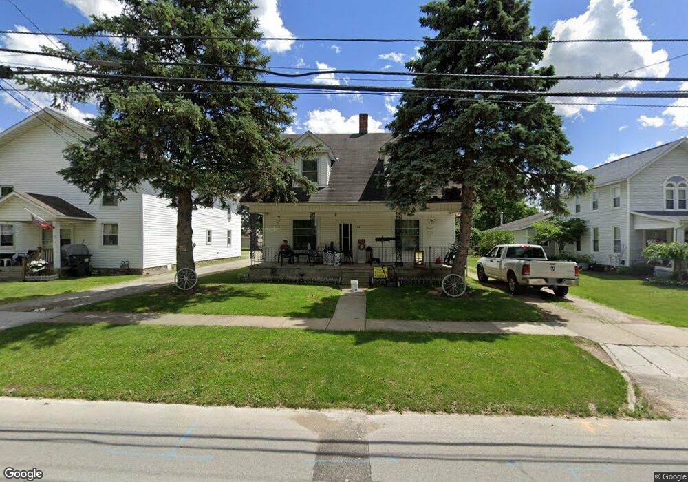
This home is located at 152 Duane St, Clyde, OH 43410 and is currently estimated at $120,541, approximately $50 per square foot. 152 Duane St is a home located in Sandusky County with nearby schools including Clyde High School, St Mary's Catholic School, and Harvest Temple Christian Academy.
Ownership History
Date
Name
Owned For
Owner Type
Purchase Details
Closed on
Nov 30, 2023
Sold by
Ginnever Richard
Bought by
Crawford Brodie
Current Estimated Value
Purchase Details
Closed on
Feb 19, 2016
Sold by
Frederick Heather
Bought by
Ginnerver Richard
Purchase Details
Closed on
Dec 15, 2003
Sold by
Frederick Elizabeth M
Bought by
Frederick Elizabeth M and The Elizabeth M Frederick Trust
Purchase Details
Closed on
May 19, 2003
Sold by
Estate Of Laurel Wilbur Frederick
Bought by
Frederick Elizabeth Mary
Create a Home Valuation Report for This Property
The Home Valuation Report is an in-depth analysis detailing your home's value as well as a comparison with similar homes in the area
Home Values in the Area
Average Home Value in this Area
Purchase History
| Date | Buyer | Sale Price | Title Company |
|---|---|---|---|
| Crawford Brodie | -- | None Listed On Document | |
| Ginnerver Richard | $29,000 | Attorney | |
| Frederick Elizabeth M | -- | -- | |
| Frederick Elizabeth Mary | -- | -- |
Source: Public Records
Tax History
| Year | Tax Paid | Tax Assessment Tax Assessment Total Assessment is a certain percentage of the fair market value that is determined by local assessors to be the total taxable value of land and additions on the property. | Land | Improvement |
|---|---|---|---|---|
| 2025 | $1,332 | $99,300 | $12,300 | $87,000 |
| 2024 | $1,332 | $34,760 | $4,310 | $30,450 |
| 2023 | $1,304 | $27,790 | $3,430 | $24,360 |
| 2022 | $1,134 | $27,790 | $3,430 | $24,360 |
| 2021 | $1,147 | $27,790 | $3,430 | $24,360 |
| 2020 | $1,243 | $29,160 | $3,430 | $25,730 |
| 2019 | $1,229 | $29,160 | $3,430 | $25,730 |
| 2018 | $877 | $20,830 | $3,430 | $17,400 |
| 2017 | $833 | $19,250 | $3,430 | $15,820 |
| 2016 | $835 | $19,600 | $3,430 | $16,170 |
| 2015 | $825 | $19,600 | $3,430 | $16,170 |
| 2014 | $2,076 | $32,170 | $3,330 | $28,840 |
| 2013 | $1,581 | $32,170 | $3,330 | $28,840 |
Source: Public Records
Map
Nearby Homes
- 1337 E Sr 20
- 0 W Mcpherson Hwy
- 1337 U S 20
- 246 Spring St
- 135 Mechanic St
- 209 Fair St
- 119 Warnecke Dr
- 0 Durnwald Dr
- CR 260 89.6 acres Durnwald Dr
- 761 N Woodland Ave
- 891 N Woodland Ave
- 119 Woodhaven Crescent
- 1270 W Mcpherson Hwy
- 4534 County Road 175
- 0 County Road 175
- 1727 E Mcpherson Hwy
- 101 Nathan Dr
- 2690 County Road 213
- 5255 County Road 177
- 3850 County Road 231
Your Personal Tour Guide
Ask me questions while you tour the home.