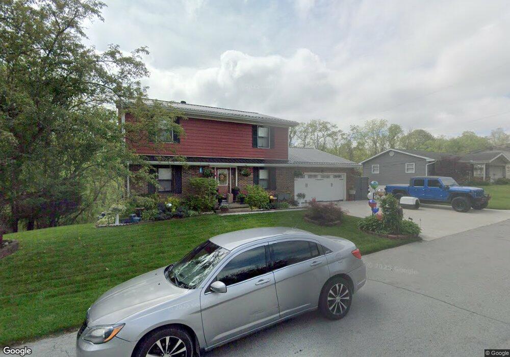
152 Merrick Rd Cambridge, OH 43725
Estimated Value: $272,939 - $421,000
Studio
--
Bath
2,352
Sq Ft
$139/Sq Ft
Est. Value
About This Home
This home is located at 152 Merrick Rd, Cambridge, OH 43725 and is currently estimated at $327,235, approximately $139 per square foot. 152 Merrick Rd is a home with nearby schools including Cambridge High School and St. Benedict Elementary School.
Ownership History
Date
Name
Owned For
Owner Type
Purchase Details
Closed on
Dec 4, 2024
Sold by
Carter Stacy J and Hill Stacy
Bought by
Hill Stacy and Hill Shawn
Current Estimated Value
Purchase Details
Closed on
Nov 10, 2006
Sold by
Blaine John C and Blaine Frances E
Bought by
Blaine John C and Blaine Frances E
Purchase Details
Closed on
Jul 24, 2006
Sold by
Gibson Raymond L and Gibson Diane L
Bought by
Carter Stacy J
Home Financials for this Owner
Home Financials are based on the most recent Mortgage that was taken out on this home.
Original Mortgage
$151,140
Interest Rate
6.73%
Mortgage Type
USDA
Purchase Details
Closed on
Mar 16, 2005
Sold by
Theodosopoulos Alex N and Theodosopoulos Karen
Bought by
Blaine John C and Blaine Frances E
Create a Home Valuation Report for This Property
The Home Valuation Report is an in-depth analysis detailing your home's value as well as a comparison with similar homes in the area
Home Values in the Area
Average Home Value in this Area
Purchase History
| Date | Buyer | Sale Price | Title Company |
|---|---|---|---|
| Hill Stacy | -- | None Listed On Document | |
| Hill Stacy | -- | None Listed On Document | |
| Blaine John C | -- | -- | |
| Carter Stacy J | $155,000 | -- | |
| Blaine John C | -- | -- |
Source: Public Records
Mortgage History
| Date | Status | Borrower | Loan Amount |
|---|---|---|---|
| Previous Owner | Carter Stacy J | $151,140 |
Source: Public Records
Tax History
| Year | Tax Paid | Tax Assessment Tax Assessment Total Assessment is a certain percentage of the fair market value that is determined by local assessors to be the total taxable value of land and additions on the property. | Land | Improvement |
|---|---|---|---|---|
| 2025 | $3,796 | $76,020 | $14,560 | $61,460 |
| 2024 | $3,798 | $76,020 | $14,560 | $61,460 |
| 2023 | $3,698 | $64,893 | $12,428 | $52,465 |
| 2022 | $3,212 | $64,890 | $12,420 | $52,470 |
| 2021 | $3,179 | $64,890 | $12,420 | $52,470 |
| 2020 | $3,057 | $61,540 | $11,110 | $50,430 |
| 2019 | $3,023 | $61,540 | $11,110 | $50,430 |
| 2018 | $2,731 | $61,540 | $11,110 | $50,430 |
| 2017 | $2,620 | $53,340 | $9,660 | $43,680 |
| 2016 | $2,621 | $53,340 | $9,660 | $43,680 |
| 2015 | $2,621 | $53,340 | $9,660 | $43,680 |
| 2014 | -- | $47,410 | $8,400 | $39,010 |
| 2013 | $2,329 | $47,410 | $8,400 | $39,010 |
Source: Public Records
Map
Nearby Homes
- 148 Merrick Rd
- 122 Myrna Dr
- 141 Meadowpark Dr
- 6123 Fairdale Dr
- 5721 Skyline Dr
- 5617 Skyline Dr
- 7321 Glenn Hwy
- 62368 Piedmont Rd
- 93 Beatty Ave
- 209 Jefferson Ave
- 445 N 3rd St
- 405 Foster Ave
- 606 S 7th St
- 708 S 7th St
- 501 Wheeling Ave
- 427 N 7th St
- 519 Taylor Ave
- 707 Stewart Ave
- 623 S 9th St
- 318 N 8th St
Your Personal Tour Guide
Ask me questions while you tour the home.