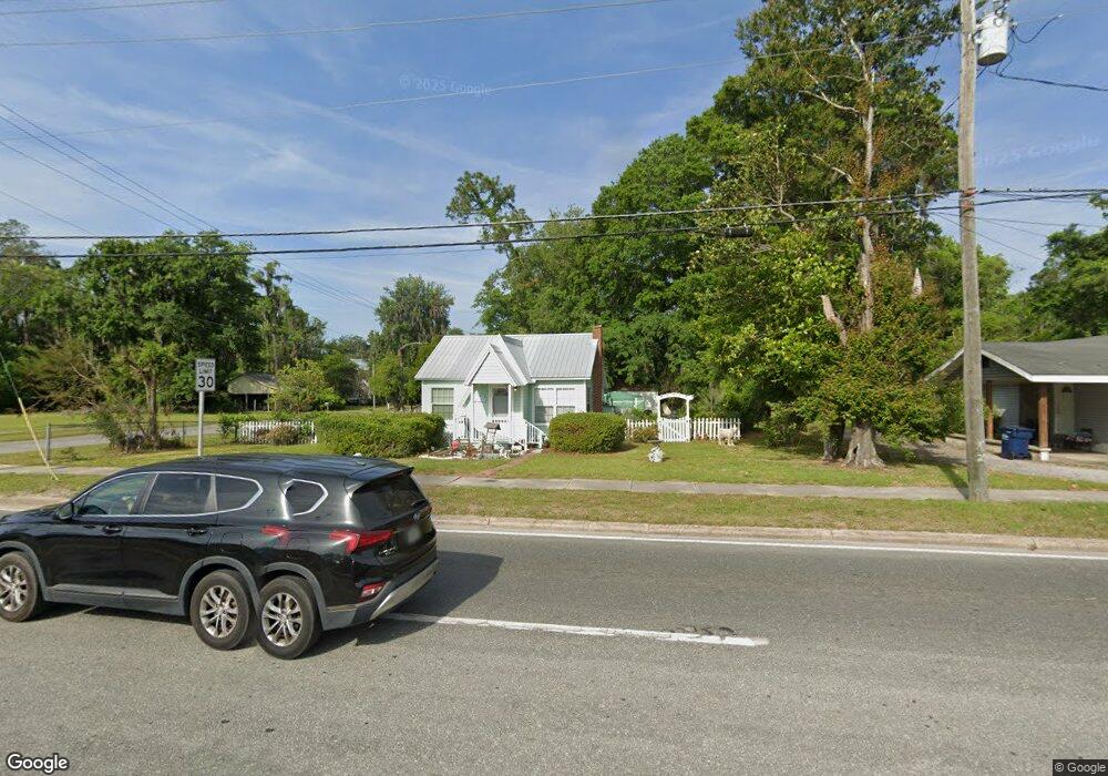
152 S 6th St MacClenny, FL 32063
Estimated Value: $91,121 - $142,000
Studio
1
Bath
788
Sq Ft
$149/Sq Ft
Est. Value
About This Home
This home is located at 152 S 6th St, MacClenny, FL 32063 and is currently estimated at $117,780, approximately $149 per square foot. 152 S 6th St is a home located in Baker County with nearby schools including Keller Intermediate School, MacClenny Elementary School, and Baker County Middle School.
Ownership History
Date
Name
Owned For
Owner Type
Purchase Details
Closed on
Aug 26, 2014
Sold by
Gerson Anita
Bought by
Nelson Carolina D
Current Estimated Value
Home Financials for this Owner
Home Financials are based on the most recent Mortgage that was taken out on this home.
Original Mortgage
$42,000
Outstanding Balance
$13,090
Interest Rate
4.2%
Mortgage Type
Seller Take Back
Estimated Equity
$104,690
Purchase Details
Closed on
Nov 28, 2012
Sold by
Bailes William A
Bought by
Gerson Anita
Purchase Details
Closed on
Jun 10, 2010
Sold by
Gerson Anita
Bought by
Bailes William A
Create a Home Valuation Report for This Property
The Home Valuation Report is an in-depth analysis detailing your home's value as well as a comparison with similar homes in the area
Home Values in the Area
Average Home Value in this Area
Purchase History
| Date | Buyer | Sale Price | Title Company |
|---|---|---|---|
| Nelson Carolina D | $48,000 | Baker Title & Escrow Company | |
| Gerson Anita | -- | Baker Title & Escrow Company | |
| Gerson Anita | -- | Attorney | |
| Bailes William A | -- | None Available |
Source: Public Records
Mortgage History
| Date | Status | Borrower | Loan Amount |
|---|---|---|---|
| Open | Nelson Carolina D | $42,000 |
Source: Public Records
Tax History
| Year | Tax Paid | Tax Assessment Tax Assessment Total Assessment is a certain percentage of the fair market value that is determined by local assessors to be the total taxable value of land and additions on the property. | Land | Improvement |
|---|---|---|---|---|
| 2025 | $1,209 | $69,449 | -- | -- |
| 2024 | $1,114 | $63,135 | -- | -- |
| 2023 | $1,043 | $57,395 | $0 | $0 |
| 2022 | $965 | $52,177 | $0 | $0 |
| 2021 | $854 | $47,434 | $13,379 | $34,055 |
| 2020 | $818 | $44,997 | $0 | $0 |
| 2019 | $776 | $42,347 | $12,835 | $29,512 |
| 2018 | $750 | $40,454 | $0 | $0 |
| 2017 | $739 | $39,487 | $0 | $0 |
| 2016 | $724 | $37,941 | $0 | $0 |
| 2015 | $711 | $36,483 | $0 | $0 |
| 2014 | $695 | $35,496 | $0 | $0 |
Source: Public Records
Map
Nearby Homes
Your Personal Tour Guide
Ask me questions while you tour the home.