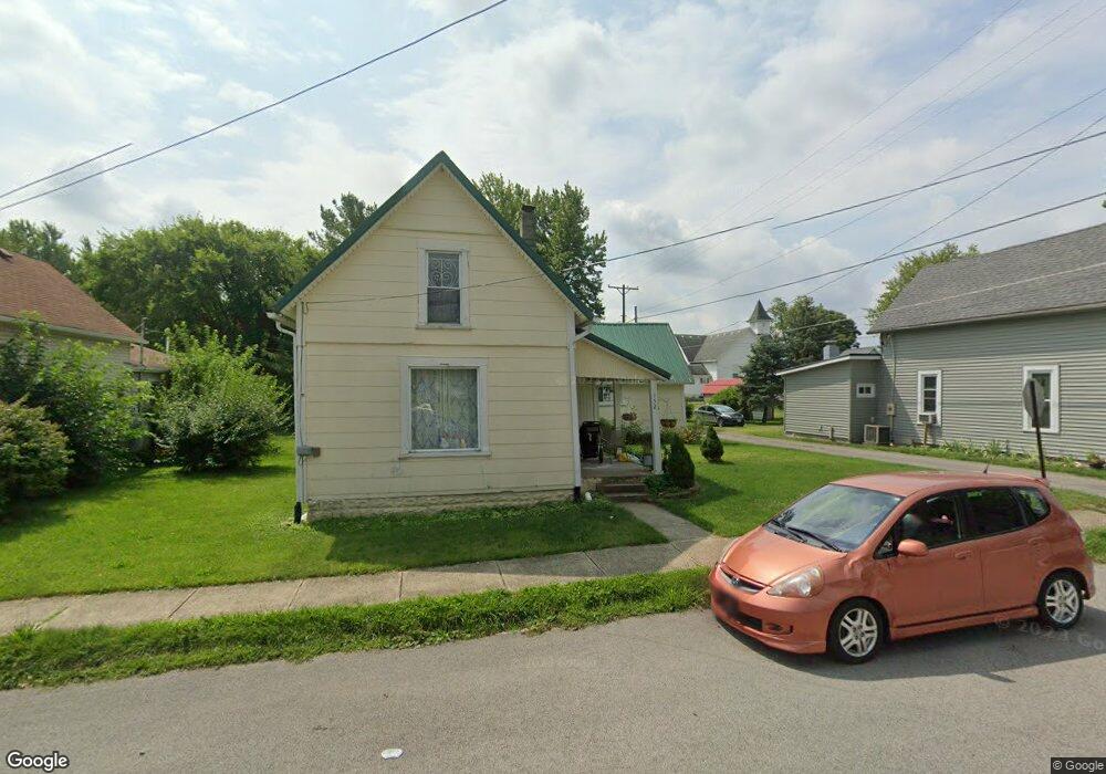
152 State (P) West Mansfield, OH 43358
Estimated Value: $110,000 - $193,000
3
Beds
1
Bath
1,419
Sq Ft
$106/Sq Ft
Est. Value
About This Home
This home is located at 152 State (P), West Mansfield, OH 43358 and is currently estimated at $149,776, approximately $105 per square foot. 152 State (P) is a home located in Logan County with nearby schools including Benjamin Logan Elementary School, Benjamin Logan Middle School, and Benjamin Logan High School.
Ownership History
Date
Name
Owned For
Owner Type
Purchase Details
Closed on
Sep 28, 2022
Sold by
Leitch Ryan W
Bought by
Wells Diane and Wells Dennis J
Current Estimated Value
Home Financials for this Owner
Home Financials are based on the most recent Mortgage that was taken out on this home.
Original Mortgage
$56,250
Outstanding Balance
$53,765
Interest Rate
5.13%
Mortgage Type
New Conventional
Estimated Equity
$96,011
Purchase Details
Closed on
Dec 2, 2010
Bought by
Ryan W Leitch
Purchase Details
Closed on
Jul 1, 2009
Bought by
Ronald A Culp
Purchase Details
Closed on
Mar 20, 2009
Bought by
Wells Fargo Bank Na Trustee
Purchase Details
Closed on
Jan 27, 2004
Bought by
Dillon Debra Etvir
Create a Home Valuation Report for This Property
The Home Valuation Report is an in-depth analysis detailing your home's value as well as a comparison with similar homes in the area
Home Values in the Area
Average Home Value in this Area
Purchase History
| Date | Buyer | Sale Price | Title Company |
|---|---|---|---|
| Wells Diane | $150 | -- | |
| Ryan W Leitch | $63,000 | -- | |
| Ronald A Culp | $7,800 | -- | |
| Wells Fargo Bank Na Trustee | $33,300 | -- | |
| Dillon Debra Etvir | -- | -- |
Source: Public Records
Mortgage History
| Date | Status | Borrower | Loan Amount |
|---|---|---|---|
| Open | Wells Diane | $56,250 |
Source: Public Records
Tax History Compared to Growth
Tax History
| Year | Tax Paid | Tax Assessment Tax Assessment Total Assessment is a certain percentage of the fair market value that is determined by local assessors to be the total taxable value of land and additions on the property. | Land | Improvement |
|---|---|---|---|---|
| 2024 | $1,189 | $31,320 | $5,250 | $26,070 |
| 2023 | $1,189 | $31,320 | $5,250 | $26,070 |
| 2022 | $1,176 | $25,060 | $4,200 | $20,860 |
| 2021 | $1,007 | $25,060 | $4,200 | $20,860 |
| 2020 | $1,009 | $19,700 | $4,040 | $15,660 |
| 2019 | $1,012 | $19,700 | $4,040 | $15,660 |
| 2018 | $767 | $19,700 | $4,040 | $15,660 |
| 2016 | $733 | $17,920 | $3,680 | $14,240 |
| 2014 | $720 | $17,920 | $3,680 | $14,240 |
| 2013 | $714 | $17,920 | $3,680 | $14,240 |
| 2012 | $542 | $10,890 | $3,680 | $7,210 |
Source: Public Records
Map
Nearby Homes
- 262 S Main St
- 289 E Center St
- 23750 Drake-Skidmore Rd
- 25400 Storms Rd
- 0 Township Road 127
- 28370 State Route 739
- 0 Ohio 292
- 30650 State Route 739
- 31535 State Route 31
- 0 Ohio 31
- 32220 State Route 31
- 28384 Bitler Rd
- 25875 Ohio 31
- 5266 Ohio 540
- 21560 Johnson Rd
- 0 Johnson Rd Unit 222024368
- 0 Johnson Rd Unit 225027964
- 0 Johnson Rd Unit Lot 2 222024351
- 18055 Miller Rd
- 212 S Sandusky St