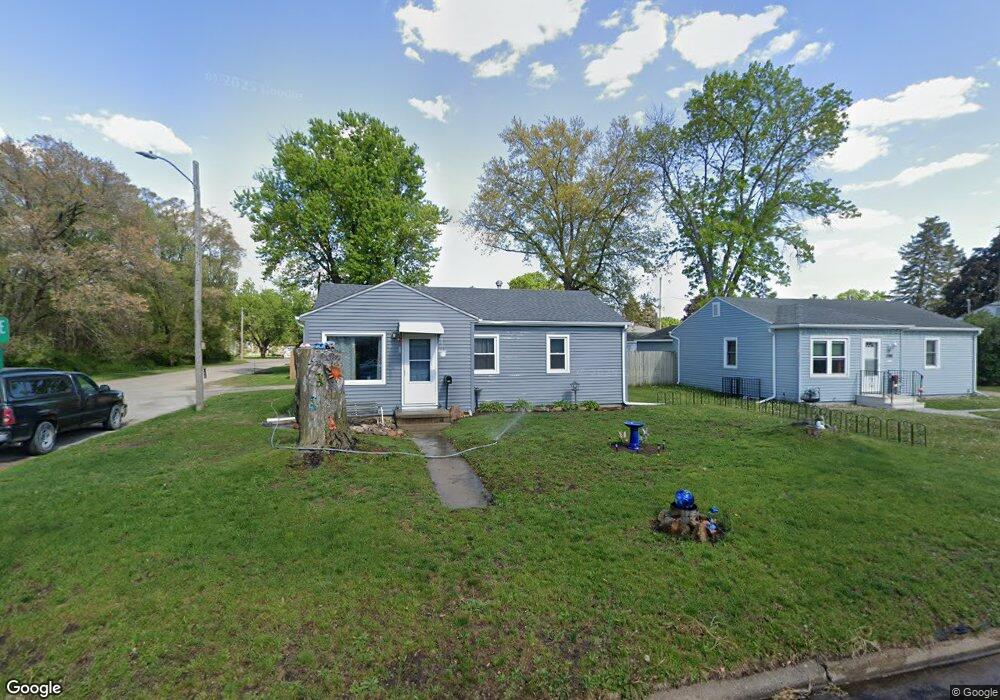
152 Thomas Ave Waterloo, IA 50703
Estimated Value: $79,000 - $97,000
3
Beds
1
Bath
812
Sq Ft
$110/Sq Ft
Est. Value
About This Home
This home is located at 152 Thomas Ave, Waterloo, IA 50703 and is currently estimated at $89,509, approximately $110 per square foot. 152 Thomas Ave is a home located in Black Hawk County with nearby schools including Lincoln Elementary School, George Washington Carver Academy, and East High School.
Ownership History
Date
Name
Owned For
Owner Type
Purchase Details
Closed on
Sep 2, 2005
Sold by
Schmitz Scott A and Schmitz Elaine F
Bought by
Mettlin Kirk and Mettlin Tamara
Current Estimated Value
Home Financials for this Owner
Home Financials are based on the most recent Mortgage that was taken out on this home.
Original Mortgage
$64,000
Outstanding Balance
$36,460
Interest Rate
7%
Mortgage Type
Adjustable Rate Mortgage/ARM
Estimated Equity
$53,049
Create a Home Valuation Report for This Property
The Home Valuation Report is an in-depth analysis detailing your home's value as well as a comparison with similar homes in the area
Purchase History
| Date | Buyer | Sale Price | Title Company |
|---|---|---|---|
| Mettlin Kirk | $64,000 | Black Hawk County Abstract C |
Source: Public Records
Mortgage History
| Date | Status | Borrower | Loan Amount |
|---|---|---|---|
| Open | Mettlin Kirk | $64,000 |
Source: Public Records
Tax History
| Year | Tax Paid | Tax Assessment Tax Assessment Total Assessment is a certain percentage of the fair market value that is determined by local assessors to be the total taxable value of land and additions on the property. | Land | Improvement |
|---|---|---|---|---|
| 2025 | $1,302 | $82,470 | $11,020 | $71,450 |
| 2024 | $1,302 | $70,260 | $11,020 | $59,240 |
| 2023 | $1,192 | $70,260 | $11,020 | $59,240 |
| 2022 | $1,158 | $63,150 | $11,020 | $52,130 |
| 2021 | $1,204 | $63,150 | $11,020 | $52,130 |
| 2020 | $1,180 | $61,770 | $9,640 | $52,130 |
| 2019 | $1,180 | $61,770 | $9,640 | $52,130 |
| 2018 | $1,118 | $58,840 | $9,640 | $49,200 |
| 2017 | $1,156 | $58,840 | $9,640 | $49,200 |
| 2016 | $1,138 | $58,840 | $9,640 | $49,200 |
| 2015 | $1,138 | $58,840 | $9,640 | $49,200 |
| 2014 | $1,008 | $52,280 | $9,640 | $42,640 |
Source: Public Records
Map
Nearby Homes
Your Personal Tour Guide
Ask me questions while you tour the home.