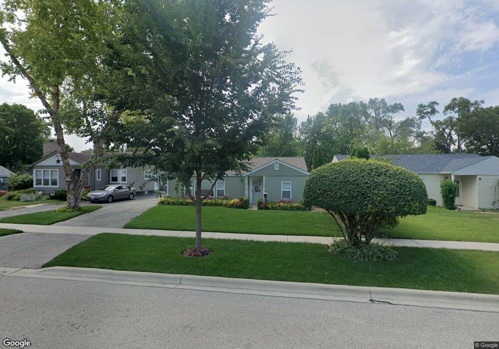
152 Walnut Ct Mundelein, IL 60060
Estimated Value: $240,000 - $285,000
--
Bed
1
Bath
1,316
Sq Ft
$201/Sq Ft
Est. Value
About This Home
This home is located at 152 Walnut Ct, Mundelein, IL 60060 and is currently estimated at $263,937, approximately $200 per square foot. 152 Walnut Ct is a home located in Lake County with nearby schools including Diamond Lake Elementary School, West Oak Middle School, and Mundelein Cons High School.
Ownership History
Date
Name
Owned For
Owner Type
Purchase Details
Closed on
Apr 4, 2022
Sold by
Jeffrey Bopp
Bought by
Bopp Jeffrey and Bopp Marilyn Clark
Current Estimated Value
Purchase Details
Closed on
Jul 10, 2003
Sold by
Bopp Jeffrey and Bopp Laila
Bought by
Bopp Jeffrey
Home Financials for this Owner
Home Financials are based on the most recent Mortgage that was taken out on this home.
Original Mortgage
$100,000
Interest Rate
6.18%
Mortgage Type
Stand Alone First
Purchase Details
Closed on
Oct 27, 1999
Sold by
Markko Christopher G and Markko Jamie F
Bought by
Stein Laila B and Bopp Jeffrey
Home Financials for this Owner
Home Financials are based on the most recent Mortgage that was taken out on this home.
Original Mortgage
$105,000
Interest Rate
8%
Create a Home Valuation Report for This Property
The Home Valuation Report is an in-depth analysis detailing your home's value as well as a comparison with similar homes in the area
Home Values in the Area
Average Home Value in this Area
Purchase History
| Date | Buyer | Sale Price | Title Company |
|---|---|---|---|
| Bopp Jeffrey | -- | Walter Schummer Pc | |
| Bopp Jeffrey | -- | -- | |
| Stein Laila B | $117,000 | -- |
Source: Public Records
Mortgage History
| Date | Status | Borrower | Loan Amount |
|---|---|---|---|
| Previous Owner | Bopp Jeffrey | $100,000 | |
| Previous Owner | Stein Laila B | $105,000 |
Source: Public Records
Tax History Compared to Growth
Tax History
| Year | Tax Paid | Tax Assessment Tax Assessment Total Assessment is a certain percentage of the fair market value that is determined by local assessors to be the total taxable value of land and additions on the property. | Land | Improvement |
|---|---|---|---|---|
| 2024 | $5,800 | $69,650 | $18,875 | $50,775 |
| 2023 | $5,114 | $62,370 | $16,902 | $45,468 |
| 2022 | $5,114 | $53,587 | $16,246 | $37,341 |
| 2021 | $4,919 | $52,433 | $15,896 | $36,537 |
| 2020 | $4,586 | $49,097 | $14,885 | $34,212 |
| 2019 | $4,053 | $44,209 | $13,403 | $30,806 |
| 2018 | $3,199 | $36,420 | $10,772 | $25,648 |
| 2017 | $3,171 | $35,270 | $10,432 | $24,838 |
| 2016 | $3,040 | $33,441 | $9,891 | $23,550 |
| 2015 | $2,918 | $31,256 | $9,245 | $22,011 |
| 2014 | $3,611 | $30,837 | $9,121 | $21,716 |
| 2012 | $3,555 | $38,882 | $11,501 | $27,381 |
Source: Public Records
Map
Nearby Homes
- 433 E High St
- 510 S Hickory St
- 18 S Hawthorne Blvd
- 701 Thomas Ct
- 425 S Lake St
- 40 S Seymour Ave
- 49 N Shaddle Ave
- 114 W Hawthorne Blvd
- 640 Allanson Rd
- 29746 U S 45
- 228 Woodlawn Dr
- 130 Shadydell Ave
- 261 N Shaddle Ave
- 215 Brice Ave
- 31 Washington Blvd Unit 108
- 331 Plaza Cir
- 841 Wilcox St
- 116 N Prairie Ave
- 328 Brice Ave
- 1255 Huntington Dr
- 146 Walnut Ct
- 156 Walnut Ct
- 142 Walnut Ct
- 166 Walnut Ct
- 136 Walnut Ct
- 137 S Hawthorne Blvd
- 133 S Hawthorne Blvd
- 143 S Hawthorne Blvd
- 127 S Hawthorne Blvd
- 502 E High St
- 147 S Hawthorne Blvd
- 132 Walnut Ct
- 123 S Hawthorne Blvd
- 165 Walnut Ct
- 161 Walnut Ct
- 418 E High St
- 117 S Hawthorne Blvd
- 155 Walnut Ct
- 126 Walnut Ct
- 157 S Hawthorne Blvd