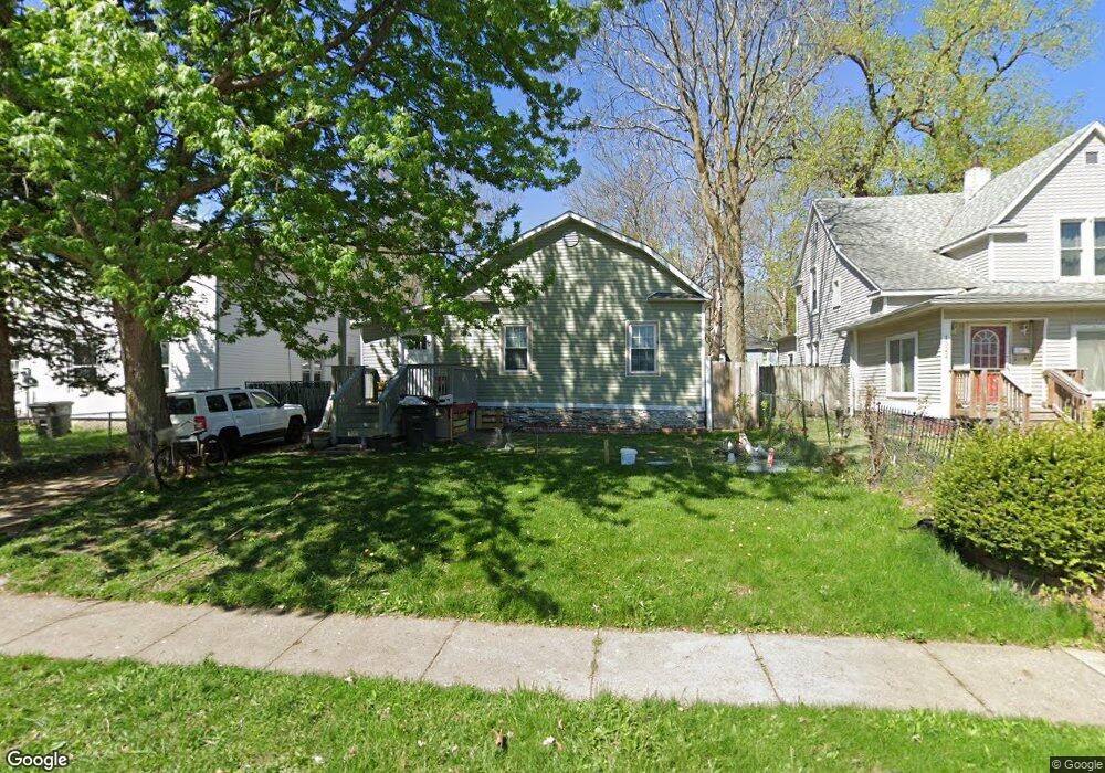
1520 17th St Des Moines, IA 50314
Mondamin Presidential NeighborhoodEstimated Value: $95,000 - $127,000
2
Beds
1
Bath
720
Sq Ft
$155/Sq Ft
Est. Value
About This Home
This home is located at 1520 17th St, Des Moines, IA 50314 and is currently estimated at $111,332, approximately $154 per square foot. 1520 17th St is a home located in Polk County with nearby schools including King Elementary School, Meredith Middle School, and Hoover High School.
Ownership History
Date
Name
Owned For
Owner Type
Purchase Details
Closed on
Feb 23, 2005
Sold by
Rojas Simon C
Bought by
Rojas Simon C and Patino Angel
Current Estimated Value
Purchase Details
Closed on
Oct 15, 2002
Sold by
Nations Credit Financial Services Corp
Bought by
Rojas Simon Colin
Purchase Details
Closed on
Mar 22, 2001
Sold by
Reszel Andrew and Reszel Constance A
Bought by
Nations Credit Financial Services Corp
Purchase Details
Closed on
Jan 21, 1998
Sold by
Searle James R and Searle Deeann M
Bought by
Reszel Andrew H
Home Financials for this Owner
Home Financials are based on the most recent Mortgage that was taken out on this home.
Original Mortgage
$41,300
Interest Rate
6.88%
Purchase Details
Closed on
Jun 1, 1997
Sold by
Barcus David D and Varnorny Barcus Lavina
Bought by
Searle James R and Searle Deeann M
Create a Home Valuation Report for This Property
The Home Valuation Report is an in-depth analysis detailing your home's value as well as a comparison with similar homes in the area
Home Values in the Area
Average Home Value in this Area
Purchase History
| Date | Buyer | Sale Price | Title Company |
|---|---|---|---|
| Rojas Simon C | -- | -- | |
| Rojas Simon Colin | $9,500 | -- | |
| Nations Credit Financial Services Corp | $17,900 | -- | |
| Reszel Andrew H | $32,000 | -- | |
| Searle James R | -- | -- |
Source: Public Records
Mortgage History
| Date | Status | Borrower | Loan Amount |
|---|---|---|---|
| Previous Owner | Reszel Andrew H | $41,300 |
Source: Public Records
Tax History Compared to Growth
Tax History
| Year | Tax Paid | Tax Assessment Tax Assessment Total Assessment is a certain percentage of the fair market value that is determined by local assessors to be the total taxable value of land and additions on the property. | Land | Improvement |
|---|---|---|---|---|
| 2025 | $878 | $78,600 | $13,700 | $64,900 |
| 2024 | $878 | $68,000 | $11,700 | $56,300 |
| 2023 | $782 | $44,600 | $11,700 | $32,900 |
| 2022 | $776 | $33,200 | $8,900 | $24,300 |
| 2021 | $734 | $33,200 | $8,900 | $24,300 |
| 2020 | $1,006 | $29,400 | $7,900 | $21,500 |
| 2019 | $1,273 | $29,400 | $7,900 | $21,500 |
| 2018 | $708 | $26,600 | $7,100 | $19,500 |
| 2017 | $716 | $26,600 | $7,100 | $19,500 |
| 2016 | $698 | $26,500 | $7,000 | $19,500 |
| 2015 | $698 | $26,500 | $7,000 | $19,500 |
| 2014 | $837 | $25,100 | $7,200 | $17,900 |
Source: Public Records
Map
Nearby Homes
- 1534 18th St
- 1716 Mondamin Ave
- 1457 17th St
- 1608 Mondamin Ave
- 1443 17th St
- 1622 Martin Luther King Junior Pkwy
- 1434 Martin Luther King Junior Pkwy
- 1656 Martin Luther King Junior Pkwy
- 1414 Harrison Ave
- 1440 21st St
- 1341 Clark St
- 1615 Jefferson Ave
- 1605 22nd St
- 1330 Clark St
- 1347 Forest Ave
- 1559 23rd St
- 1946 Franklin Ave
- 1503 13th St
- 1915 22nd St
- 1609 12th St