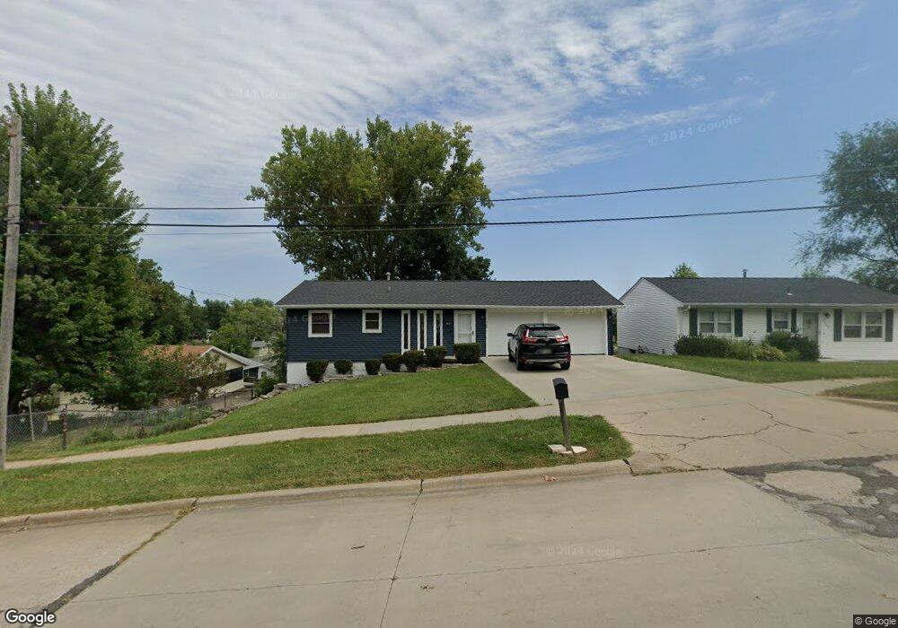
1520 34th St SE Cedar Rapids, IA 52403
Estimated Value: $161,000 - $193,000
3
Beds
2
Baths
720
Sq Ft
$251/Sq Ft
Est. Value
About This Home
This home is located at 1520 34th St SE, Cedar Rapids, IA 52403 and is currently estimated at $180,602, approximately $250 per square foot. 1520 34th St SE is a home located in Linn County with nearby schools including Erskine Elementary School, McKinley STEAM Academy, and George Washington High School.
Ownership History
Date
Name
Owned For
Owner Type
Purchase Details
Closed on
Nov 27, 1999
Sold by
Evans Todd D and Evans Marie E
Bought by
Burdt Samuel P and Burdt Amy E
Current Estimated Value
Home Financials for this Owner
Home Financials are based on the most recent Mortgage that was taken out on this home.
Original Mortgage
$109,166
Outstanding Balance
$34,277
Interest Rate
7.9%
Mortgage Type
FHA
Estimated Equity
$146,325
Create a Home Valuation Report for This Property
The Home Valuation Report is an in-depth analysis detailing your home's value as well as a comparison with similar homes in the area
Home Values in the Area
Average Home Value in this Area
Purchase History
| Date | Buyer | Sale Price | Title Company |
|---|---|---|---|
| Burdt Samuel P | $109,500 | -- |
Source: Public Records
Mortgage History
| Date | Status | Borrower | Loan Amount |
|---|---|---|---|
| Open | Burdt Samuel P | $109,166 |
Source: Public Records
Tax History Compared to Growth
Tax History
| Year | Tax Paid | Tax Assessment Tax Assessment Total Assessment is a certain percentage of the fair market value that is determined by local assessors to be the total taxable value of land and additions on the property. | Land | Improvement |
|---|---|---|---|---|
| 2025 | $2,818 | $175,700 | $32,700 | $143,000 |
| 2024 | $3,022 | $172,500 | $32,700 | $139,800 |
| 2023 | $3,022 | $159,200 | $29,700 | $129,500 |
| 2022 | $2,848 | $143,300 | $26,700 | $116,600 |
| 2021 | $2,864 | $137,500 | $26,700 | $110,800 |
| 2020 | $2,864 | $129,800 | $20,800 | $109,000 |
| 2019 | $2,678 | $124,200 | $20,800 | $103,400 |
| 2018 | $2,606 | $124,200 | $20,800 | $103,400 |
| 2017 | $2,408 | $115,300 | $20,800 | $94,500 |
| 2016 | $2,408 | $113,300 | $20,800 | $92,500 |
| 2015 | $2,420 | $113,723 | $20,790 | $92,933 |
| 2014 | $2,420 | $113,723 | $20,790 | $92,933 |
| 2013 | $2,368 | $113,723 | $20,790 | $92,933 |
Source: Public Records
Map
Nearby Homes
- 3510 Pioneer Ave SE
- 3535 Pioneer Ave SE
- 3600 Bel Air Dr SE
- 1331 34th St SE
- 1401 Harold Dr SE
- 1521 Oak Ridge Ln SE Unit 3
- 2861 Seely Ave SE
- 1241 38th St SE
- 1111 Brockman Dr SE
- 1013 36th St SE
- 1425 42nd St SE
- 1135 Crestview Dr SE
- 1158 28th St SE
- 1310 42nd St SE
- 1310 42nd St SE Unit LotWP001
- 3630 Mt Vernon Rd SE Unit 6
- 1117 Crestview Dr SE
- TBD 42nd St SE
- Tbd 42nd St SE
- Tbd 42nd St SE
- 1528 34th St SE
- 3407 Bel Air Dr SE
- 3401 Bel Air Dr SE
- 3413 Bel Air Dr SE
- 3502 Pioneer Ave SE Unit 3502
- 3504 Pioneer Ave SE Unit 3504
- 3419 Bel Air Dr SE
- 3330 Pioneer Ave SE
- 1602 34th St SE Unit 1602
- 1511 34th St SE
- 3425 Bel Air Dr SE
- 1604 34th St SE Unit 1604
- 1606 34th St SE Unit 1606
- 1608 34th St SE
- 1438 34th St SE
- 3412 Bel Air Dr SE
- 3501 Bel Air Dr SE
- 1503 34th St SE
- 3508 Pioneer Ave SE
- 3418 Bel Air Dr SE