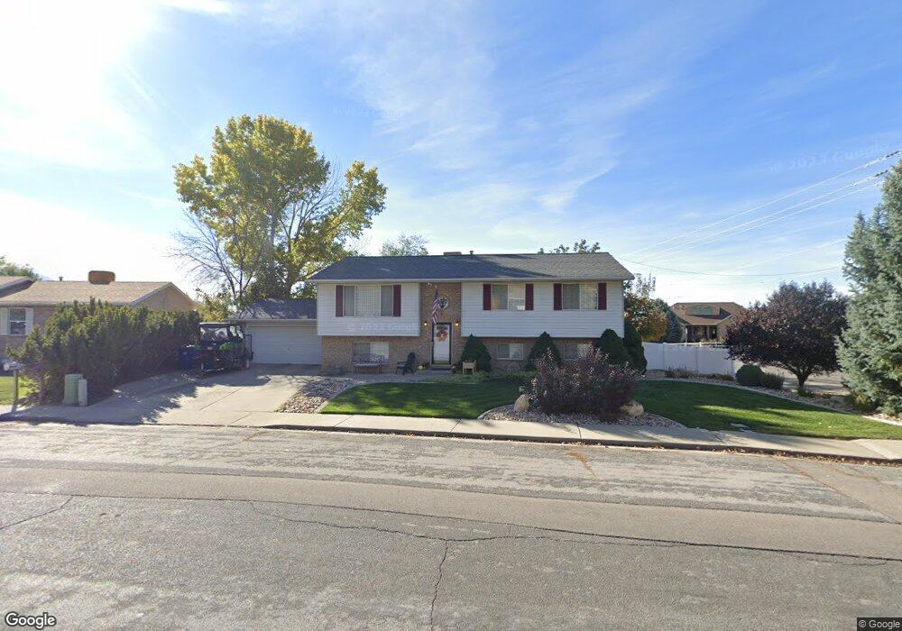
1520 E Murdock Dr Pleasant Grove, UT 84062
Estimated Value: $559,000 - $606,000
5
Beds
3
Baths
2,637
Sq Ft
$220/Sq Ft
Est. Value
About This Home
This home is located at 1520 E Murdock Dr, Pleasant Grove, UT 84062 and is currently estimated at $580,578, approximately $220 per square foot. 1520 E Murdock Dr is a home located in Utah County with nearby schools including Lindon Elementary School, Oak Canyon Junior High School, and Pleasant Grove High School.
Ownership History
Date
Name
Owned For
Owner Type
Purchase Details
Closed on
Aug 28, 2002
Sold by
Arias Italo M and Stuebner Arias Dawna
Bought by
Arias Italo M and Stuebner Arias Dawna
Current Estimated Value
Home Financials for this Owner
Home Financials are based on the most recent Mortgage that was taken out on this home.
Original Mortgage
$35,550
Interest Rate
6.22%
Mortgage Type
Stand Alone Second
Purchase Details
Closed on
Jun 27, 2001
Sold by
Miller Brett and Miller Heather
Bought by
Arias Italo M and Steubner Arias Dawna
Home Financials for this Owner
Home Financials are based on the most recent Mortgage that was taken out on this home.
Original Mortgage
$159,497
Outstanding Balance
$57,139
Interest Rate
7.14%
Mortgage Type
FHA
Estimated Equity
$523,439
Create a Home Valuation Report for This Property
The Home Valuation Report is an in-depth analysis detailing your home's value as well as a comparison with similar homes in the area
Home Values in the Area
Average Home Value in this Area
Purchase History
| Date | Buyer | Sale Price | Title Company |
|---|---|---|---|
| Arias Italo M | -- | -- | |
| Arias Italo M | -- | Metro National Title |
Source: Public Records
Mortgage History
| Date | Status | Borrower | Loan Amount |
|---|---|---|---|
| Closed | Arias Italo M | $35,550 | |
| Open | Arias Italo M | $159,497 |
Source: Public Records
Tax History
| Year | Tax Paid | Tax Assessment Tax Assessment Total Assessment is a certain percentage of the fair market value that is determined by local assessors to be the total taxable value of land and additions on the property. | Land | Improvement |
|---|---|---|---|---|
| 2025 | $2,234 | $288,310 | -- | -- |
| 2024 | $2,234 | $266,640 | $0 | $0 |
| 2023 | $2,191 | $267,740 | $0 | $0 |
| 2022 | $2,212 | $268,950 | $0 | $0 |
| 2021 | $1,931 | $357,400 | $139,400 | $218,000 |
| 2020 | $1,768 | $320,900 | $124,500 | $196,400 |
| 2019 | $1,632 | $306,300 | $109,900 | $196,400 |
| 2018 | $1,541 | $273,400 | $102,600 | $170,800 |
| 2017 | $1,398 | $132,055 | $0 | $0 |
| 2016 | $1,435 | $130,845 | $0 | $0 |
| 2015 | $1,351 | $116,655 | $0 | $0 |
| 2014 | $1,312 | $112,200 | $0 | $0 |
Source: Public Records
Map
Nearby Homes
Your Personal Tour Guide
Ask me questions while you tour the home.