Estimated Value: $256,398 - $328,000
--
Bed
--
Bath
2,001
Sq Ft
$145/Sq Ft
Est. Value
About This Home
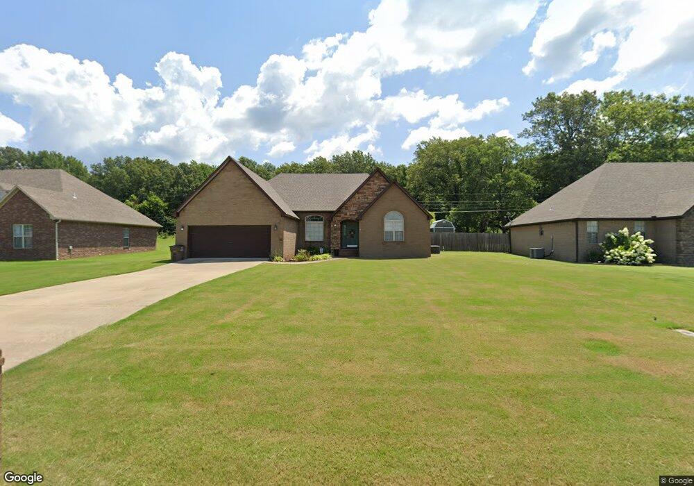
This home is located at 1520 Killough Rd N, Wynne, AR 72396 and is currently estimated at $290,350, approximately $145 per square foot. 1520 Killough Rd N is a home with nearby schools including Wynne Intermediate School, Wynne Primary School, and Wynne Junior High School.
Ownership History
Date
Name
Owned For
Owner Type
Purchase Details
Closed on
Mar 17, 2017
Sold by
Brockway Dustin and Brockway Jennifer
Bought by
Woodard Christopher Nelson and Woodard Ashlee Taren
Current Estimated Value
Home Financials for this Owner
Home Financials are based on the most recent Mortgage that was taken out on this home.
Original Mortgage
$114,500
Outstanding Balance
$94,897
Interest Rate
4.15%
Mortgage Type
New Conventional
Estimated Equity
$195,453
Create a Home Valuation Report for This Property
The Home Valuation Report is an in-depth analysis detailing your home's value as well as a comparison with similar homes in the area
Home Values in the Area
Average Home Value in this Area
Purchase History
| Date | Buyer | Sale Price | Title Company |
|---|---|---|---|
| Woodard Christopher Nelson | $179,500 | Janus Title Llc |
Source: Public Records
Mortgage History
| Date | Status | Borrower | Loan Amount |
|---|---|---|---|
| Open | Woodard Christopher Nelson | $114,500 |
Source: Public Records
Tax History Compared to Growth
Tax History
| Year | Tax Paid | Tax Assessment Tax Assessment Total Assessment is a certain percentage of the fair market value that is determined by local assessors to be the total taxable value of land and additions on the property. | Land | Improvement |
|---|---|---|---|---|
| 2024 | $1,335 | $37,140 | $4,770 | $32,370 |
| 2023 | $1,413 | $37,140 | $4,770 | $32,370 |
| 2022 | $1,463 | $37,140 | $4,770 | $32,370 |
| 2021 | $1,463 | $37,140 | $4,770 | $32,370 |
| 2020 | $1,403 | $37,140 | $4,770 | $32,370 |
| 2019 | $1,318 | $34,200 | $3,990 | $30,210 |
| 2018 | $1,343 | $34,200 | $3,990 | $30,210 |
| 2017 | $1,343 | $34,200 | $3,990 | $30,210 |
| 2016 | $1,343 | $34,200 | $3,990 | $30,210 |
| 2015 | $1,343 | $34,200 | $3,990 | $30,210 |
| 2014 | $1,361 | $34,570 | $4,800 | $29,770 |
Source: Public Records
Map
Nearby Homes
- 1405 Peterson Rd
- 1737 Peterson Rd
- 1308 Killough Rd N
- 1721 Quail Run Dr
- 1709 Quail Run Dr
- 1310 Bridges Ave E
- 1721 Peterson Dr
- 1840 Cogbill Rd
- 1404 Airpark Rd
- 1805 Hf Henson Rd
- 1011 Hilltop Dr
- 1008 Languille Ave E
- 1920 Airpark Rd
- 1916 Cogbill Rd
- 226 Nathan Dr E
- 29 Sunset Dr
- 1812 Eve St
- 4 Briarcliff Cir
- 109 Nathan Dr E
- 1810 Killough Rd N
- 1500 Killough Rd N
- N Killough Rd
- 1500 N Killough Rd
- 1540 Killough Rd N
- 1503 Killough Rd N
- 1501 Killough Rd N
- 1505 Killough Rd N
- 1490 Killough Rd N
- 1476 Killough Rd N
- 1409 Killough Rd N
- 1550 Killough Rd N
- 1448 Killough Rd N
- 1620 N Killough Rd
- 1405 N Killough Rd
- 1424 Killough Rd N
- 1624 Killough Rd N
- 1619 N Killough Rd N
- 1400 Killough Rd N
- 1401 Killough Rd N
- 1621 Killough Rd N