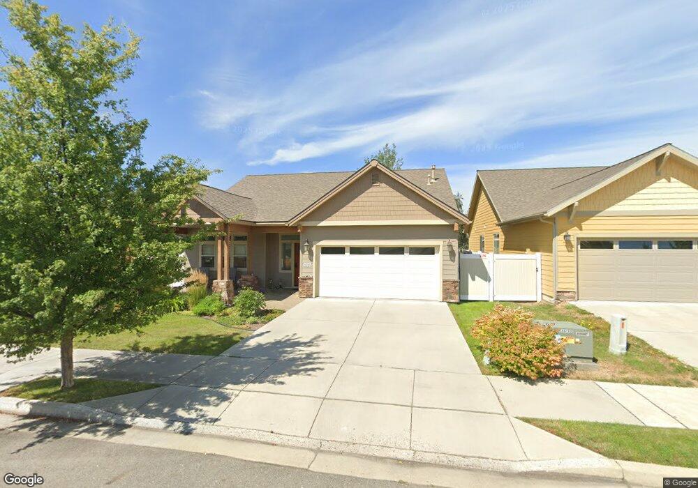
1520 River Rock Rd Sandpoint, ID 83864
Estimated Value: $585,540 - $663,000
3
Beds
2
Baths
1,603
Sq Ft
$385/Sq Ft
Est. Value
About This Home
This home is located at 1520 River Rock Rd, Sandpoint, ID 83864 and is currently estimated at $616,635, approximately $384 per square foot. 1520 River Rock Rd is a home with nearby schools including Washington Elementary School, Sandpoint Middle School, and Sandpoint High School.
Ownership History
Date
Name
Owned For
Owner Type
Purchase Details
Closed on
May 8, 2015
Sold by
Parsons Gary D
Bought by
Hagan Curtis F and Hagan Bonnie L
Current Estimated Value
Home Financials for this Owner
Home Financials are based on the most recent Mortgage that was taken out on this home.
Original Mortgage
$320,230
Outstanding Balance
$246,335
Interest Rate
3.64%
Mortgage Type
VA
Estimated Equity
$370,300
Purchase Details
Closed on
Oct 23, 2014
Sold by
Timberline Investments Llc
Bought by
Moore Charesse
Home Financials for this Owner
Home Financials are based on the most recent Mortgage that was taken out on this home.
Original Mortgage
$75,000
Interest Rate
4.1%
Mortgage Type
Purchase Money Mortgage
Create a Home Valuation Report for This Property
The Home Valuation Report is an in-depth analysis detailing your home's value as well as a comparison with similar homes in the area
Home Values in the Area
Average Home Value in this Area
Purchase History
| Date | Buyer | Sale Price | Title Company |
|---|---|---|---|
| Hagan Curtis F | -- | North Idaho Title Company | |
| Parsons Gary D | -- | North Idaho Title Company | |
| Moore Charesse | -- | None Available |
Source: Public Records
Mortgage History
| Date | Status | Borrower | Loan Amount |
|---|---|---|---|
| Open | Hagan Curtis F | $320,230 | |
| Previous Owner | Moore Charesse | $75,000 |
Source: Public Records
Tax History Compared to Growth
Tax History
| Year | Tax Paid | Tax Assessment Tax Assessment Total Assessment is a certain percentage of the fair market value that is determined by local assessors to be the total taxable value of land and additions on the property. | Land | Improvement |
|---|---|---|---|---|
| 2025 | $3,427 | $633,181 | $242,771 | $390,410 |
| 2024 | $3,905 | $650,035 | $265,395 | $384,640 |
| 2023 | $3,108 | $697,570 | $265,395 | $432,175 |
| 2022 | $4,027 | $672,036 | $279,321 | $392,715 |
| 2021 | $3,177 | $410,926 | $149,742 | $261,184 |
| 2020 | $3,148 | $389,277 | $126,592 | $262,685 |
| 2019 | $2,901 | $359,779 | $116,268 | $243,511 |
| 2018 | $2,866 | $332,935 | $116,268 | $216,667 |
| 2017 | $2,866 | $319,272 | $0 | $0 |
| 2016 | $2,581 | $282,663 | $0 | $0 |
| 2015 | -- | $77,922 | $0 | $0 |
| 2014 | -- | $49,677 | $0 | $0 |
Source: Public Records
Map
Nearby Homes
- 1721 Northshore Dr
- 1405 Autumn Ln
- 1410 J r Ct
- 1406 J r Ct
- 1020 Park Ave
- 1309 Westwood Ln
- 1515 Northshore Dr
- 702 S Merton Ave
- 704 S Merton Ave
- 1320 Mathison Dr
- 135 Madera Dr
- 424 S Olive Ave Unit 103
- 424 S Olive Ave
- 424 S Olive Ave Unit 203
- 424 S Olive Ave Unit 303
- 414 Creekside Ln
- 411 S Olive Ave Unit 1
- 439 S Marion Ave
- 17 Canoe Cove
- 327 S Olive Ave Unit J
- 1516 River Rock Rd
- 1512 River Rock Rd
- 1517 Autumn Ln
- 1521 River Rock Rd
- 1508 River Rock Rd
- 1515 River Rock Rd
- 1513 Autumn Ln
- 1509 Autumn Ln
- NNA Autumn Ln
- 914 Cattail Ct
- 1505 River Rock Rd
- 1503 Autumn Ln
- 1501 River Rock Rd
- 918 Cattail Ct
- 1518 Autumn Ln
- 1514 Autumn Ln
- 913 Cattail Ct
- 1510 Autumn Ln
- 1425 River Rock Rd
- 922 Cattail Ct