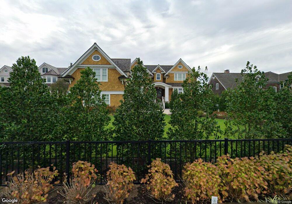
1520 Runyon Ln Mantoloking, NJ 08738
Estimated Value: $4,384,000 - $6,946,000
4
Beds
3
Baths
2,335
Sq Ft
$2,414/Sq Ft
Est. Value
About This Home
This home is located at 1520 Runyon Ln, Mantoloking, NJ 08738 and is currently estimated at $5,637,760, approximately $2,414 per square foot. 1520 Runyon Ln is a home located in Ocean County with nearby schools including G Harold Antrim Elementary School, Point Pleasant Beach High School, and St. Peter School.
Ownership History
Date
Name
Owned For
Owner Type
Purchase Details
Closed on
Jan 9, 2020
Sold by
Pnc Bank National Association
Bought by
Robbins Ronald
Current Estimated Value
Home Financials for this Owner
Home Financials are based on the most recent Mortgage that was taken out on this home.
Original Mortgage
$2,664,800
Outstanding Balance
$2,282,038
Interest Rate
2.12%
Mortgage Type
New Conventional
Estimated Equity
$3,355,722
Purchase Details
Closed on
Apr 26, 2002
Create a Home Valuation Report for This Property
The Home Valuation Report is an in-depth analysis detailing your home's value as well as a comparison with similar homes in the area
Home Values in the Area
Average Home Value in this Area
Purchase History
| Date | Buyer | Sale Price | Title Company |
|---|---|---|---|
| Robbins Ronald | $3,350,000 | Anchor Title Agency Llc | |
| -- | -- | -- |
Source: Public Records
Mortgage History
| Date | Status | Borrower | Loan Amount |
|---|---|---|---|
| Open | Robbins Ronald | $2,664,800 |
Source: Public Records
Tax History Compared to Growth
Tax History
| Year | Tax Paid | Tax Assessment Tax Assessment Total Assessment is a certain percentage of the fair market value that is determined by local assessors to be the total taxable value of land and additions on the property. | Land | Improvement |
|---|---|---|---|---|
| 2025 | $50,654 | $5,903,700 | $2,578,900 | $3,324,800 |
| 2024 | $48,135 | $5,903,700 | $2,578,900 | $3,324,800 |
| 2023 | $41,300 | $5,898,900 | $2,578,900 | $3,320,000 |
| 2022 | $18,052 | $2,578,900 | $2,578,900 | $0 |
| 2021 | $18,155 | $2,578,900 | $2,578,900 | $0 |
| 2020 | $21,727 | $3,051,600 | $2,578,900 | $472,700 |
| 2019 | $18,295 | $2,606,100 | $2,210,100 | $396,000 |
| 2018 | $18,034 | $2,606,100 | $2,210,100 | $396,000 |
| 2017 | $18,165 | $2,606,100 | $2,210,100 | $396,000 |
| 2016 | $18,086 | $2,606,100 | $2,210,100 | $396,000 |
| 2015 | $17,800 | $2,346,100 | $2,210,100 | $136,000 |
| 2014 | $14,710 | $2,346,100 | $2,210,100 | $136,000 |
Source: Public Records
Map
Nearby Homes
- 1519 Runyon Ln
- 122 Squan Beach Dr
- 233 Curtis Point Dr
- 1318 Ocean Ave
- 150 Sunset Ln
- 275 Curtis Point Dr
- 304 Schooner Ln
- 1207 Ocean Ave
- 1201 Ocean Ave
- 1097 Barnegat Ln
- 308 Cove Dr
- 1063 Ocean Ave
- 366 Highway 35 N
- 1027 Ocean Ave
- 438 Highway 35 N Unit 1304
- 12 Shell Rd
- 982 Barnegat Ln
- 21 Scoop Rd
- 25 Scoop Rd
- 47 Nina Ct