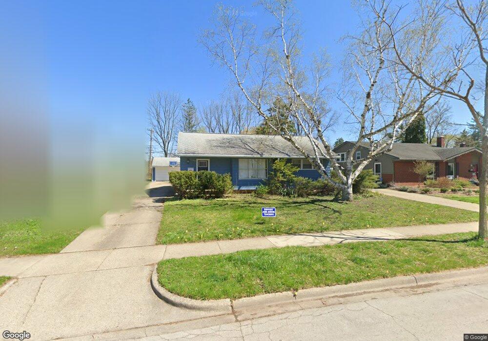
1520 Saunders Crescent Ann Arbor, MI 48103
Garden Homes NeighborhoodEstimated Value: $457,000 - $473,217
3
Beds
2
Baths
1,024
Sq Ft
$454/Sq Ft
Est. Value
About This Home
This home is located at 1520 Saunders Crescent, Ann Arbor, MI 48103 and is currently estimated at $465,304, approximately $454 per square foot. 1520 Saunders Crescent is a home located in Washtenaw County with nearby schools including Wines Elementary School, Forsythe Middle School, and Skyline High School.
Ownership History
Date
Name
Owned For
Owner Type
Purchase Details
Closed on
May 3, 2017
Sold by
Uren Rebecca L and Szezygiel Edward
Bought by
Hall Daniel B and Hall Ana Carro
Current Estimated Value
Home Financials for this Owner
Home Financials are based on the most recent Mortgage that was taken out on this home.
Original Mortgage
$244,150
Outstanding Balance
$202,799
Interest Rate
4.23%
Mortgage Type
New Conventional
Estimated Equity
$262,505
Purchase Details
Closed on
Mar 5, 2015
Sold by
Szczygiel Edward J and Szczygiel Gwen L
Bought by
Szczygiel Edward J and Szczygiel Edward
Create a Home Valuation Report for This Property
The Home Valuation Report is an in-depth analysis detailing your home's value as well as a comparison with similar homes in the area
Home Values in the Area
Average Home Value in this Area
Purchase History
| Date | Buyer | Sale Price | Title Company |
|---|---|---|---|
| Hall Daniel B | $25,700 | None Available | |
| Szczygiel Edward J | -- | None Available |
Source: Public Records
Mortgage History
| Date | Status | Borrower | Loan Amount |
|---|---|---|---|
| Open | Hall Daniel B | $244,150 |
Source: Public Records
Tax History
| Year | Tax Paid | Tax Assessment Tax Assessment Total Assessment is a certain percentage of the fair market value that is determined by local assessors to be the total taxable value of land and additions on the property. | Land | Improvement |
|---|---|---|---|---|
| 2025 | $7,448 | $199,100 | $0 | $0 |
| 2024 | $7,264 | $188,500 | $0 | $0 |
| 2023 | $6,698 | $173,000 | $0 | $0 |
| 2022 | $7,299 | $144,700 | $0 | $0 |
| 2021 | $7,127 | $146,800 | $0 | $0 |
| 2020 | $6,983 | $142,200 | $0 | $0 |
| 2019 | $6,646 | $140,100 | $140,100 | $0 |
| 2018 | $6,552 | $131,300 | $0 | $0 |
| 2017 | $3,921 | $125,300 | $0 | $0 |
| 2016 | $3,782 | $78,399 | $0 | $0 |
| 2015 | $3,602 | $78,165 | $0 | $0 |
| 2014 | $3,602 | $75,724 | $0 | $0 |
| 2013 | -- | $75,724 | $0 | $0 |
Source: Public Records
Map
Nearby Homes
- 1212 Wines Dr
- 1043 Pine Tree Dr
- 1019 Hasper Dr
- 2344 S Circle Dr
- 1322 Miller Ave
- 2374 Newport Rd
- 2108 Newport Rd Unit Parcel 2108
- 2108 Newport Rd
- 2174 Overlook Ct Unit 326
- 2176 Overlook Ct
- 2136 Newport Rd
- 1390 Patricia Ave Unit 17
- 2134 Overlook Ct
- 1106 Paul St
- 665 Vine Ct
- 2219 Dexter Ave
- 645 Allison Dr
- 601 Cressfield Ln
- 630 Archwood Dr
- 1506 Dexter Ave
- 1520 Saunders Crescent Unit CRS
- 1514 Saunders Crescent
- 1524 Saunders Crescent
- 1510 Saunders Crescent
- 1530 Saunders Crescent
- 1656 Hillridge Blvd
- 1534 Saunders Crescent
- 1515 Saunders Crescent
- 1521 Saunders Crescent
- 1500 Saunders Crescent
- 1511 Saunders Crescent
- 1525 Saunders Crescent
- 1600 Saunders Crescent
- 1501 Saunders Crescent
- 1505 Saunders Crescent
- 1531 Saunders Crescent
- 1650 Hillridge Blvd
- 1642 Hillridge Blvd
- 1825 Hillridge Blvd
- 1601 Saunders Crescent
Your Personal Tour Guide
Ask me questions while you tour the home.