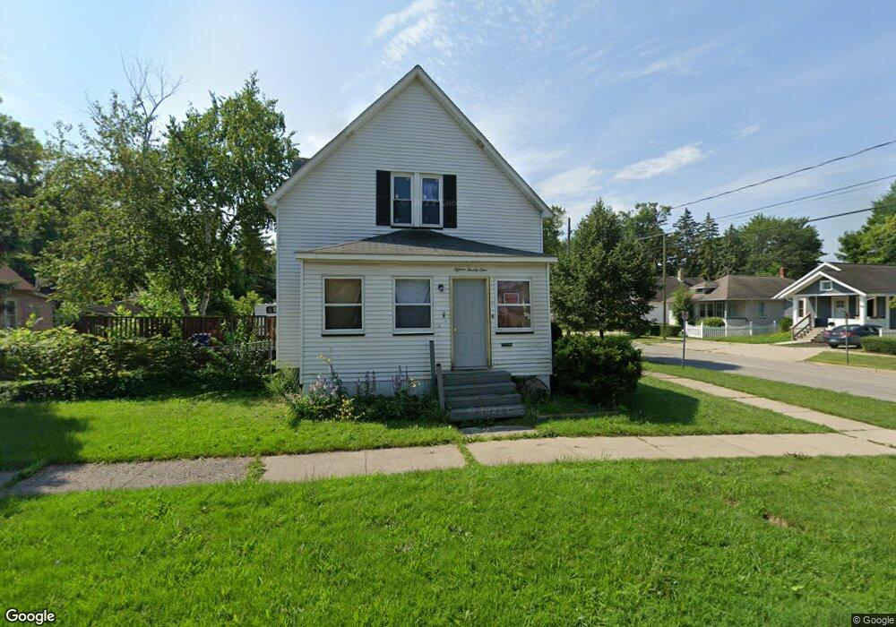
1521 Union Ave Saginaw, MI 48602
Covenant NeighborhoodEstimated Value: $60,229 - $90,000
--
Bed
--
Bath
1,596
Sq Ft
$47/Sq Ft
Est. Value
About This Home
This home is located at 1521 Union Ave, Saginaw, MI 48602 and is currently estimated at $74,807, approximately $46 per square foot. 1521 Union Ave is a home located in Saginaw County with nearby schools including Stone School, Thompson Middle School, and Arthur Hill High School.
Ownership History
Date
Name
Owned For
Owner Type
Purchase Details
Closed on
Mar 21, 2023
Sold by
Leiner Robert R
Bought by
Flores Basilio
Current Estimated Value
Purchase Details
Closed on
Feb 24, 2021
Sold by
Leiner Bonnie Jean
Bought by
Leiner Robert Richard and Chambers Amber Rachelle
Purchase Details
Closed on
Mar 11, 1982
Sold by
Leiner Larry F
Bought by
Leiner Bonnie J
Purchase Details
Closed on
Jul 28, 1980
Sold by
Leiner Larry F and Leiner Bonnie J
Bought by
Leiner Bonnie J
Purchase Details
Closed on
Mar 27, 1980
Sold by
Armbruster John W and Armbruster Diane K
Bought by
Leiner Larry F and Leiner Bonnie J
Create a Home Valuation Report for This Property
The Home Valuation Report is an in-depth analysis detailing your home's value as well as a comparison with similar homes in the area
Home Values in the Area
Average Home Value in this Area
Purchase History
| Date | Buyer | Sale Price | Title Company |
|---|---|---|---|
| Flores Basilio | $1,000 | -- | |
| Leiner Robert Richard | -- | None Available | |
| Leiner Bonnie J | -- | -- | |
| Leiner Bonnie J | -- | -- | |
| Leiner Larry F | -- | -- |
Source: Public Records
Tax History Compared to Growth
Tax History
| Year | Tax Paid | Tax Assessment Tax Assessment Total Assessment is a certain percentage of the fair market value that is determined by local assessors to be the total taxable value of land and additions on the property. | Land | Improvement |
|---|---|---|---|---|
| 2025 | $4,087 | $32,200 | $0 | $0 |
| 2024 | $3,690 | $29,100 | $0 | $0 |
| 2023 | $1,341 | $27,000 | $0 | $0 |
| 2022 | $1,609 | $23,600 | $0 | $0 |
| 2021 | $1,171 | $21,100 | $0 | $0 |
| 2020 | $1,042 | $20,100 | $0 | $0 |
| 2019 | $1,041 | $17,800 | $1,000 | $16,800 |
| 2018 | $807 | $17,514 | $0 | $0 |
| 2017 | $735 | $15,650 | $0 | $0 |
| 2016 | $709 | $15,247 | $0 | $0 |
| 2014 | -- | $16,316 | $0 | $15,238 |
| 2013 | -- | $17,070 | $0 | $0 |
Source: Public Records
Map
Nearby Homes
- 1818 N Woodbridge St
- 1827 Delaware St
- 2004 Delaware St
- 1608 Congress Ave
- 2015 Delaware St
- 1739 N Woodbridge St
- 1616 State St
- 2104 Delaware Blvd
- 1710 State St
- 2105 Mershon St
- 1920 N Clinton St
- 1634 Delaware St
- 2207 Delaware Blvd
- 1833 N Bond St
- 2015 W Genesee Ave
- 1720 N Oakley St
- 2220 Mershon St
- 1721 N Bond St Unit 1723 N Bond
- 1614 Barnard St
- 1603 Cooper Ave
- 1515 Union Ave
- 1831 N Woodbridge St
- 1829 N Woodbridge St
- 1827 N Woodbridge St
- 1512 Union Ave
- 1520 Union Ave
- 1821 N Woodbridge St
- 1903 N Woodbridge St
- 1508 Union Ave
- 1509 Union Ave
- 1814 N Woodbridge St
- 1910 N Woodbridge St
- 1815 N Woodbridge St
- 1505 Union Ave
- 1909 N Woodbridge St
- 1825 N Mason St
- 1821 N Mason St
- 1905 N Mason St
- 1612 Union Ave
- 1914 N Woodbridge St