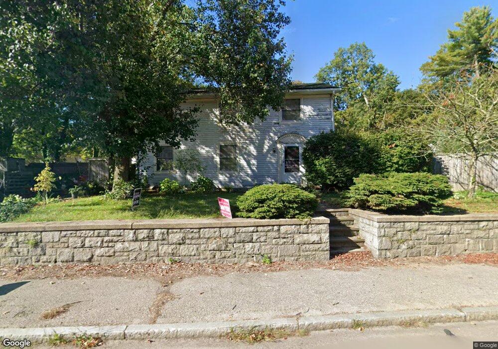
1521 West St Attleboro, MA 02703
Estimated Value: $398,585 - $441,000
2
Beds
1
Bath
1,128
Sq Ft
$372/Sq Ft
Est. Value
About This Home
This home is located at 1521 West St, Attleboro, MA 02703 and is currently estimated at $420,146, approximately $372 per square foot. 1521 West St is a home located in Bristol County with nearby schools including A. Irvin Studley Elementary School, Robert J. Coelho Middle School, and Attleboro High School.
Ownership History
Date
Name
Owned For
Owner Type
Purchase Details
Closed on
May 19, 2008
Sold by
Pipes Jeffrey T
Bought by
Pipes Jeffrey T and Pipes Lisa C
Current Estimated Value
Home Financials for this Owner
Home Financials are based on the most recent Mortgage that was taken out on this home.
Original Mortgage
$202,500
Outstanding Balance
$128,443
Interest Rate
5.91%
Mortgage Type
Purchase Money Mortgage
Estimated Equity
$291,703
Purchase Details
Closed on
Jul 7, 1992
Sold by
Gardner Mildred L
Bought by
Pipes Jeffrey T
Home Financials for this Owner
Home Financials are based on the most recent Mortgage that was taken out on this home.
Original Mortgage
$74,169
Interest Rate
8.49%
Mortgage Type
Purchase Money Mortgage
Create a Home Valuation Report for This Property
The Home Valuation Report is an in-depth analysis detailing your home's value as well as a comparison with similar homes in the area
Home Values in the Area
Average Home Value in this Area
Purchase History
| Date | Buyer | Sale Price | Title Company |
|---|---|---|---|
| Pipes Jeffrey T | -- | -- | |
| Pipes Jeffrey T | $82,000 | -- |
Source: Public Records
Mortgage History
| Date | Status | Borrower | Loan Amount |
|---|---|---|---|
| Open | Pipes Jeffrey T | $202,500 | |
| Previous Owner | Pipes Jeffrey T | $24,600 | |
| Previous Owner | Pipes Jeffrey T | $93,000 | |
| Previous Owner | Pipes Jeffrey T | $74,169 |
Source: Public Records
Tax History Compared to Growth
Tax History
| Year | Tax Paid | Tax Assessment Tax Assessment Total Assessment is a certain percentage of the fair market value that is determined by local assessors to be the total taxable value of land and additions on the property. | Land | Improvement |
|---|---|---|---|---|
| 2025 | $3,927 | $312,900 | $129,600 | $183,300 |
| 2024 | $3,939 | $309,400 | $129,600 | $179,800 |
| 2023 | $3,785 | $276,500 | $117,700 | $158,800 |
| 2022 | $3,676 | $254,400 | $112,200 | $142,200 |
| 2021 | $3,394 | $229,300 | $107,900 | $121,400 |
| 2020 | $3,323 | $228,200 | $104,800 | $123,400 |
| 2019 | $3,100 | $218,900 | $102,800 | $116,100 |
| 2018 | $2,948 | $198,900 | $99,800 | $99,100 |
| 2017 | $2,916 | $200,400 | $99,800 | $100,600 |
| 2016 | $2,665 | $179,800 | $93,200 | $86,600 |
| 2015 | $2,446 | $166,300 | $93,200 | $73,100 |
| 2014 | $2,367 | $159,400 | $88,300 | $71,100 |
Source: Public Records
Map
Nearby Homes
- 338 Newport Ave
- 23 Cumberland Ave
- 0 Middle St
- 135 Cumberland Ave
- 176 Read St
- 543 Newport Ave
- 15 Arline Dr
- 59 Samuel Way
- 11 Howarth Ave
- 64 Highland Ave Unit A
- 64 Highland Ave Unit B
- 27 Killarney Way
- 155 May St
- 130 Zoar Ave
- 39 Slade Ave
- 20 Georgia Rae Way
- 0 Mendon Rd
- 44 Buffington St
- 980 Newport Ave
- 12 Tyson Place
- 1529 West St
- 334 Newport Ave
- 338 Newport Ave Unit 3
- 338 Newport Ave Unit 2
- 338 Newport Ave Unit 1
- 1526 West St
- 330 Newport Ave
- 352 Newport Ave
- 1501 West St
- 1536 West St
- 3 Read St
- 6 Earle Ave
- 1544 West St
- 320 Newport Ave
- 325 Newport Ave
- 1550 West St
- 1481 West St
- 21 Earle Ave
- 329 Newport Ave
- 24 Earle Ave