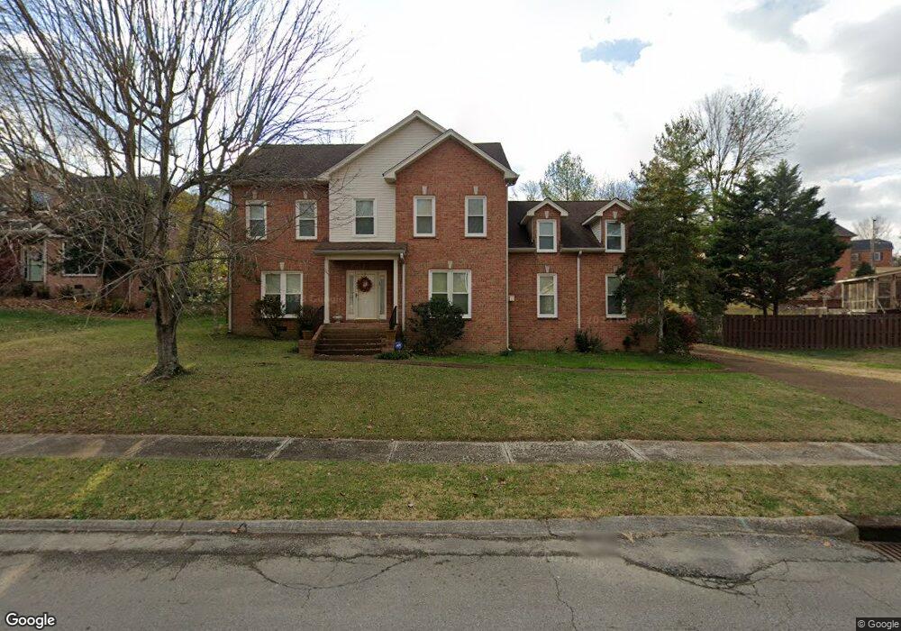
1522 Brookstone Cir Mount Juliet, TN 37122
Estimated Value: $560,477 - $661,000
--
Bed
3
Baths
3,184
Sq Ft
$191/Sq Ft
Est. Value
About This Home
This home is located at 1522 Brookstone Cir, Mount Juliet, TN 37122 and is currently estimated at $607,369, approximately $190 per square foot. 1522 Brookstone Cir is a home located in Wilson County with nearby schools including Mt. Juliet Elementary School, Mt. Juliet Middle School, and Green Hill High School.
Ownership History
Date
Name
Owned For
Owner Type
Purchase Details
Closed on
Sep 7, 2000
Sold by
Stinson Steven W
Bought by
Hunter Derek W
Current Estimated Value
Purchase Details
Closed on
Jun 10, 2000
Bought by
Hunter Derek W and Hunter Angela R
Purchase Details
Closed on
Aug 5, 1997
Sold by
Leighton Bush
Bought by
Steven Stinson
Home Financials for this Owner
Home Financials are based on the most recent Mortgage that was taken out on this home.
Original Mortgage
$55,000
Interest Rate
7.65%
Purchase Details
Closed on
Aug 1, 1997
Sold by
Leighton Bush
Bought by
Stinson Steven W
Home Financials for this Owner
Home Financials are based on the most recent Mortgage that was taken out on this home.
Original Mortgage
$55,000
Interest Rate
7.65%
Purchase Details
Closed on
Apr 8, 1997
Sold by
Polston Michael T
Bought by
Leighton Bush
Purchase Details
Closed on
Jan 10, 1992
Create a Home Valuation Report for This Property
The Home Valuation Report is an in-depth analysis detailing your home's value as well as a comparison with similar homes in the area
Home Values in the Area
Average Home Value in this Area
Purchase History
| Date | Buyer | Sale Price | Title Company |
|---|---|---|---|
| Hunter Derek W | $245,000 | -- | |
| Hunter Derek W | $245,000 | -- | |
| Steven Stinson | $199,000 | -- | |
| Stinson Steven W | $199,000 | -- | |
| Leighton Bush | $30,900 | -- | |
| -- | -- | -- |
Source: Public Records
Mortgage History
| Date | Status | Borrower | Loan Amount |
|---|---|---|---|
| Previous Owner | Not Available | $55,000 |
Source: Public Records
Tax History Compared to Growth
Tax History
| Year | Tax Paid | Tax Assessment Tax Assessment Total Assessment is a certain percentage of the fair market value that is determined by local assessors to be the total taxable value of land and additions on the property. | Land | Improvement |
|---|---|---|---|---|
| 2024 | $1,907 | $99,925 | $21,250 | $78,675 |
| 2022 | $1,907 | $99,925 | $21,250 | $78,675 |
| 2021 | $2,017 | $99,925 | $21,250 | $78,675 |
| 2020 | $1,962 | $99,925 | $21,250 | $78,675 |
| 2019 | $242 | $73,050 | $18,750 | $54,300 |
| 2018 | $1,954 | $72,750 | $18,750 | $54,000 |
| 2017 | $1,954 | $72,750 | $18,750 | $54,000 |
| 2016 | $1,954 | $72,750 | $18,750 | $54,000 |
| 2015 | $2,015 | $72,750 | $18,750 | $54,000 |
| 2014 | $1,711 | $61,749 | $0 | $0 |
Source: Public Records
Map
Nearby Homes
- 1520 Brookstone Cir
- 1013 Brookstone Blvd
- 288 Page Dr
- 493 Page Dr
- 271 Page Dr
- 1120 Brookstone Blvd
- 1105 Camden Cir
- 506 Page Dr
- 2202 Dinah Ct
- 222 Jackson Trail
- 3107 Oxford Dr
- 212 Jackson Trail
- 3890 W Division St
- 2001 Lynnhaven Ct
- 604 Georgian Way
- 1229 Mount Vernon Ln
- 4014 Ethan Ave
- 1733 Hartford Ln
- 144 W Division St
- 2006 Lynnhaven Ct
- 21 Brookview Cir Unit 21
- 21 Brookview Circle #21
- 1524 Brookstone Cir
- 1708 Walden Ct
- 1526 Brookstone Cir
- 1706 Walden Ct
- 1705 Walden Ct
- 1521 Brookstone Cir
- 394 Page Dr
- 396 Page Dr
- 1523 Brookstone Cir
- 1519 Brookstone Cir
- 1514 Brookstone Cir
- 392 Page Dr
- 1704 Walden Ct
- 1517 Brookstone Cir
- 1702 Walden Ct
- 1528 Brookstone Cir
- 398 Page Dr
- 1530 Brookstone Cir