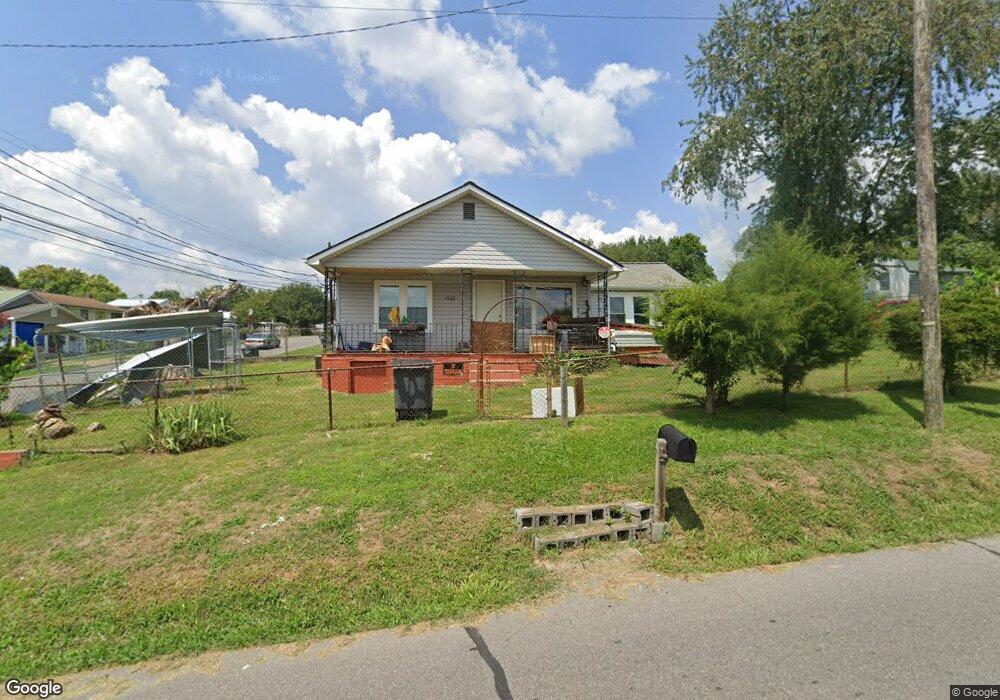
1522 Clinton St Kingsport, TN 37660
Estimated Value: $94,000 - $127,000
3
Beds
1
Bath
800
Sq Ft
$133/Sq Ft
Est. Value
About This Home
This home is located at 1522 Clinton St, Kingsport, TN 37660 and is currently estimated at $106,606, approximately $133 per square foot. 1522 Clinton St is a home located in Sullivan County with nearby schools including Theodore Roosevelt Elementary School, John Sevier Middle School, and Ross N. Robinson Middle School.
Ownership History
Date
Name
Owned For
Owner Type
Purchase Details
Closed on
Sep 5, 2025
Sold by
Mata Leon Benjamin and Lopez Sandra L
Bought by
Mata Leon Benjamin and Lopez Rodriguez Sandra
Current Estimated Value
Purchase Details
Closed on
Jul 11, 2016
Sold by
Walker Jimmy H
Bought by
Leon Benjamin Mata and Lopez Sandra L
Purchase Details
Closed on
Mar 31, 2011
Sold by
Alexander Gary
Bought by
Walker Jimmy H and Walker Norma E
Purchase Details
Closed on
May 8, 1997
Sold by
Jean Arnold Bobbie
Bought by
Gary Alexander
Purchase Details
Closed on
Aug 2, 1994
Sold by
Hobbs Peters Lola
Bought by
Jean Arnold Bobby
Purchase Details
Closed on
Jul 28, 1994
Create a Home Valuation Report for This Property
The Home Valuation Report is an in-depth analysis detailing your home's value as well as a comparison with similar homes in the area
Home Values in the Area
Average Home Value in this Area
Purchase History
| Date | Buyer | Sale Price | Title Company |
|---|---|---|---|
| Mata Leon Benjamin | -- | Patriot Title | |
| Leon Benjamin Mata | $31,000 | -- | |
| Walker Jimmy H | $31,500 | -- | |
| Gary Alexander | $40,000 | -- | |
| Jean Arnold Bobby | -- | -- | |
| -- | $32,000 | -- |
Source: Public Records
Tax History Compared to Growth
Tax History
| Year | Tax Paid | Tax Assessment Tax Assessment Total Assessment is a certain percentage of the fair market value that is determined by local assessors to be the total taxable value of land and additions on the property. | Land | Improvement |
|---|---|---|---|---|
| 2024 | -- | $9,675 | $1,350 | $8,325 |
| 2023 | $426 | $9,675 | $1,350 | $8,325 |
| 2022 | $426 | $9,675 | $1,350 | $8,325 |
| 2021 | $415 | $9,675 | $1,350 | $8,325 |
| 2020 | $228 | $9,675 | $1,350 | $8,325 |
| 2019 | $411 | $8,875 | $1,350 | $7,525 |
| 2018 | $401 | $8,875 | $1,350 | $7,525 |
| 2017 | $401 | $8,875 | $1,350 | $7,525 |
| 2016 | $375 | $8,075 | $1,350 | $6,725 |
| 2014 | -- | $8,070 | $0 | $0 |
Source: Public Records
Map
Nearby Homes
- 830 Fairview Ave
- 1133 Tay Station
- 1109 Tay Station
- 1320 Mimosa Dr
- 1104 Tay Station
- 1413 Gress Mag Mountain
- 1237 Stamp Lodge Rd
- 1245 Stamp Lodge Rd
- 1249 Stamp Lodge Rd
- 0 Stonegate Rd
- 917 Walnut Ave
- 722 Fairview Ave
- 702 Riverside Ave
- 1461 Gress Mag Mountain
- 626 Riverside Ave
- 601 Fairview Ave
- 1620 Lake St
- 605 Robin Ln
- 1118 Hampton Ave
- 529 Walnut Ave
- 907 Riverside Ave
- 825 Riverside Ave
- 823 Riverside Ave
- 913 Riverside Ave
- 900 Fairview Ave
- 910 Fairview Ave
- 910 Fairview Ave Unit 1
- 821 Riverside Ave
- 914 Fairview Ave
- 917 Riverside Ave
- 906 Riverside Ave
- 910 Riverside Ave
- 826 Fairview Ave
- 918 Fairview Ave
- 704 Theobald Way
- 712 Theobald Way
- 918 Riverside Ave
- 817 Riverside Ave
- 921 Riverside Ave
- 705 Theobald Way