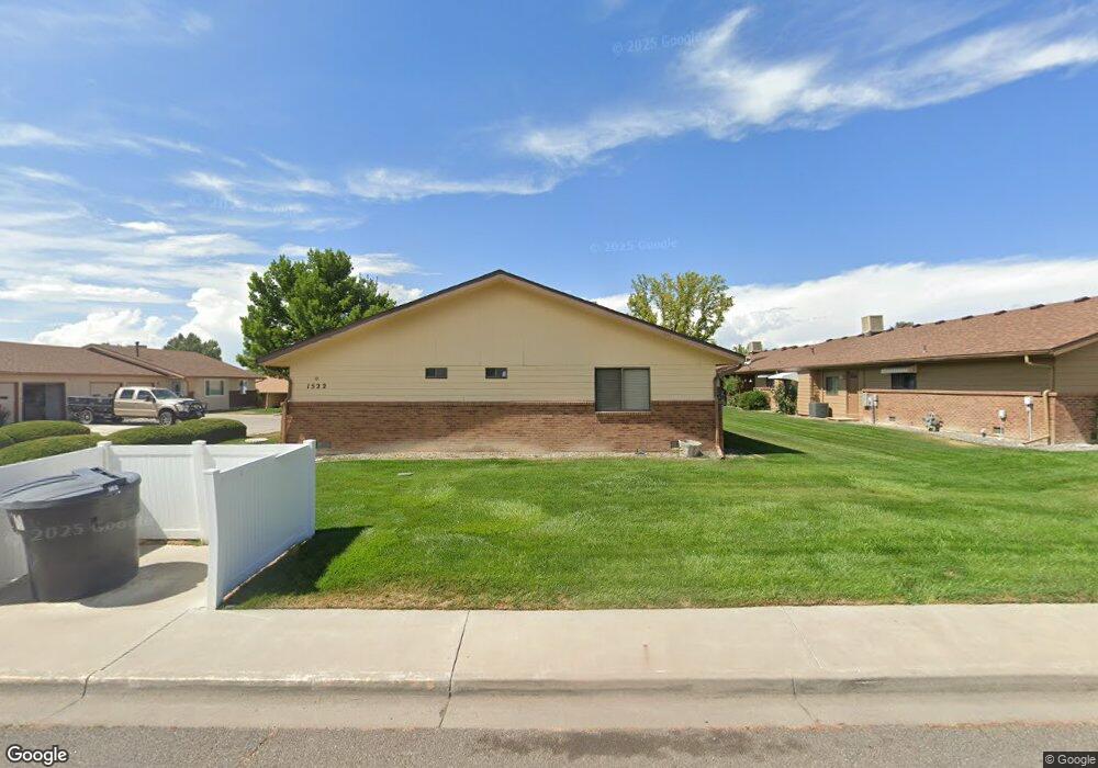
1522 Kent Ave Unit A Montrose, CO 81401
Estimated Value: $313,607 - $330,000
2
Beds
2
Baths
1,233
Sq Ft
$259/Sq Ft
Est. Value
About This Home
This home is located at 1522 Kent Ave Unit A, Montrose, CO 81401 and is currently estimated at $319,152, approximately $258 per square foot. 1522 Kent Ave Unit A is a home located in Montrose County with nearby schools including Pomona Elementary School, Columbine Middle School, and Montrose High School.
Ownership History
Date
Name
Owned For
Owner Type
Purchase Details
Closed on
Apr 26, 2013
Sold by
Peck Sylvia N
Bought by
Burnet Dean
Current Estimated Value
Purchase Details
Closed on
Apr 24, 2013
Sold by
Peck Walter Fredrick
Bought by
Peck Sylvia N
Purchase Details
Closed on
Jul 11, 2000
Sold by
Peck W Fred
Bought by
Peck Sylvia N
Purchase Details
Closed on
Oct 15, 1991
Sold by
Phillips Construction Co Inc
Bought by
Peck W Fred W and Peck Sylvia N
Create a Home Valuation Report for This Property
The Home Valuation Report is an in-depth analysis detailing your home's value as well as a comparison with similar homes in the area
Home Values in the Area
Average Home Value in this Area
Purchase History
| Date | Buyer | Sale Price | Title Company |
|---|---|---|---|
| Burnet Dean | $122,000 | Land Title | |
| Peck Sylvia N | -- | Land Title | |
| Peck Sylvia N | -- | Land Title | |
| Peck Sylvia N | -- | -- | |
| Peck W Fred W | $63,500 | -- |
Source: Public Records
Tax History Compared to Growth
Tax History
| Year | Tax Paid | Tax Assessment Tax Assessment Total Assessment is a certain percentage of the fair market value that is determined by local assessors to be the total taxable value of land and additions on the property. | Land | Improvement |
|---|---|---|---|---|
| 2024 | $1,190 | $16,510 | $2,740 | $13,770 |
| 2023 | $1,190 | $20,950 | $3,480 | $17,470 |
| 2022 | $933 | $13,370 | $2,430 | $10,940 |
| 2021 | $961 | $13,750 | $2,500 | $11,250 |
| 2020 | $829 | $12,200 | $2,070 | $10,130 |
| 2019 | $835 | $12,200 | $2,070 | $10,130 |
| 2018 | $672 | $9,570 | $1,670 | $7,900 |
| 2017 | $667 | $9,570 | $1,670 | $7,900 |
| 2016 | $671 | $9,790 | $1,610 | $8,180 |
| 2015 | $659 | $9,790 | $1,610 | $8,180 |
| 2014 | $555 | $8,810 | $1,400 | $7,410 |
Source: Public Records
Map
Nearby Homes
- 1510 Kent Ave Unit A
- 1510 Kent Ave
- 2135 Winston Way Unit B
- 2055 Princeton Way Unit A
- 2125 Hartford Way Unit A
- 2136 Stratford Dr Unit A
- 2036 Scarborough Way Unit J
- 2038 Winston Way Unit A
- 1323 Manchester Dr
- 2210 Devon St
- 2409 Pecan St
- 2130 Devon St
- 1239 Leeds Ave
- 1119 Phillips Ct Unit G
- 1119 Phillips Ct
- 1119 Phillips Ct Unit A
- 1219 Peppertree Dr
- 1205 Dover Rd
- 1413 Chatam Dr
- 2319 Stone Bridge Dr
- 1510 Kent Ave Unit C
- 1510 Kent Ave Unit B
- 1528 Kent Ave Unit B
- 1528 Kent Ave Unit A
- 1528 Kent Ave Unit B
- 2146 Hartford Way
- 2135 Winston Way Unit A
- 1444 Kent Ave Unit C
- 1444 Kent Ave Unit B
- 1444 Kent Ave Unit A
- 1523 Kent Ave
- 1531 Kent Ave
- 2130 Hartford Way Unit B
- 2130 Hartford Way Unit A
- 2130 Hartford Way
- 1515 Kent Ave
- 1539 Kent Ave
- 2256 Bradford Dr Unit B
- 2256 Bradford Dr Unit A
- 2256 Bradford Dr