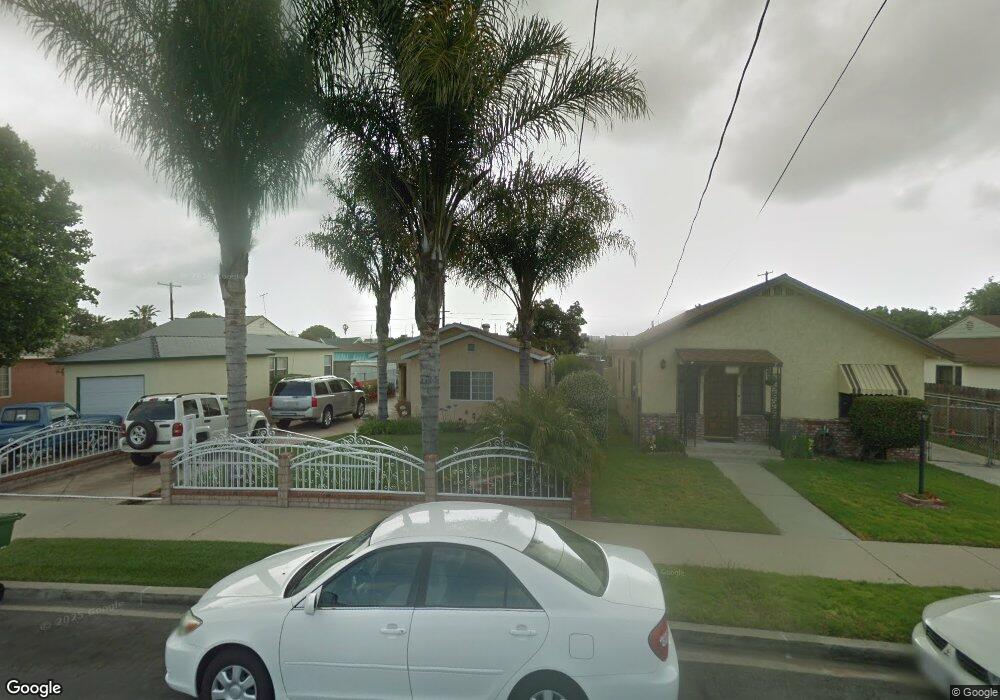
1522 N Banning Blvd Wilmington, CA 90744
Estimated Value: $661,000 - $710,000
3
Beds
2
Baths
1,144
Sq Ft
$596/Sq Ft
Est. Value
About This Home
This home is located at 1522 N Banning Blvd, Wilmington, CA 90744 and is currently estimated at $681,665, approximately $595 per square foot. 1522 N Banning Blvd is a home located in Los Angeles County with nearby schools including Broad Avenue Elementary School, Wilmington Middle School STEAM Magnet, and Phineas Banning Senior High School.
Ownership History
Date
Name
Owned For
Owner Type
Purchase Details
Closed on
Oct 1, 2023
Sold by
Ruvalcaba Hilario and Ruvalcaba Maria
Bought by
Ruvalcaba Revocable Living Trust and Ruvalcaba
Current Estimated Value
Purchase Details
Closed on
Apr 3, 2017
Sold by
Tegel
Bought by
Tegel
Home Financials for this Owner
Home Financials are based on the most recent Mortgage that was taken out on this home.
Interest Rate
4.14%
Purchase Details
Closed on
Apr 19, 1999
Sold by
Butler Kenneth P and Butler Louise D
Bought by
Butler Kenneth P
Create a Home Valuation Report for This Property
The Home Valuation Report is an in-depth analysis detailing your home's value as well as a comparison with similar homes in the area
Home Values in the Area
Average Home Value in this Area
Purchase History
| Date | Buyer | Sale Price | Title Company |
|---|---|---|---|
| Ruvalcaba Revocable Living Trust | -- | Accommodation/Courtesy Recordi | |
| Tegel | -- | -- | |
| Butler Kenneth P | -- | -- |
Source: Public Records
Mortgage History
| Date | Status | Borrower | Loan Amount |
|---|---|---|---|
| Previous Owner | Tegel | -- |
Source: Public Records
Tax History Compared to Growth
Tax History
| Year | Tax Paid | Tax Assessment Tax Assessment Total Assessment is a certain percentage of the fair market value that is determined by local assessors to be the total taxable value of land and additions on the property. | Land | Improvement |
|---|---|---|---|---|
| 2025 | $2,069 | $160,083 | $93,001 | $67,082 |
| 2024 | $2,069 | $156,945 | $91,178 | $65,767 |
| 2023 | $2,032 | $153,869 | $89,391 | $64,478 |
| 2022 | $1,941 | $150,853 | $87,639 | $63,214 |
| 2021 | $1,912 | $147,896 | $85,921 | $61,975 |
| 2019 | $1,856 | $143,511 | $83,373 | $60,138 |
| 2018 | $1,797 | $140,698 | $81,739 | $58,959 |
| 2016 | $1,705 | $135,236 | $78,566 | $56,670 |
| 2015 | $1,681 | $133,205 | $77,386 | $55,819 |
| 2014 | $1,694 | $130,597 | $75,871 | $54,726 |
Source: Public Records
Map
Nearby Homes
- 1526 Lakme Ave
- 1630 Lakme Ave
- 1610 Broad Ave
- 1627 Broad Ave
- 1353 Lakme Ave
- 1610 N Fries Ave
- 914 E O St
- 1304 N Fries Ave
- 1603 Lagoon Ave
- 1405 Lagoon Ave
- 1607 Ravenna Ave
- 1337 Lagoon Ave
- 890 Oceanside St
- 1119 E Colon St
- 1329 Watson Ave
- 1119 E M St
- 810 Oceanside St
- 1611 Bay View Ave
- 1046 N Banning Blvd
- 1319 E Colon St
- 1526 N Banning Blvd
- 1518 N Banning Blvd
- 1530 N Banning Blvd
- 1514 N Banning Blvd
- 1523 Baypoint Ave
- 1534 N Banning Blvd
- 1529 Baypoint Ave
- 1510 N Banning Blvd
- 1519 Baypoint Ave
- 1535 Baypoint Ave
- 1513 Baypoint Ave
- 1538 N Banning Blvd
- 1506 N Banning Blvd
- 1541 Baypoint Ave
- 1523 N Banning Blvd
- 1509 Baypoint Ave
- 1527 N Banning Blvd
- 1519 N Banning Blvd
- 1542 N Banning Blvd
- 1531 N Banning Blvd