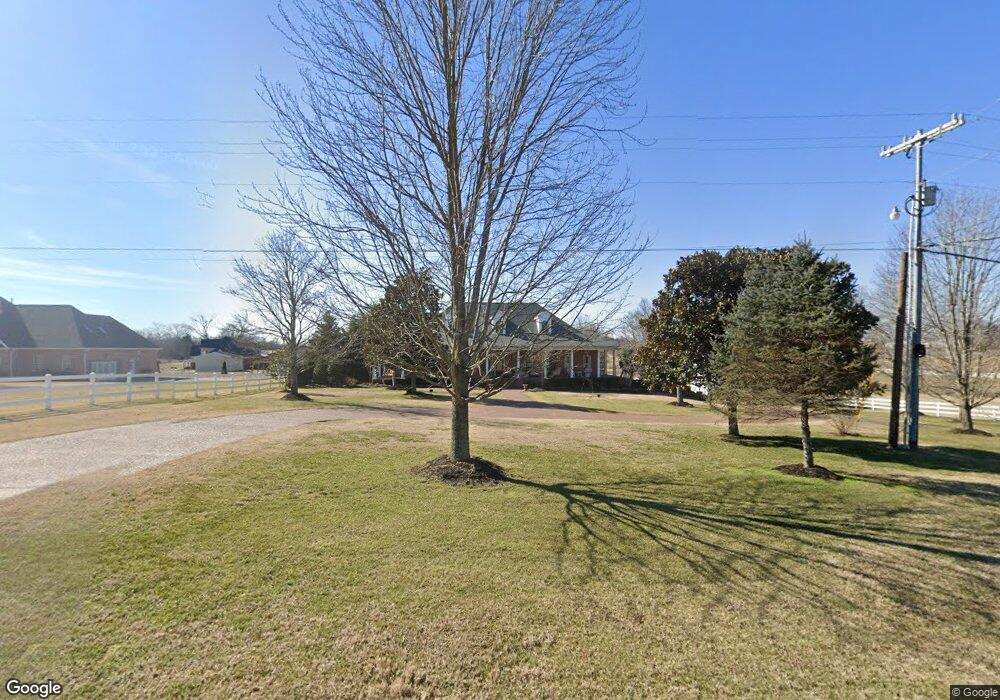
1523 Highway 25 Gallatin, TN 37066
Estimated Value: $775,000 - $1,360,000
--
Bed
4
Baths
4,444
Sq Ft
$227/Sq Ft
Est. Value
About This Home
This home is located at 1523 Highway 25, Gallatin, TN 37066 and is currently estimated at $1,009,921, approximately $227 per square foot. 1523 Highway 25 is a home located in Sumner County with nearby schools including Howard Elementary School, Rucker Stewart Middle School, and Station Camp High School.
Ownership History
Date
Name
Owned For
Owner Type
Purchase Details
Closed on
Oct 11, 2018
Sold by
Hagemeyer George D and Hagemeyer Nancy B
Bought by
Hagemeyer George D and Hagemeyer Nancy B
Current Estimated Value
Purchase Details
Closed on
Feb 15, 2000
Sold by
Gregory Thomas M and Gregory Florene
Bought by
Smith Roy A and Smith Patricia L
Purchase Details
Closed on
May 14, 1998
Sold by
Dixon Caster D and Dixon Earline C
Bought by
Gregory Thomas M and Gregory Florene
Create a Home Valuation Report for This Property
The Home Valuation Report is an in-depth analysis detailing your home's value as well as a comparison with similar homes in the area
Home Values in the Area
Average Home Value in this Area
Purchase History
| Date | Buyer | Sale Price | Title Company |
|---|---|---|---|
| Hagemeyer George D | -- | Midtown Title Llc | |
| Smith Roy A | $11,389 | -- | |
| Gregory Thomas M | $41,073 | -- | |
| Smith Roy A | $80,154 | -- |
Source: Public Records
Tax History Compared to Growth
Tax History
| Year | Tax Paid | Tax Assessment Tax Assessment Total Assessment is a certain percentage of the fair market value that is determined by local assessors to be the total taxable value of land and additions on the property. | Land | Improvement |
|---|---|---|---|---|
| 2024 | $3,244 | $228,275 | $11,825 | $216,450 |
| 2023 | $2,731 | $121,250 | $15,025 | $106,225 |
| 2022 | $2,743 | $121,250 | $15,025 | $106,225 |
| 2021 | $2,743 | $121,250 | $15,025 | $106,225 |
| 2020 | $2,743 | $121,250 | $15,025 | $106,225 |
| 2019 | $2,743 | $0 | $0 | $0 |
| 2018 | $3,106 | $0 | $0 | $0 |
| 2017 | $3,106 | $0 | $0 | $0 |
| 2016 | $0 | $0 | $0 | $0 |
| 2015 | -- | $0 | $0 | $0 |
| 2014 | -- | $0 | $0 | $0 |
Source: Public Records
Map
Nearby Homes
- 1176 Liberty Ln
- 1017 Wickshire Dr
- 1036 Middleton Ln
- 650 Neals Ln
- 608 Bradford Dr
- 540 Bradford Dr
- 662 Neals Ln
- 1328 Wentworth Dr
- 1869 Tennessee 25
- 688 Douglas Ln
- 1273 Wentworth Dr
- 420 Dorchester Place
- 415 Buckingham Blvd
- 308 Collier Ln
- 300 Remington Ave
- 305 Remington Ave
- 1239 Wentworth Dr
- 376 Huntington Dr
- 2045 Liberty Ln
- 315 Cummings Ln
- 1507 Highway 25
- 1507 Highway 25
- 1507 25w Hwy
- 1516 Highway 25
- 1004 Liberty Ln
- 1002 Liberty Ln
- 1003 Liberty Ln
- 1421 Highway 25
- 0 Liberty Ln Unit 1945847
- 0 Liberty Ln Unit 1904394
- 0 Liberty Ln Unit 1904391
- 0 Liberty Ln Unit 1886938
- 0 Liberty Ln Unit RTC1331254
- 0 Liberty Ln Unit RTC2497767
- 0 Liberty Ln Unit 2159642
- 0 Liberty Ln Unit 2010363
- 130 Rollins Ln
- 1719 25w Hwy
- 141 Village Green Rd
- 1716 25w Hwy