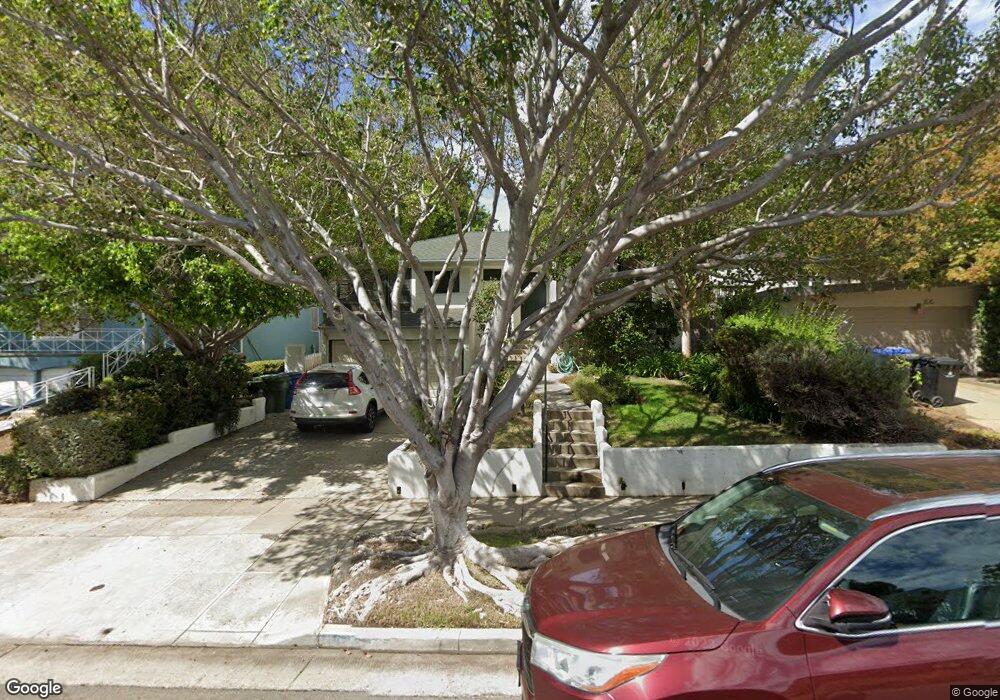
1523 Malcolm Ave Los Angeles, CA 90024
Westwood NeighborhoodEstimated Value: $2,258,000 - $2,320,274
3
Beds
3
Baths
2,085
Sq Ft
$1,093/Sq Ft
Est. Value
About This Home
This home is located at 1523 Malcolm Ave, Los Angeles, CA 90024 and is currently estimated at $2,279,819, approximately $1,093 per square foot. 1523 Malcolm Ave is a home located in Los Angeles County with nearby schools including Fairburn Avenue Elementary School, Westwood Charter School, and Ralph Waldo Emerson Community Charter Middle School.
Ownership History
Date
Name
Owned For
Owner Type
Purchase Details
Closed on
Jan 18, 2013
Sold by
Purcell Arthur H and Purcell Deborah R
Bought by
The Arthur H Purcell & Deborah R Purcel
Current Estimated Value
Home Financials for this Owner
Home Financials are based on the most recent Mortgage that was taken out on this home.
Original Mortgage
$205,000
Interest Rate
3.28%
Mortgage Type
New Conventional
Purchase Details
Closed on
Jan 7, 2013
Sold by
The Arthur H Purcell & Deborah R Purcell
Bought by
Purcell Arthur H and Purcell Deborah R
Home Financials for this Owner
Home Financials are based on the most recent Mortgage that was taken out on this home.
Original Mortgage
$205,000
Interest Rate
3.28%
Mortgage Type
New Conventional
Purchase Details
Closed on
Aug 30, 2006
Sold by
Purcell Arthur H and Purcell Deborah R
Bought by
Purcell Arthur H
Create a Home Valuation Report for This Property
The Home Valuation Report is an in-depth analysis detailing your home's value as well as a comparison with similar homes in the area
Home Values in the Area
Average Home Value in this Area
Purchase History
| Date | Buyer | Sale Price | Title Company |
|---|---|---|---|
| The Arthur H Purcell & Deborah R Purcel | -- | First American Title Company | |
| Purcell Arthur H | -- | First American Title Company | |
| Purcell Arthur H | -- | None Available |
Source: Public Records
Mortgage History
| Date | Status | Borrower | Loan Amount |
|---|---|---|---|
| Closed | Purcell Arthur H | $205,000 |
Source: Public Records
Tax History
| Year | Tax Paid | Tax Assessment Tax Assessment Total Assessment is a certain percentage of the fair market value that is determined by local assessors to be the total taxable value of land and additions on the property. | Land | Improvement |
|---|---|---|---|---|
| 2025 | $11,879 | $989,402 | $748,011 | $241,391 |
| 2024 | $11,879 | $970,003 | $733,345 | $236,658 |
| 2023 | $11,652 | $950,984 | $718,966 | $232,018 |
| 2022 | $11,113 | $932,338 | $704,869 | $227,469 |
| 2021 | $10,969 | $914,058 | $691,049 | $223,009 |
| 2019 | $10,640 | $886,949 | $670,553 | $216,396 |
| 2018 | $10,577 | $869,558 | $657,405 | $212,153 |
| 2016 | $10,108 | $835,794 | $631,878 | $203,916 |
| 2015 | $9,959 | $823,240 | $622,387 | $200,853 |
| 2014 | $9,994 | $807,115 | $610,196 | $196,919 |
Source: Public Records
Map
Nearby Homes
- 1645 Malcolm Ave Unit 302
- 10745 Ohio Ave
- 1545 Kelton Ave
- 10725 Ohio Ave Unit 2
- 10725 Ohio Ave Unit 301
- 1440 Veteran Ave Unit 601
- 1440 Veteran Ave Unit 236
- 1440 Veteran Ave Unit 220
- 1440 Veteran Ave Unit 204
- 1440 Veteran Ave Unit 531
- 1440 Veteran Ave Unit 544
- 1740 Malcolm Ave Unit 204
- 1621 Manning Ave
- 1748 Malcolm Ave
- 1754 Malcolm Ave
- 10707 Rochester Ave
- 1375 Kelton Ave Unit 206
- 1300 Midvale Ave Unit 408
- 10655 Kinnard Ave Unit 304
- 1361 Kelton Ave Unit 502
- 1515 Malcolm Ave
- 1527 Malcolm Ave
- 1511 Malcolm Ave
- 1531 Malcolm Ave
- 1520 Glendon Ave
- 1516 Glendon Ave
- 1507 Malcolm Ave
- 1526 Glendon Ave
- 1526 Glendon Ave
- 1539 Malcolm Ave
- 1532 Glendon Ave
- 1501 Malcolm Ave
- 1522 Malcolm Ave
- 1516 Malcolm Ave
- 1508 Glendon Ave
- 1526 Malcolm Ave
- 1510 Malcolm Ave
- 1536 Glendon Ave
- 1543 Malcolm Ave
- 1532 Malcolm Ave
Your Personal Tour Guide
Ask me questions while you tour the home.