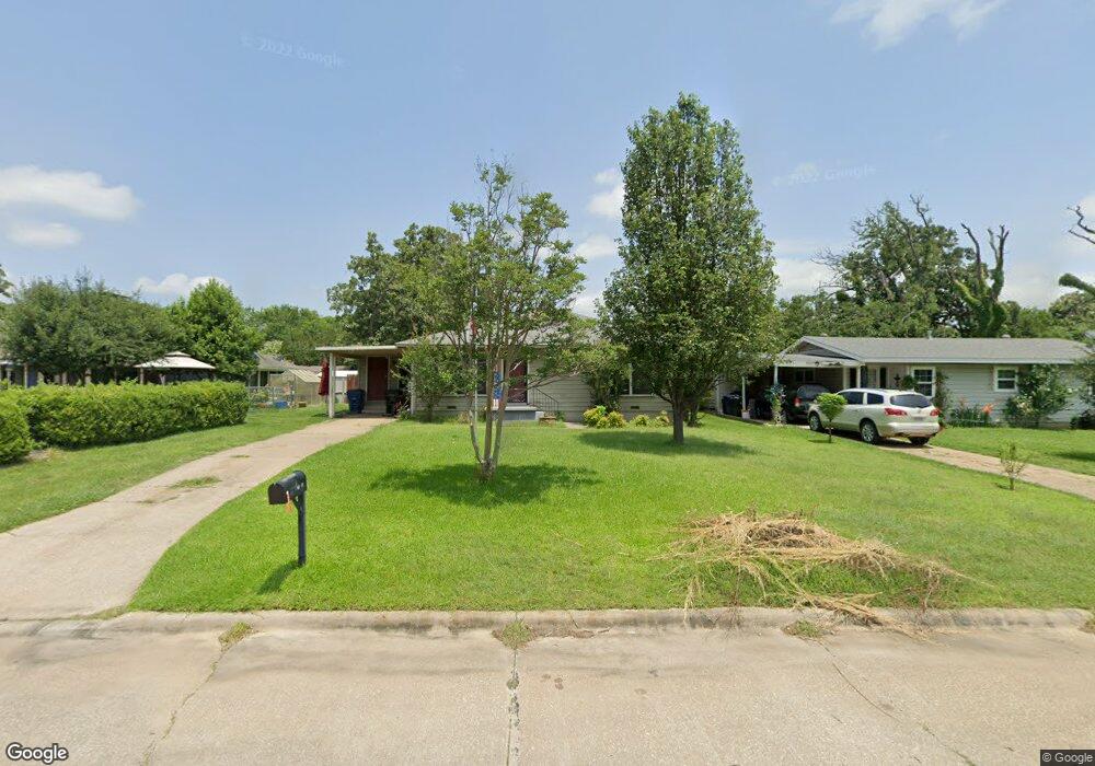
1523 W Munson St Denison, TX 75020
Estimated Value: $173,854 - $214,000
--
Bed
--
Bath
1,470
Sq Ft
$132/Sq Ft
Est. Value
About This Home
This home is located at 1523 W Munson St, Denison, TX 75020 and is currently estimated at $193,927, approximately $131 per square foot. 1523 W Munson St is a home located in Grayson County with nearby schools including Houston Elementary School, Scott Middle School, and Denison High School.
Ownership History
Date
Name
Owned For
Owner Type
Purchase Details
Closed on
May 28, 2013
Sold by
Bush Kevin W and Bush Jessica L
Bought by
Miller Shelbie L and Miller Darlene
Current Estimated Value
Home Financials for this Owner
Home Financials are based on the most recent Mortgage that was taken out on this home.
Original Mortgage
$70,695
Outstanding Balance
$50,154
Interest Rate
3.43%
Mortgage Type
FHA
Estimated Equity
$143,773
Purchase Details
Closed on
Nov 3, 2006
Sold by
Gundlach Carl L and Gundlach Melinda S
Bought by
Bush Kevin W and Bush Jessica L
Home Financials for this Owner
Home Financials are based on the most recent Mortgage that was taken out on this home.
Original Mortgage
$54,000
Interest Rate
6.37%
Mortgage Type
Purchase Money Mortgage
Create a Home Valuation Report for This Property
The Home Valuation Report is an in-depth analysis detailing your home's value as well as a comparison with similar homes in the area
Home Values in the Area
Average Home Value in this Area
Purchase History
| Date | Buyer | Sale Price | Title Company |
|---|---|---|---|
| Miller Shelbie L | -- | None Available | |
| Bush Kevin W | -- | Chapin Title Co Inc |
Source: Public Records
Mortgage History
| Date | Status | Borrower | Loan Amount |
|---|---|---|---|
| Open | Miller Shelbie L | $70,695 | |
| Previous Owner | Bush Kevin W | $54,000 |
Source: Public Records
Tax History Compared to Growth
Tax History
| Year | Tax Paid | Tax Assessment Tax Assessment Total Assessment is a certain percentage of the fair market value that is determined by local assessors to be the total taxable value of land and additions on the property. | Land | Improvement |
|---|---|---|---|---|
| 2025 | $1,089 | $152,722 | $42,036 | $110,686 |
| 2024 | $3,398 | $146,265 | $0 | $0 |
| 2023 | $1,044 | $132,968 | $0 | $0 |
| 2022 | $2,872 | $120,880 | $0 | $0 |
| 2021 | $2,772 | $109,891 | $18,600 | $91,291 |
| 2020 | $3,028 | $114,812 | $18,600 | $96,212 |
| 2019 | $3,147 | $114,361 | $18,600 | $95,761 |
| 2018 | $2,844 | $102,517 | $15,066 | $87,451 |
| 2017 | $2,591 | $92,609 | $11,904 | $80,705 |
| 2016 | $2,092 | $74,795 | $11,810 | $62,985 |
| 2015 | $2,109 | $74,665 | $11,810 | $62,855 |
| 2014 | $1,871 | $66,244 | $11,810 | $54,434 |
Source: Public Records
Map
Nearby Homes
- 1508 W Shepherd St
- 1315 W Hull St
- 900 Old State Ln
- 1730 W Hull St
- 1104 S French Ave
- 901 Old State Ln
- 1224 W Nelson St
- 501 S Eddy Ave
- 1217 W Nelson St
- 1319 W Morgan St
- 1131 W Shepherd St
- 1510 W Heron St
- 1326 W Crawford St
- 1127 W Morgan St
- 1223 W Owing St
- 612 Ambassador St
- 1120 W Owing St
- 12 Ambassador Ct
- 1109 S Chandler Ave
- 600 Ambassador St
- 1519 W Munson St
- 820 S Fairbanks Ave
- 1517 W Munson St
- 1528 W Day St
- 1526 W Day St
- 800 S Fairbanks Ave
- 1512 W Day St
- 1501 W Munson St
- 1514 W Munson St
- 1504 W Day St
- 900 S Fairbanks Ave
- 1510 W Munson St
- 1506 W Munson St
- 1600 W Munson St
- 1500 W Day St
- 1600 W Day St
- 901 S Maurice Ave
- 1519 W Day St
- 720 S Fairbanks Ave
- 920 S Fairbanks Ave